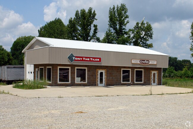
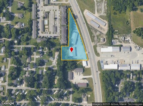
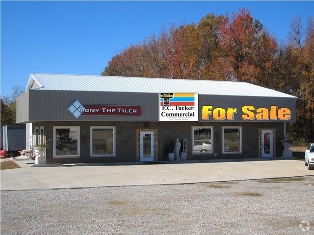
Property Record
7457 W State Route 66, Newburgh, IN 47630
NEARBY LISTINGS FOR SALE OR LEASE
Property Detail
7457 W State Route 66
87-12-26-400-090.000-019
Survey For Margaret L Lenn
Commercialnec
PT E 1/2 SE S26 T6 R9 2.648 A TRACT 2 & PARCEL 2
X
Warrick
21101C0110F
Indiana
2024
2.65 AC
2024
Warrick County
030703
Evansville
9,600 SF
Evansville, IN-KY
DEMOGRAPHICS near 7457 W State Route 66
1 Mile
3 Mile
5 Mile
2024 Total Population
5,797
32,105
47,697
2029 Population
6,013
33,528
49,489
Pop Growth 2024-2029
+ 3.73%
+ 4.43%
+ 3.76%
Average Age
37
40
41
2024 Total Households
2,164
12,307
18,707
HH Growth 2024-2029
+ 3.70%
+ 4.45%
+ 3.68%
Median Household Inc
$90,442
$100,314
$92,770
Avg Household Size
2.60
2.50
2.50
2024 Avg HH Vehicles
2.00
2.00
2.00
Median Home Value
$184,988
$254,605
$238,397
Median Year Built
1978
1991
1989
Nearby Places
Map Layers
Map Styles
 Street
 Aerial
- Restaurants
- Banks
- Shops
- Fitness
- Groceries
PUBLIC TRANSPORTATION
AIRPORT
Evansville Regional
DRIVE
WALK
Distance
Evansville Regional
23 min
13.4 mi
Freight Ports
Port of Toledo
DRIVE
WALK
Distance
Port of Toledo
458 min
394.4 mi
SALE & LEASE HISTORY
LISTING DATE
SALE/LEASE

Mar 21, 2019
For Lease
Nearby Properties
Address
Land Use
TOTAL SIZE
Lot Size
Zoning
Address
Land Use
TOTAL SIZE
Lot Size
Zoning
130,000 SF
Address
Land Use
TOTAL SIZE
Lot Size
Zoning
75,107 SF
13.68 AC
Address
Land Use
TOTAL SIZE
Lot Size
Zoning
3,940 SF
17.67 AC
Address
Land Use
TOTAL SIZE
Lot Size
Zoning
3,260 SF
9.96 AC
Address
Land Use
TOTAL SIZE
Lot Size
Zoning
31,950 SF
6.22 AC
Address
Land Use
TOTAL SIZE
Lot Size
Zoning
26,664 SF
10.81 AC
Address
Land Use
TOTAL SIZE
Lot Size
Zoning
4,389 SF
9.09 AC
Address
Land Use
TOTAL SIZE
Lot Size
Zoning
28,632 SF
6.27 AC
Address
Land Use
TOTAL SIZE
Lot Size
Zoning
197,528 SF
21.55 AC
Address
Land Use
TOTAL SIZE
Lot Size
Zoning
61,299 SF
2.22 AC
Address
Land Use
TOTAL SIZE
Lot Size
Zoning
99,714 SF
5 AC
Address
Land Use
TOTAL SIZE
Lot Size
Zoning
32,117 SF
12.88 AC
Address
Land Use
TOTAL SIZE
Lot Size
Zoning
72,946 SF
2.64 AC
Address
Land Use
TOTAL SIZE
Lot Size
Zoning
90,181 SF
10.66 AC
Address
Land Use
TOTAL SIZE
Lot Size
Zoning
88,964 SF
8.72 AC
Address
Land Use
TOTAL SIZE
Lot Size
Zoning
28,632 SF
1.22 AC
Address
Land Use
TOTAL SIZE
Lot Size
Zoning
15,784 SF
7.06 AC
Address
Land Use
TOTAL SIZE
Lot Size
Zoning
33,899 SF
4.92 AC
Address
Land Use
TOTAL SIZE
Lot Size
Zoning
52,226 SF
6.79 AC
Address
Land Use
TOTAL SIZE
Lot Size
Zoning
71,338 SF
6.05 AC
Address
Land Use
TOTAL SIZE
Lot Size
Zoning
91,290 SF
7.06 AC
Address
Land Use
TOTAL SIZE
Lot Size
Zoning
24,124 SF
2.86 AC
Address
Land Use
TOTAL SIZE
Lot Size
Zoning
34,560 SF
16.85 AC
Address
Land Use
TOTAL SIZE
Lot Size
Zoning
8,628 SF
3.42 AC
Address
Land Use
TOTAL SIZE
Lot Size
Zoning
7,380 SF
5.37 AC
Address
Land Use
TOTAL SIZE
Lot Size
Zoning
34,527 SF
1.81 AC
Address
Land Use
TOTAL SIZE
Lot Size
Zoning
1,700 SF
3.98 AC
Address
Land Use
TOTAL SIZE
Lot Size
Zoning
34,527 SF
1.61 AC
Address
Land Use
TOTAL SIZE
Lot Size
Zoning
Address
Land Use
TOTAL SIZE
Lot Size
Zoning
31,683 SF
1.85 AC
The World's #1 Commercial Real Estate Marketplace
Connect with us
© 2025 CoStar Group
The information above has been obtained from sources believed reliable. While we do not doubt its accuracy we have not verified it and make no guarantee, warranty or representation about it. It is your responsibility to independently confirm its accuracy and completeness. Any projections, opinions, assumptions, or estimates used are for example only and do not represent the current or future performance of the property. The value of this transaction to you depends on tax and other factors which should be evaluated by your tax, financial, and legal advisors. You and your advisors should conduct a careful, independent investigation of the property to determine to your satisfaction the suitability of the property for your needs.