Property Record
746 E 16Th St, Holland, MI 49423

Save to a Folder
{{folder.Name}}
{{folder.ListingIds.length}} Properties
{{folder.ListingIds.length}} Property
Create a New Folder
Property Detail
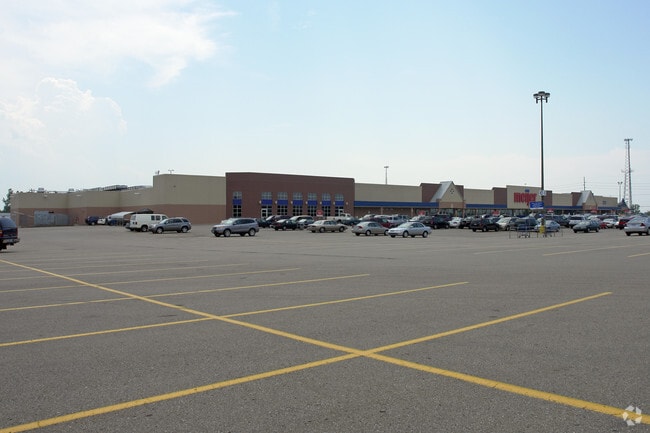
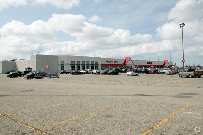
746 E 16Th St
70-16-34-100-042
N 1/2 OF NW 1/4 EXC S 231 FT OF W 297 FT, ALSO EXC E 1/2 OF NE 1/4 OF NW 1/4, ALSO EXC COM S 89D 09M 10S E 38766 FT FROM NW
Wholesaleoutletdiscountstore
OTTAWA
GMU
Michigan
B and X Area of moderate flood hazard, usually the area between the limits of the 100-year and 500-year floods.
49.31 AC
2025
Holland East
2026
West Michigan
025200
Grand Rapids-Wyoming-Kentwood, MI
228,876 SF
NEARBY LISTINGS FOR SALE OR LEASE
DEMOGRAPHICS near 746 E 16Th St
1 mile
3 mile
5 mile
2025 Total Population
6,058
44,539
93,720
2030 Population
6,115
45,309
95,442
Pop Growth 2025-2030
+ 0.94%
+ 1.73%
+ 1.84%
Average Age
40
39
39
2025 Total Households
2,569
16,763
34,865
HH Growth 2025-2030
+ 1.13%
+ 1.90%
+ 1.98%
Median Household Inc
$54,406
$70,057
$76,837
Avg Household Size
2.20
2.40
2.60
2025 Avg HH Vehicles
2.00
2.00
2.00
Median Home Value
$244,169
$264,259
$284,220
Median Year Built
1978
1977
1983
Nearby Places
Map Layers
Map Styles
 Street
 Aerial
Layers
 Traffic
 Biking
Places
Listings with unknown addresses are not visible on the map
- Restaurants
- Banks
- Shops
- Fitness
- Groceries
PUBLIC TRANSPORTATION
COMMUTER RAIL
Holland Amtrak Station (Pere Marquette - Amtrak)
Drive
Walk
Distance
Holland Amtrak Station (Pere Marquette - Amtrak)
5 min
1.8 mi
AIRPORT
Gerald R Ford International
Drive
Walk
Distance
Gerald R Ford International
43 min
33.1 mi
Freight Ports
Port Milwaukee
Drive
Walk
Distance
Port Milwaukee
278 min
236.2 mi
Nearby Properties
Address
Land Use
TOTAL SIZE
Lot Size
Zoning
Address
Land Use
TOTAL SIZE
Lot Size
Zoning
1,599,294 SF
Address
Land Use
TOTAL SIZE
Lot Size
Zoning
572,832 SF
10.89 AC
PUD
Address
Land Use
TOTAL SIZE
Lot Size
Zoning
1,788,352 SF
173.33 AC
Address
Land Use
TOTAL SIZE
Lot Size
Zoning
662,015 SF
177 AC
SEE MAP
Address
Land Use
TOTAL SIZE
Lot Size
Zoning
669,408 SF
99.60 AC
I
Address
Land Use
TOTAL SIZE
Lot Size
Zoning
198,712 SF
Address
Land Use
TOTAL SIZE
Lot Size
Zoning
557,392 SF
28.50 AC
Address
Land Use
TOTAL SIZE
Lot Size
Zoning
556,819 SF
85.45 AC
Address
Land Use
TOTAL SIZE
Lot Size
Zoning
245,093 SF
10.70 AC
PUD
Address
Land Use
TOTAL SIZE
Lot Size
Zoning
249,051 SF
15.59 AC
HDR
Address
Land Use
TOTAL SIZE
Lot Size
Zoning
660,002 SF
32.13 AC
I-2
Address
Land Use
TOTAL SIZE
Lot Size
Zoning
218,722 SF
8.59 AC
PUD
Address
Land Use
TOTAL SIZE
Lot Size
Zoning
320,270 SF
33.25 AC
PUD
Address
Land Use
TOTAL SIZE
Lot Size
Zoning
674,052 SF
79.30 AC
Address
Land Use
TOTAL SIZE
Lot Size
Zoning
329,784 SF
38.51 AC
I-2
Address
Land Use
TOTAL SIZE
Lot Size
Zoning
226,347 SF
19.44 AC
I-2
Address
Land Use
TOTAL SIZE
Lot Size
Zoning
239,465 SF
Address
Land Use
TOTAL SIZE
Lot Size
Zoning
132,127 SF
42.69 AC
SEE MAP
Address
Land Use
TOTAL SIZE
Lot Size
Zoning
209,455 SF
17 AC
C-2
Address
Land Use
TOTAL SIZE
Lot Size
Zoning
127,432 SF
3.77 AC
C-2
Address
Land Use
TOTAL SIZE
Lot Size
Zoning
94,790 SF
1.74 AC
F-CDT
Address
Land Use
TOTAL SIZE
Lot Size
Zoning
90,865 SF
180,230 AC
C-2
Address
Land Use
TOTAL SIZE
Lot Size
Zoning
150,822 SF
Address
Land Use
TOTAL SIZE
Lot Size
Zoning
58,710 SF
6.96 AC
C-2
Address
Land Use
TOTAL SIZE
Lot Size
Zoning
114,088 SF
10.79 AC
PRD
Address
Land Use
TOTAL SIZE
Lot Size
Zoning
134,490 SF
15.76 AC
C-2
Address
Land Use
TOTAL SIZE
Lot Size
Zoning
181,754 SF
13.44 AC
R3
Address
Land Use
TOTAL SIZE
Lot Size
Zoning
391,842 SF
28.34 AC
Address
Land Use
TOTAL SIZE
Lot Size
Zoning
136,520 SF
26.49 AC
PUD
Address
Land Use
TOTAL SIZE
Lot Size
Zoning
87,389 SF
6.42 AC
C-1
The World's #1 Commercial Real Estate Marketplace
Connect with us
© 2026 CoStar Group
The information above has been obtained from sources believed reliable. While we do not doubt its accuracy we have not verified it and make no guarantee, warranty or representation about it. It is your responsibility to independently confirm its accuracy and completeness. Any projections, opinions, assumptions, or estimates used are for example only and do not represent the current or future performance of the property. The value of this transaction to you depends on tax and other factors which should be evaluated by your tax, financial, and legal advisors. You and your advisors should conduct a careful, independent investigation of the property to determine to your satisfaction the suitability of the property for your needs.