Property Record
7462 S Everett St, Littleton, CO 80128

Property Detail
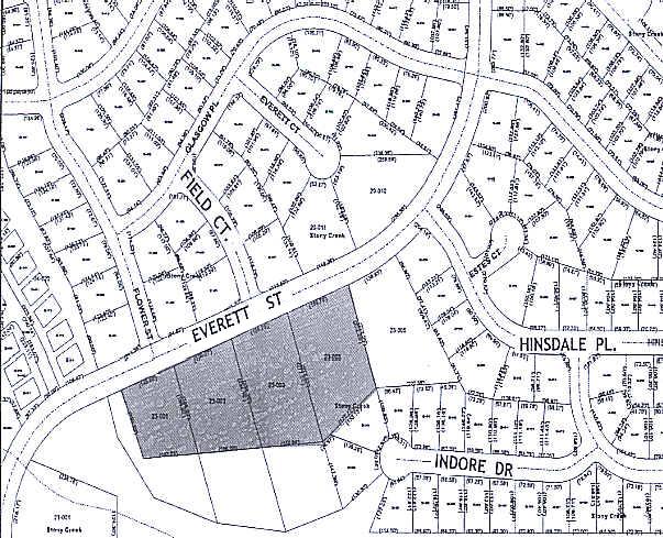
7462 S Everett St
59-274-23-003
SECTION 27 TOWNSHIP 05 RANGE 69 QTR SE SUBDIVISIONCD 716400 SUBDIVISIONNAME STONY CREEK FLG # 3 BLOCK 007 LOT 0017 SIZE: 41859 TRACT VALUE: .961 SECTION 27 TOWNSHIP 05 RANGE 69 QTR SE SUBDIVISIONCD 716400 SUBDIVISIONNAME STONY CREEK FLG # 3 BLOCK 007
Commercialnec
JEFFERSON
PD
Colorado
B and X Area of moderate flood hazard, usually the area between the limits of the 100-year and 500-year floods.
17-20
0
3.03 AC
2025
Southwest Denver
012023
Denver
5,535 SF
Denver-Aurora-Centennial, CO
NEARBY LISTINGS FOR SALE OR LEASE
DEMOGRAPHICS near 7462 S Everett St
1 mile
3 mile
5 mile
2025 Total Population
15,050
82,825
169,942
2030 Population
14,887
82,295
171,196
Pop Growth 2025-2030
(1.08%)
(0.64%)
+ 0.74%
Average Age
41
42
43
2025 Total Households
5,727
32,407
68,466
HH Growth 2025-2030
(1.22%)
(0.63%)
+ 0.93%
Median Household Inc
$116,083
$122,773
$116,780
Avg Household Size
2.60
2.50
2.40
2025 Avg HH Vehicles
2.00
2.00
2.00
Median Home Value
$639,151
$684,103
$686,766
Median Year Built
1983
1986
1987
Nearby Places
Map Layers
Map Styles
 Street
 Aerial
Layers
 Traffic
 Biking
Places
Listings with unknown addresses are not visible on the map
- Restaurants
- Banks
- Shops
- Fitness
- Groceries
PUBLIC TRANSPORTATION
AIRPORT
Denver International
Drive
Walk
Distance
Denver International
55 min
48.4 mi
Nearby Properties
Address
Land Use
TOTAL SIZE
Lot Size
Zoning
Address
Land Use
TOTAL SIZE
Lot Size
Zoning
381,135 SF
35.02 AC
Address
Land Use
TOTAL SIZE
Lot Size
Zoning
272,246 SF
31.76 AC
PD
Address
Land Use
TOTAL SIZE
Lot Size
Zoning
2,884.97 AC
A1
Address
Land Use
TOTAL SIZE
Lot Size
Zoning
600,847 SF
35.87 AC
PD
Address
Land Use
TOTAL SIZE
Lot Size
Zoning
314,257 SF
82.60 AC
PD
Address
Land Use
TOTAL SIZE
Lot Size
Zoning
600,847 SF
32.41 AC
PD
Address
Land Use
TOTAL SIZE
Lot Size
Zoning
178,421 SF
12.31 AC
PD
Address
Land Use
TOTAL SIZE
Lot Size
Zoning
272,775 SF
27.94 AC
Address
Land Use
TOTAL SIZE
Lot Size
Zoning
304,475 SF
22.32 AC
Address
Land Use
TOTAL SIZE
Lot Size
Zoning
400,138 SF
21.23 AC
PD
Address
Land Use
TOTAL SIZE
Lot Size
Zoning
123,843 SF
6.03 AC
Address
Land Use
TOTAL SIZE
Lot Size
Zoning
189,672 SF
16.74 AC
PD
Address
Land Use
TOTAL SIZE
Lot Size
Zoning
329,538 SF
14.64 AC
B-4
Address
Land Use
TOTAL SIZE
Lot Size
Zoning
101,795 SF
12.61 AC
PD
Address
Land Use
TOTAL SIZE
Lot Size
Zoning
308,134 SF
14.56 AC
LPD-C
Address
Land Use
TOTAL SIZE
Lot Size
Zoning
279,023 SF
13.15 AC
LPD-R
Address
Land Use
TOTAL SIZE
Lot Size
Zoning
101,699 SF
10.34 AC
Address
Land Use
TOTAL SIZE
Lot Size
Zoning
297,003 SF
26.77 AC
PD
Address
Land Use
TOTAL SIZE
Lot Size
Zoning
221,123 SF
14.82 AC
PD
Address
Land Use
TOTAL SIZE
Lot Size
Zoning
119,540 SF
10.67 AC
C1
Address
Land Use
TOTAL SIZE
Lot Size
Zoning
97,000 SF
9.88 AC
PD
Address
Land Use
TOTAL SIZE
Lot Size
Zoning
218,391 SF
9.73 AC
PD
Address
Land Use
TOTAL SIZE
Lot Size
Zoning
100,550 SF
7.72 AC
PD
Address
Land Use
TOTAL SIZE
Lot Size
Zoning
33,555 SF
4.18 AC
Address
Land Use
TOTAL SIZE
Lot Size
Zoning
187,987 SF
10.07 AC
PD
Address
Land Use
TOTAL SIZE
Lot Size
Zoning
94,577 SF
5.76 AC
B-4
Address
Land Use
TOTAL SIZE
Lot Size
Zoning
68,365 SF
12.17 AC
PD
Address
Land Use
TOTAL SIZE
Lot Size
Zoning
188,435 SF
8.40 AC
LPD-C
Address
Land Use
TOTAL SIZE
Lot Size
Zoning
107,693 SF
9.17 AC
PD
Address
Land Use
TOTAL SIZE
Lot Size
Zoning
109,559 SF
13.37 AC
B-4
The World's #1 Commercial Real Estate Marketplace
Connect with us
© 2026 CoStar Group
The information above has been obtained from sources believed reliable. While we do not doubt its accuracy we have not verified it and make no guarantee, warranty or representation about it. It is your responsibility to independently confirm its accuracy and completeness. Any projections, opinions, assumptions, or estimates used are for example only and do not represent the current or future performance of the property. The value of this transaction to you depends on tax and other factors which should be evaluated by your tax, financial, and legal advisors. You and your advisors should conduct a careful, independent investigation of the property to determine to your satisfaction the suitability of the property for your needs.