Property Record
7462 State Rd, Cleveland, OH 44134


NEARBY LISTINGS FOR SALE OR LEASE
-
-
View all Cleveland listings for sale on LoopNet.com
Property Detail
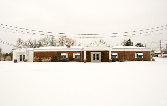
7462 State Rd
Cleveland-Elyria, OH
Pt Add
454-22-009
FF 113.00 D 346.85 .7534AC OL 32 PT ADD TO ROAD 2010S/R
Funeralhome
Cuyahoga
X
Ohio
39035C0302E
32
2024
0.75 AC
2024
Southwest
177609
Cleveland
5,946 SF
DEMOGRAPHICS near 7462 State Rd
1 mile
3 mile
5 mile
2024 Total Population
6,918
80,657
197,059
2029 Population
6,655
78,144
190,926
Pop Growth 2024-2029
(3.80%)
(3.12%)
(3.11%)
Average Age
47
44
43
2024 Total Households
2,831
34,605
85,135
HH Growth 2024-2029
(4.03%)
(3.29%)
(3.30%)
Median Household Inc
$76,267
$68,861
$67,556
Avg Household Size
2.30
2.30
2.20
2024 Avg HH Vehicles
2.00
2.00
2.00
Median Home Value
$173,672
$170,236
$171,649
Median Year Built
1966
1962
1962
Nearby Places
Map Layers
Map Styles
 Street
 Aerial
Transit
 Traffic
 Biking
Places
Listings with unknown addresses are not visible on the map
- Restaurants
- Banks
- Shops
- Fitness
- Groceries
PUBLIC TRANSPORTATION
COMMUTER RAIL
Drive
Walk
Distance
14 min
6.2 mi
Drive
Walk
Distance
17 min
7.9 mi
AIRPORT
Cleveland-Hopkins International
Drive
Walk
Distance
Cleveland-Hopkins International
24 min
11.2 mi
Akron-Canton Regional
Drive
Walk
Distance
Akron-Canton Regional
58 min
43.0 mi
Nearby Properties
Address
Land Use
TOTAL SIZE
Lot Size
Zoning
Address
Land Use
TOTAL SIZE
Lot Size
Zoning
477,641 SF
14.07 AC
MF-1
Address
Land Use
TOTAL SIZE
Lot Size
Zoning
725,585 SF
76.92 AC
SF-A
Address
Land Use
TOTAL SIZE
Lot Size
Zoning
245,255 SF
14 AC
Address
Land Use
TOTAL SIZE
Lot Size
Zoning
168,729 SF
11.56 AC
GB
Address
Land Use
TOTAL SIZE
Lot Size
Zoning
238,500 SF
20.31 AC
SC
Address
Land Use
TOTAL SIZE
Lot Size
Zoning
379,061 SF
42.68 AC
Address
Land Use
TOTAL SIZE
Lot Size
Zoning
632,686 SF
16.44 AC
MF-3
Address
Land Use
TOTAL SIZE
Lot Size
Zoning
162,134 SF
12.24 AC
CG
Address
Land Use
TOTAL SIZE
Lot Size
Zoning
281,600 SF
18.73 AC
SF-A
Address
Land Use
TOTAL SIZE
Lot Size
Zoning
137,178 SF
8.62 AC
Address
Land Use
TOTAL SIZE
Lot Size
Zoning
440,765 SF
44.35 AC
2F
Address
Land Use
TOTAL SIZE
Lot Size
Zoning
149,522 SF
19.09 AC
PF
Address
Land Use
TOTAL SIZE
Lot Size
Zoning
28,189 SF
15.33 AC
B-1OR2
Address
Land Use
TOTAL SIZE
Lot Size
Zoning
245,255 SF
13.34 AC
Address
Land Use
TOTAL SIZE
Lot Size
Zoning
83,375 SF
9.29 AC
MF-1
Address
Land Use
TOTAL SIZE
Lot Size
Zoning
74,731 SF
15.23 AC
A
Address
Land Use
TOTAL SIZE
Lot Size
Zoning
315,434 SF
3.48 AC
A
Address
Land Use
TOTAL SIZE
Lot Size
Zoning
162,134 SF
13.35 AC
CG
Address
Land Use
TOTAL SIZE
Lot Size
Zoning
166,370 SF
8.64 AC
HB
Address
Land Use
TOTAL SIZE
Lot Size
Zoning
99,522 SF
52.18 AC
A
Address
Land Use
TOTAL SIZE
Lot Size
Zoning
185,022 SF
14.23 AC
Address
Land Use
TOTAL SIZE
Lot Size
Zoning
114,101 SF
4.40 AC
SF-AA
Address
Land Use
TOTAL SIZE
Lot Size
Zoning
238,500 SF
20.89 AC
SC
Address
Land Use
TOTAL SIZE
Lot Size
Zoning
180,095 SF
26.26 AC
SF-AA
Address
Land Use
TOTAL SIZE
Lot Size
Zoning
126,224 SF
5.31 AC
RB
Address
Land Use
TOTAL SIZE
Lot Size
Zoning
100,047 SF
5.34 AC
SF-A
Address
Land Use
TOTAL SIZE
Lot Size
Zoning
92,553 SF
11.61 AC
CB
Address
Land Use
TOTAL SIZE
Lot Size
Zoning
204,594 SF
22.97 AC
R1-A
Address
Land Use
TOTAL SIZE
Lot Size
Zoning
113,975 SF
11.68 AC
B
Address
Land Use
TOTAL SIZE
Lot Size
Zoning
227,794 SF
8.42 AC
MF-3
The World's #1 Commercial Real Estate Marketplace
Connect with us
© 2026 CoStar Group
The information above has been obtained from sources believed reliable. While we do not doubt its accuracy we have not verified it and make no guarantee, warranty or representation about it. It is your responsibility to independently confirm its accuracy and completeness. Any projections, opinions, assumptions, or estimates used are for example only and do not represent the current or future performance of the property. The value of this transaction to you depends on tax and other factors which should be evaluated by your tax, financial, and legal advisors. You and your advisors should conduct a careful, independent investigation of the property to determine to your satisfaction the suitability of the property for your needs.