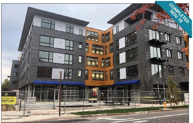
Property Record
747 E 32Nd Ave, Eugene, OR 97405

Property Detail
747 E 32Nd Ave
Eugene-Springfield, OR
TL 05900
0649770
Lane
Multifamilydwelling
Oregon
C-2
5900
B and X Area of moderate flood hazard, usually the area between the limits of the 100-year and 500-year floods.
1.83 AC
2025
Southeast Eugene
2025
Portland
005000
NEARBY LISTINGS FOR SALE OR LEASE
DEMOGRAPHICS near 747 E 32Nd Ave
1 mile
3 mile
5 mile
2025 Total Population
13,583
85,234
169,937
2030 Population
13,427
84,967
168,658
Pop Growth 2025-2030
(1.15%)
(0.31%)
(0.75%)
Average Age
42
38
40
2025 Total Households
5,831
36,489
71,736
HH Growth 2025-2030
(1.23%)
(0.48%)
(0.88%)
Median Household Inc
$84,302
$55,196
$63,284
Avg Household Size
2.20
2.10
2.20
2025 Avg HH Vehicles
2.00
2.00
2.00
Median Home Value
$548,083
$556,754
$472,244
Median Year Built
1966
1974
1974
Nearby Places
Map Layers
Map Styles
 Street
 Aerial
Transit
 Traffic
 Biking
Places
Listings with unknown addresses are not visible on the map
- Restaurants
- Banks
- Shops
- Fitness
- Groceries
SALE & LEASE HISTORY
LISTING DATE
SALE/LEASE

Jan 02, 2019
For Lease
Dec 01, 2023
For Lease
Nearby Properties
Address
Land Use
TOTAL SIZE
Lot Size
Zoning
Address
Land Use
TOTAL SIZE
Lot Size
Zoning
110.25 AC
PL
Address
Land Use
TOTAL SIZE
Lot Size
Zoning
15.37 AC
PL
Address
Land Use
TOTAL SIZE
Lot Size
Zoning
71.87 AC
PL
Address
Land Use
TOTAL SIZE
Lot Size
Zoning
121.46 AC
E25
Address
Land Use
TOTAL SIZE
Lot Size
Zoning
1.56 AC
C-2
Address
Land Use
TOTAL SIZE
Lot Size
Zoning
1.86 AC
C-2
Address
Land Use
TOTAL SIZE
Lot Size
Zoning
24 AC
C-2
Address
Land Use
TOTAL SIZE
Lot Size
Zoning
13.82 AC
PL
Address
Land Use
TOTAL SIZE
Lot Size
Zoning
9.81 AC
C-2
Address
Land Use
TOTAL SIZE
Lot Size
Zoning
3.99 AC
I-3
Address
Land Use
TOTAL SIZE
Lot Size
Zoning
5.87 AC
C-2
Address
Land Use
TOTAL SIZE
Lot Size
Zoning
2.76 AC
C-3
Address
Land Use
TOTAL SIZE
Lot Size
Zoning
3.10 AC
S-WS
Address
Land Use
TOTAL SIZE
Lot Size
Zoning
2.56 AC
C-2
Address
Land Use
TOTAL SIZE
Lot Size
Zoning
1.23 AC
C-3
Address
Land Use
TOTAL SIZE
Lot Size
Zoning
16.80 AC
PL
Address
Land Use
TOTAL SIZE
Lot Size
Zoning
2.77 AC
C-2
Address
Land Use
TOTAL SIZE
Lot Size
Zoning
3.29 AC
S-RP
Address
Land Use
TOTAL SIZE
Lot Size
Zoning
1.21 AC
C-2
Address
Land Use
TOTAL SIZE
Lot Size
Zoning
2.15 AC
PL
Address
Land Use
TOTAL SIZE
Lot Size
Zoning
17.37 AC
AG
Address
Land Use
TOTAL SIZE
Lot Size
Zoning
4.31 AC
C-2
Address
Land Use
TOTAL SIZE
Lot Size
Zoning
2.59 AC
C-2
Address
Land Use
TOTAL SIZE
Lot Size
Zoning
5.70 AC
R-1
Address
Land Use
TOTAL SIZE
Lot Size
Zoning
1.08 AC
C-2
Address
Land Use
TOTAL SIZE
Lot Size
Zoning
0.54 AC
C-2
Address
Land Use
TOTAL SIZE
Lot Size
Zoning
46.88 AC
PL
Address
Land Use
TOTAL SIZE
Lot Size
Zoning
1.85 AC
C-2
Address
Land Use
TOTAL SIZE
Lot Size
Zoning
0.25 AC
C-2
Address
Land Use
TOTAL SIZE
Lot Size
Zoning
17.68 AC
PL
The World's #1 Commercial Real Estate Marketplace
Connect with us
© 2026 CoStar Group
The information above has been obtained from sources believed reliable. While we do not doubt its accuracy we have not verified it and make no guarantee, warranty or representation about it. It is your responsibility to independently confirm its accuracy and completeness. Any projections, opinions, assumptions, or estimates used are for example only and do not represent the current or future performance of the property. The value of this transaction to you depends on tax and other factors which should be evaluated by your tax, financial, and legal advisors. You and your advisors should conduct a careful, independent investigation of the property to determine to your satisfaction the suitability of the property for your needs.