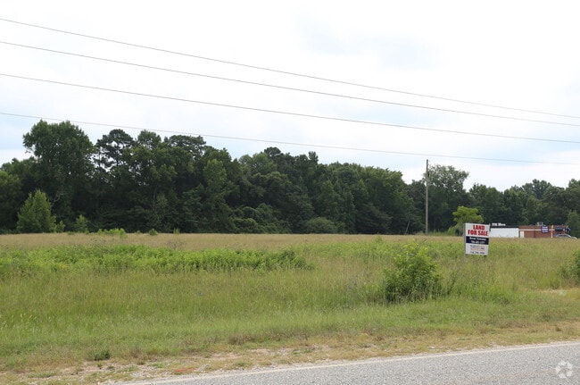
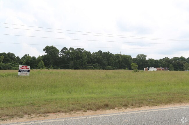
Property Record
747 Summerville Rd, Smiths Station, AL 36877

NEARBY LISTINGS FOR SALE OR LEASE
Property Detail
747 Summerville Rd
15-06-24-0-000-001.008
COM SE COR SEC;N 2623'S;W 671'S TO POB;W 1460'S TO E R/W HWY 431;SE 1333'S;ELY 239'S;NE 140'S; NW 110'; NE 285'; SE 244.4'; N
Conveniencestore
Lee
X
Alabama
01113C0050D
16.80 AC
2025
Lee County
2025
Columbus GA
042002
Auburn-Opelika, AL
11,768 SF
DEMOGRAPHICS near 747 Summerville Rd
1 Mile
3 Mile
5 Mile
2024 Total Population
2,281
15,292
46,560
2029 Population
2,558
16,828
49,227
Pop Growth 2024-2029
+ 12.14%
+ 10.04%
+ 5.73%
Average Age
39
40
40
2024 Total Households
930
5,931
18,230
HH Growth 2024-2029
+ 12.15%
+ 9.98%
+ 5.38%
Median Household Inc
$58,345
$59,171
$62,223
Avg Household Size
2.40
2.50
2.50
2024 Avg HH Vehicles
2.00
2.00
2.00
Median Home Value
$246,376
$180,134
$176,738
Median Year Built
2003
1995
1994
Nearby Places
Map Layers
Map Styles
 Street
 Aerial
- Restaurants
- Banks
- Shops
- Fitness
- Groceries
PUBLIC TRANSPORTATION
AIRPORT
Columbus
DRIVE
WALK
Distance
Columbus
18 min
11.9 mi
Freight Ports
Port of Panama City
DRIVE
WALK
Distance
Port of Panama City
238 min
189.0 mi
SALE & LEASE HISTORY
LISTING DATE
SALE/LEASE

Aug 13, 2018
For Sale
Nearby Properties
Address
Land Use
TOTAL SIZE
Lot Size
Zoning
Address
Land Use
TOTAL SIZE
Lot Size
Zoning
24.20 AC
Address
Land Use
TOTAL SIZE
Lot Size
Zoning
11,124 SF
5 AC
Address
Land Use
TOTAL SIZE
Lot Size
Zoning
104,950 SF
6 AC
C
Address
Land Use
TOTAL SIZE
Lot Size
Zoning
30,120 SF
7 AC
Address
Land Use
TOTAL SIZE
Lot Size
Zoning
1,800 SF
13 AC
O
Address
Land Use
TOTAL SIZE
Lot Size
Zoning
10,672 SF
5.55 AC
Address
Land Use
TOTAL SIZE
Lot Size
Zoning
1,540 SF
4.50 AC
Address
Land Use
TOTAL SIZE
Lot Size
Zoning
171.80 AC
Address
Land Use
TOTAL SIZE
Lot Size
Zoning
15,664 SF
3.70 AC
Address
Land Use
TOTAL SIZE
Lot Size
Zoning
1,116 SF
2.62 AC
Address
Land Use
TOTAL SIZE
Lot Size
Zoning
4,590 SF
2 AC
O
Address
Land Use
TOTAL SIZE
Lot Size
Zoning
13,288 SF
2.18 AC
Address
Land Use
TOTAL SIZE
Lot Size
Zoning
2,040 SF
5.86 AC
Address
Land Use
TOTAL SIZE
Lot Size
Zoning
10,346 SF
2.94 AC
Address
Land Use
TOTAL SIZE
Lot Size
Zoning
12,760 SF
2 AC
Address
Land Use
TOTAL SIZE
Lot Size
Zoning
8,260 SF
1.95 AC
Address
Land Use
TOTAL SIZE
Lot Size
Zoning
2,043 SF
2 AC
O
Address
Land Use
TOTAL SIZE
Lot Size
Zoning
169.82 AC
Address
Land Use
TOTAL SIZE
Lot Size
Zoning
3,912 SF
0.60 AC
Address
Land Use
TOTAL SIZE
Lot Size
Zoning
11,977 SF
1.61 AC
Address
Land Use
TOTAL SIZE
Lot Size
Zoning
27,360 SF
2.84 AC
Address
Land Use
TOTAL SIZE
Lot Size
Zoning
5,250 SF
7.70 AC
Address
Land Use
TOTAL SIZE
Lot Size
Zoning
2,635 SF
1.18 AC
O
Address
Land Use
TOTAL SIZE
Lot Size
Zoning
4,528 SF
2.62 AC
Address
Land Use
TOTAL SIZE
Lot Size
Zoning
1,200 SF
2.05 AC
Address
Land Use
TOTAL SIZE
Lot Size
Zoning
2,800 SF
3 AC
Address
Land Use
TOTAL SIZE
Lot Size
Zoning
4,000 SF
2.38 AC
Address
Land Use
TOTAL SIZE
Lot Size
Zoning
9,034 SF
1.02 AC
Address
Land Use
TOTAL SIZE
Lot Size
Zoning
4,261 SF
1.08 AC
The World's #1 Commercial Real Estate Marketplace
Connect with us
© 2026 CoStar Group
The information above has been obtained from sources believed reliable. While we do not doubt its accuracy we have not verified it and make no guarantee, warranty or representation about it. It is your responsibility to independently confirm its accuracy and completeness. Any projections, opinions, assumptions, or estimates used are for example only and do not represent the current or future performance of the property. The value of this transaction to you depends on tax and other factors which should be evaluated by your tax, financial, and legal advisors. You and your advisors should conduct a careful, independent investigation of the property to determine to your satisfaction the suitability of the property for your needs.