Property Record
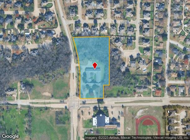
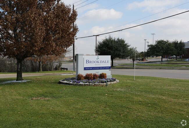
747 W Pleasant Run Rd, Desoto, TX 75115

NEARBY LISTINGS FOR SALE OR LEASE
-
-
View all Desoto listings for sale on LoopNet.com
Property Detail
747 W Pleasant Run Rd
Dallas-Fort Worth-Arlington, TX
Sterling
200997600A0010000
STERLING BLK A LT 1 ACS 4.703 INT201800028896 DD01312018 CO-DC 0997600A00100 5CS0997600A
Apartment
Dallas
X
Texas
48139C0055G
1
2024
4.70 AC
2025
Southwest Dallas
016618
Dallas/Ft Worth
20,923 SF
DEMOGRAPHICS near 747 W Pleasant Run Rd
1 Mile
3 Mile
5 Mile
2024 Total Population
6,398
73,470
205,956
2029 Population
6,314
72,579
205,824
Pop Growth 2024-2029
(1.31%)
(1.21%)
(0.06%)
Average Age
42
39
37
2024 Total Households
2,233
25,966
71,167
HH Growth 2024-2029
(1.52%)
(1.42%)
(0.27%)
Median Household Inc
$82,630
$76,388
$63,566
Avg Household Size
2.80
2.70
2.80
2024 Avg HH Vehicles
2.00
2.00
2.00
Median Home Value
$281,396
$243,469
$222,736
Median Year Built
1989
1993
1988
Nearby Places
Map Layers
Map Styles
 Street
 Aerial
- Restaurants
- Banks
- Shops
- Fitness
- Groceries
PUBLIC TRANSPORTATION
AIRPORT
Dallas Love Field
DRIVE
WALK
Distance
Dallas Love Field
34 min
21.8 mi
Dallas-Fort Worth International
DRIVE
WALK
Distance
Dallas-Fort Worth International
38 min
31.1 mi
Nearby Properties
Address
Land Use
TOTAL SIZE
Lot Size
Zoning
Address
Land Use
TOTAL SIZE
Lot Size
Zoning
726,662 SF
44.94 AC
Z239
Address
Land Use
TOTAL SIZE
Lot Size
Zoning
1,316,325 SF
54.36 AC
Z111
Address
Land Use
TOTAL SIZE
Lot Size
Zoning
1,126,320 SF
63.41 AC
Z111
Address
Land Use
TOTAL SIZE
Lot Size
Zoning
1,167,500 SF
46.04 AC
Z06
Address
Land Use
TOTAL SIZE
Lot Size
Zoning
823,000 SF
45.10 AC
Z298
Address
Land Use
TOTAL SIZE
Lot Size
Zoning
662,230 SF
38.49 AC
Z248
Address
Land Use
TOTAL SIZE
Lot Size
Zoning
123,880 SF
16.80 AC
Z236
Address
Land Use
TOTAL SIZE
Lot Size
Zoning
217,510 SF
67.57 AC
Z268
Address
Land Use
TOTAL SIZE
Lot Size
Zoning
507,318 SF
28.40 AC
Z111
Address
Land Use
TOTAL SIZE
Lot Size
Zoning
552,200 SF
41.36 AC
Z109
Address
Land Use
TOTAL SIZE
Lot Size
Zoning
489,310 SF
33.91 AC
Z111
Address
Land Use
TOTAL SIZE
Lot Size
Zoning
531,254 SF
33.40 AC
Z06
Address
Land Use
TOTAL SIZE
Lot Size
Zoning
227,423 SF
13.86 AC
Z236
Address
Land Use
TOTAL SIZE
Lot Size
Zoning
281,669 SF
16.02 AC
Z312
Address
Land Use
TOTAL SIZE
Lot Size
Zoning
421,890 SF
23.95 AC
Z111
Address
Land Use
TOTAL SIZE
Lot Size
Zoning
400,000 SF
24.69 AC
Z116
Address
Land Use
TOTAL SIZE
Lot Size
Zoning
253,794 SF
10.23 AC
Z201
Address
Land Use
TOTAL SIZE
Lot Size
Zoning
219,128 SF
11.62 AC
Z160
Address
Land Use
TOTAL SIZE
Lot Size
Zoning
222,576 SF
35.20 AC
Z239
Address
Land Use
TOTAL SIZE
Lot Size
Zoning
188,600 SF
13.52 AC
Z160
Address
Land Use
TOTAL SIZE
Lot Size
Zoning
418,511 SF
20.38 AC
Z111
Address
Land Use
TOTAL SIZE
Lot Size
Zoning
350,904 SF
18.46 AC
Z111
Address
Land Use
TOTAL SIZE
Lot Size
Zoning
305,727 SF
25.02 AC
Z06
Address
Land Use
TOTAL SIZE
Lot Size
Zoning
140,590 SF
4.90 AC
Z236
Address
Land Use
TOTAL SIZE
Lot Size
Zoning
190,592 SF
101.54 AC
Z370
Address
Land Use
TOTAL SIZE
Lot Size
Zoning
119,190 SF
60.25 AC
Z239
Address
Land Use
TOTAL SIZE
Lot Size
Zoning
373,028 SF
19.78 AC
Z116
Address
Land Use
TOTAL SIZE
Lot Size
Zoning
180,659 SF
8.19 AC
Z137
Address
Land Use
TOTAL SIZE
Lot Size
Zoning
168,476 SF
8.15 AC
Z137
Address
Land Use
TOTAL SIZE
Lot Size
Zoning
206,992 SF
14.25 AC
Z188
The World's #1 Commercial Real Estate Marketplace
Connect with us
© 2026 CoStar Group
The information above has been obtained from sources believed reliable. While we do not doubt its accuracy we have not verified it and make no guarantee, warranty or representation about it. It is your responsibility to independently confirm its accuracy and completeness. Any projections, opinions, assumptions, or estimates used are for example only and do not represent the current or future performance of the property. The value of this transaction to you depends on tax and other factors which should be evaluated by your tax, financial, and legal advisors. You and your advisors should conduct a careful, independent investigation of the property to determine to your satisfaction the suitability of the property for your needs.