Property Record
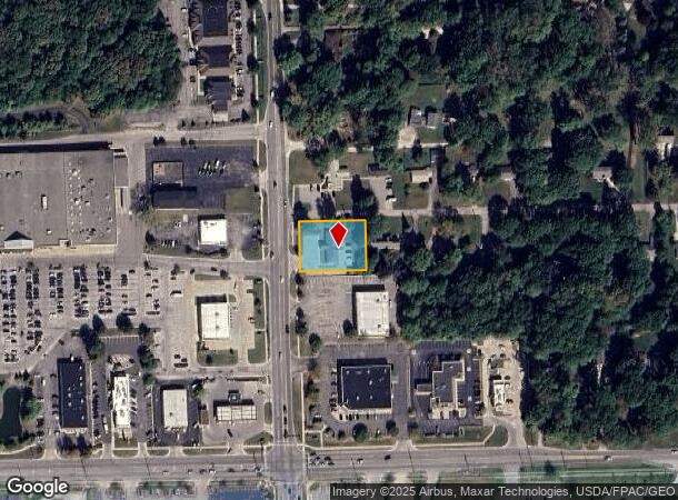
7470 Secor Rd, Lambertville, MI 48144
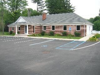
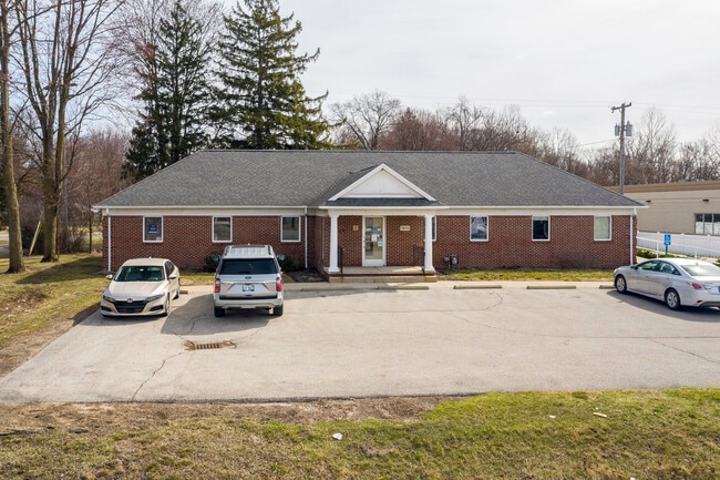
This Property Is For Sale
NEARBY LISTINGS FOR SALE OR LEASE
Property Detail
7470 Secor Rd
Monroe, MI
Suprvrs Of Springbrook Farms
02-615-020-00
W175 FT LOT 13
Medicalbuilding
Monroe
X
Michigan
26115C0363E
13
2024
0.53 AC
2025
Monroe County
833100
Detroit
2,480 SF
DEMOGRAPHICS near 7470 Secor Rd
1 Mile
3 Mile
5 Mile
2024 Total Population
5,441
43,763
118,628
2029 Population
5,456
43,478
117,124
Pop Growth 2024-2029
+ 0.28%
(0.65%)
(1.27%)
Average Age
45
42
41
2024 Total Households
2,192
18,400
50,858
HH Growth 2024-2029
+ 0.23%
(0.70%)
(1.33%)
Median Household Inc
$94,522
$68,562
$63,502
Avg Household Size
2.50
2.30
2.30
2024 Avg HH Vehicles
2.00
2.00
2.00
Median Home Value
$229,878
$175,890
$155,472
Median Year Built
1981
1969
1962
Nearby Places
- Restaurants
- Banks
- Shops
- Fitness
- Groceries
PUBLIC TRANSPORTATION
AIRPORT
Eugene F Kranz Toledo Express
DRIVE
WALK
Distance
Eugene F Kranz Toledo Express
39 min
23.9 mi
Freight Ports
Port of Toledo
DRIVE
WALK
Distance
Port of Toledo
30 min
15.5 mi
Nearby Properties
Address
Land Use
TOTAL SIZE
Lot Size
Zoning
Address
Land Use
TOTAL SIZE
Lot Size
Zoning
165,739 SF
17.77 AC
Address
Land Use
TOTAL SIZE
Lot Size
Zoning
223,900 SF
17.26 AC
Address
Land Use
TOTAL SIZE
Lot Size
Zoning
293,770 SF
13.95 AC
10-RS6
Address
Land Use
TOTAL SIZE
Lot Size
Zoning
90,113 SF
11.83 AC
10-RS6
Address
Land Use
TOTAL SIZE
Lot Size
Zoning
222,493 SF
29.88 AC
10-IC
Address
Land Use
TOTAL SIZE
Lot Size
Zoning
49,960 SF
8.33 AC
10-CO
Address
Land Use
TOTAL SIZE
Lot Size
Zoning
61,718 SF
7 AC
Address
Land Use
TOTAL SIZE
Lot Size
Zoning
6.58 AC
Address
Land Use
TOTAL SIZE
Lot Size
Zoning
87,898 SF
9.17 AC
Address
Land Use
TOTAL SIZE
Lot Size
Zoning
170,528 SF
15 AC
Address
Land Use
TOTAL SIZE
Lot Size
Zoning
64,980 SF
5.80 AC
Address
Land Use
TOTAL SIZE
Lot Size
Zoning
99,366 SF
1.57 AC
10-RS12
Address
Land Use
TOTAL SIZE
Lot Size
Zoning
49,875 SF
3.97 AC
Address
Land Use
TOTAL SIZE
Lot Size
Zoning
18,970 SF
3.72 AC
Address
Land Use
TOTAL SIZE
Lot Size
Zoning
97,790 SF
5 AC
10-RM36
Address
Land Use
TOTAL SIZE
Lot Size
Zoning
53,933 SF
5.26 AC
Address
Land Use
TOTAL SIZE
Lot Size
Zoning
5.31 AC
Address
Land Use
TOTAL SIZE
Lot Size
Zoning
124,772 SF
4.22 AC
10-IC
Address
Land Use
TOTAL SIZE
Lot Size
Zoning
12,658 SF
2.19 AC
Address
Land Use
TOTAL SIZE
Lot Size
Zoning
30,108 SF
4.43 AC
Address
Land Use
TOTAL SIZE
Lot Size
Zoning
54,786 SF
7 AC
10-RS6
Address
Land Use
TOTAL SIZE
Lot Size
Zoning
34,634 SF
37.38 AC
B2
Address
Land Use
TOTAL SIZE
Lot Size
Zoning
53,246 SF
7 AC
10-RS6
Address
Land Use
TOTAL SIZE
Lot Size
Zoning
6,164 SF
124.64 AC
Address
Land Use
TOTAL SIZE
Lot Size
Zoning
125,354 SF
4.14 AC
10-CR
Address
Land Use
TOTAL SIZE
Lot Size
Zoning
58,048 SF
2 AC
10-CR
Address
Land Use
TOTAL SIZE
Lot Size
Zoning
126,625 SF
12.32 AC
10-CRSO
Address
Land Use
TOTAL SIZE
Lot Size
Zoning
71,463 SF
9.05 AC
10-MX
Address
Land Use
TOTAL SIZE
Lot Size
Zoning
42,066 SF
7.26 AC
10-MX
Address
Land Use
TOTAL SIZE
Lot Size
Zoning
69,021 SF
2 AC
10-RM36
The World's #1 Commercial Real Estate Marketplace
Connect with us
© 2025 CoStar Group
The information above has been obtained from sources believed reliable. While we do not doubt its accuracy we have not verified it and make no guarantee, warranty or representation about it. It is your responsibility to independently confirm its accuracy and completeness. Any projections, opinions, assumptions, or estimates used are for example only and do not represent the current or future performance of the property. The value of this transaction to you depends on tax and other factors which should be evaluated by your tax, financial, and legal advisors. You and your advisors should conduct a careful, independent investigation of the property to determine to your satisfaction the suitability of the property for your needs.