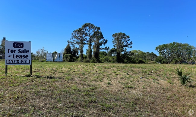
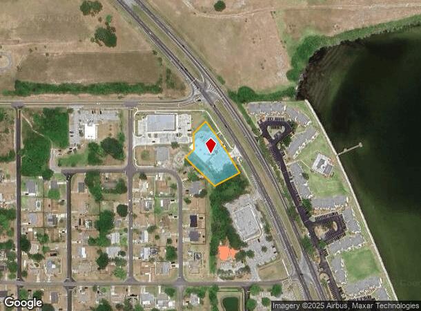
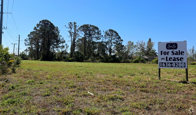
Property Record
7475 N Highway 1, Cocoa, FL 32927
NEARBY LISTINGS FOR SALE OR LEASE
Property Detail
7475 N Highway 1
Palm Bay-Melbourne-Titusville, FL
Delespine On Indian River
23-35-13-01-00007.0-0007.01
DELESPINE ON INDIAN RIVER PART OF BLK 7 AS DESC IN ORB 945 PG 826 & ORB 958 PG 444 AS DESC AS EXHIBIT B IN ORB 9477 PG 2352 PAR 7.02
Storebuilding
Brevard
X
Florida
12009C0310H
7
2024
1.04 AC
2025
Brevard County
062106
Orlando
7,326 SF
DEMOGRAPHICS near 7475 N Highway 1
1 Mile
3 Mile
5 Mile
2024 Total Population
3,597
20,492
40,506
2029 Population
3,907
22,155
43,978
Pop Growth 2024-2029
+ 8.62%
+ 8.12%
+ 8.57%
Average Age
44
42
43
2024 Total Households
1,568
8,124
16,102
HH Growth 2024-2029
+ 8.61%
+ 7.99%
+ 8.41%
Median Household Inc
$58,469
$69,812
$73,286
Avg Household Size
2.20
2.40
2.40
2024 Avg HH Vehicles
2.00
2.00
2.00
Median Home Value
$195,191
$216,043
$236,257
Median Year Built
1983
1986
1987
Nearby Places
Map Layers
Map Styles
 Street
 Aerial
- Restaurants
- Banks
- Shops
- Fitness
- Groceries
PUBLIC TRANSPORTATION
AIRPORT
Melbourne Orlando International
DRIVE
WALK
Distance
Melbourne Orlando International
51 min
35.8 mi
Orlando International
DRIVE
WALK
Distance
Orlando International
49 min
37.9 mi
Orlando Sanford International
DRIVE
WALK
Distance
Orlando Sanford International
64 min
44.6 mi
Freight Ports
Port Canaveral
DRIVE
WALK
Distance
Port Canaveral
23 min
15.3 mi
SALE & LEASE HISTORY
LISTING DATE
SALE/LEASE

Mar 27, 2018
For Lease
Mar 27, 2018
For Sale
Nearby Properties
Address
Land Use
TOTAL SIZE
Lot Size
Zoning
Address
Land Use
TOTAL SIZE
Lot Size
Zoning
413,008 SF
127.62 AC
GMLH
Address
Land Use
TOTAL SIZE
Lot Size
Zoning
248,110 SF
12.77 AC
Address
Land Use
TOTAL SIZE
Lot Size
Zoning
97,548 SF
9.18 AC
Address
Land Use
TOTAL SIZE
Lot Size
Zoning
203,226 SF
511.04 AC
P
Address
Land Use
TOTAL SIZE
Lot Size
Zoning
105,543 SF
16.08 AC
RU19
Address
Land Use
TOTAL SIZE
Lot Size
Zoning
72,664 SF
6.44 AC
PID
Address
Land Use
TOTAL SIZE
Lot Size
Zoning
141,221 SF
85 AC
IU
Address
Land Use
TOTAL SIZE
Lot Size
Zoning
96,436 SF
19.10 AC
RU19
Address
Land Use
TOTAL SIZE
Lot Size
Zoning
60,256 SF
8.44 AC
PID
Address
Land Use
TOTAL SIZE
Lot Size
Zoning
48,555 SF
42.28 AC
IU
Address
Land Use
TOTAL SIZE
Lot Size
Zoning
63,083 SF
18.93 AC
GU
Address
Land Use
TOTAL SIZE
Lot Size
Zoning
188,466 SF
10 AC
PID
Address
Land Use
TOTAL SIZE
Lot Size
Zoning
89,772 SF
10.12 AC
BU1
Address
Land Use
TOTAL SIZE
Lot Size
Zoning
83,661 SF
15.08 AC
PID
Address
Land Use
TOTAL SIZE
Lot Size
Zoning
92,647 SF
7.02 AC
BU-2
Address
Land Use
TOTAL SIZE
Lot Size
Zoning
59,557 SF
7.28 AC
BU1
Address
Land Use
TOTAL SIZE
Lot Size
Zoning
52,526 SF
5.15 AC
PID
Address
Land Use
TOTAL SIZE
Lot Size
Zoning
73,134 SF
9 AC
PIP
Address
Land Use
TOTAL SIZE
Lot Size
Zoning
24,151 SF
4.62 AC
GML-H
Address
Land Use
TOTAL SIZE
Lot Size
Zoning
21,820 SF
4.32 AC
BU1
Address
Land Use
TOTAL SIZE
Lot Size
Zoning
20,168 SF
17.98 AC
AU
Address
Land Use
TOTAL SIZE
Lot Size
Zoning
85,132 SF
13.62 AC
IU
Address
Land Use
TOTAL SIZE
Lot Size
Zoning
60,075 SF
3.55 AC
P
Address
Land Use
TOTAL SIZE
Lot Size
Zoning
36,712 SF
1.80 AC
BU1
Address
Land Use
TOTAL SIZE
Lot Size
Zoning
180.58 AC
IU
Address
Land Use
TOTAL SIZE
Lot Size
Zoning
184.43 AC
IU
Address
Land Use
TOTAL SIZE
Lot Size
Zoning
15,873 SF
2.02 AC
BU-1
Address
Land Use
TOTAL SIZE
Lot Size
Zoning
39,430 SF
2.09 AC
Address
Land Use
TOTAL SIZE
Lot Size
Zoning
7,454 SF
24.95 AC
GML
Address
Land Use
TOTAL SIZE
Lot Size
Zoning
16,014 SF
1.62 AC
BU1
The World's #1 Commercial Real Estate Marketplace
Connect with us
© 2026 CoStar Group
The information above has been obtained from sources believed reliable. While we do not doubt its accuracy we have not verified it and make no guarantee, warranty or representation about it. It is your responsibility to independently confirm its accuracy and completeness. Any projections, opinions, assumptions, or estimates used are for example only and do not represent the current or future performance of the property. The value of this transaction to you depends on tax and other factors which should be evaluated by your tax, financial, and legal advisors. You and your advisors should conduct a careful, independent investigation of the property to determine to your satisfaction the suitability of the property for your needs.