Property Record
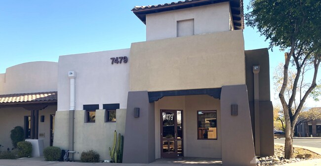
7479 E Tanque Verde Rd, Tucson, AZ 85715

NEARBY LISTINGS FOR SALE OR LEASE
Property Detail
7479 E Tanque Verde Rd
Tucson, AZ
Tanque Verde Place
114-60-0750
TANQUE VERDE PLACE LOT 50
Officecondo
Pima
X
Arizona
04019C1715L
50
2025
0.07 AC
2025
East Tucson
004031
Tucson
1,900 SF
DEMOGRAPHICS near 7479 E Tanque Verde Rd
1 Mile
3 Mile
5 Mile
2024 Total Population
11,055
85,483
229,449
2029 Population
11,394
88,573
237,384
Pop Growth 2024-2029
+ 3.07%
+ 3.61%
+ 3.46%
Average Age
45
44
43
2024 Total Households
5,498
41,894
105,444
HH Growth 2024-2029
+ 3.04%
+ 3.66%
+ 3.53%
Median Household Inc
$66,882
$56,491
$56,505
Avg Household Size
2.00
2.00
2.10
2024 Avg HH Vehicles
2.00
2.00
2.00
Median Home Value
$297,676
$278,705
$267,520
Median Year Built
1983
1978
1977
Nearby Places
Map Layers
Map Styles
 Street
 Aerial
- Restaurants
- Banks
- Shops
- Fitness
- Groceries
PUBLIC TRANSPORTATION
AIRPORT
Tucson International
DRIVE
WALK
Distance
Tucson International
33 min
15.9 mi
Freight Ports
Port of San Diego
DRIVE
WALK
Distance
Port of San Diego
1 min
369.9 mi
SALE & LEASE HISTORY
LISTING DATE
SALE/LEASE

Oct 28, 2020
For Lease
Feb 20, 2025
For Lease
Feb 20, 2025
For Sale
Nearby Properties
Address
Land Use
TOTAL SIZE
Lot Size
Zoning
Address
Land Use
TOTAL SIZE
Lot Size
Zoning
1,089,840 SF
45.56 AC
Address
Land Use
TOTAL SIZE
Lot Size
Zoning
53,431 SF
9.98 AC
Address
Land Use
TOTAL SIZE
Lot Size
Zoning
88,741 SF
8.02 AC
Address
Land Use
TOTAL SIZE
Lot Size
Zoning
684,356 SF
19.65 AC
PAD13
Address
Land Use
TOTAL SIZE
Lot Size
Zoning
473,573 SF
22.65 AC
C3
Address
Land Use
TOTAL SIZE
Lot Size
Zoning
97,724 SF
15.38 AC
SR
Address
Land Use
TOTAL SIZE
Lot Size
Zoning
308,730 SF
10.15 AC
Address
Land Use
TOTAL SIZE
Lot Size
Zoning
504,584 SF
18.17 AC
O3
Address
Land Use
TOTAL SIZE
Lot Size
Zoning
278,632 SF
37.62 AC
RX1
Address
Land Use
TOTAL SIZE
Lot Size
Zoning
430,180 SF
19.78 AC
R3
Address
Land Use
TOTAL SIZE
Lot Size
Zoning
310,878 SF
29.30 AC
TR
Address
Land Use
TOTAL SIZE
Lot Size
Zoning
11,074 SF
0.94 AC
C1
Address
Land Use
TOTAL SIZE
Lot Size
Zoning
364,128 SF
11.55 AC
O3
Address
Land Use
TOTAL SIZE
Lot Size
Zoning
109,335 SF
7.83 AC
PAD13
Address
Land Use
TOTAL SIZE
Lot Size
Zoning
256,775 SF
6.69 AC
C1
Address
Land Use
TOTAL SIZE
Lot Size
Zoning
180,149 SF
17.48 AC
PAD3
Address
Land Use
TOTAL SIZE
Lot Size
Zoning
1,804 SF
8.29 AC
R3
Address
Land Use
TOTAL SIZE
Lot Size
Zoning
326,189 SF
4.31 AC
O3
Address
Land Use
TOTAL SIZE
Lot Size
Zoning
231,434 SF
11.99 AC
Address
Land Use
TOTAL SIZE
Lot Size
Zoning
162,473 SF
6.08 AC
C3
Address
Land Use
TOTAL SIZE
Lot Size
Zoning
240,585 SF
18.16 AC
R2
Address
Land Use
TOTAL SIZE
Lot Size
Zoning
74,815 SF
5.05 AC
Address
Land Use
TOTAL SIZE
Lot Size
Zoning
265,649 SF
12.63 AC
R3
Address
Land Use
TOTAL SIZE
Lot Size
Zoning
145,152 SF
11.54 AC
C2
Address
Land Use
TOTAL SIZE
Lot Size
Zoning
162,630 SF
15.14 AC
Address
Land Use
TOTAL SIZE
Lot Size
Zoning
286,164 SF
5.80 AC
C3
Address
Land Use
TOTAL SIZE
Lot Size
Zoning
289,997 SF
21.55 AC
CR2
Address
Land Use
TOTAL SIZE
Lot Size
Zoning
118,655 SF
8.74 AC
C1
Address
Land Use
TOTAL SIZE
Lot Size
Zoning
240,951 SF
14.13 AC
CB1
Address
Land Use
TOTAL SIZE
Lot Size
Zoning
242,289 SF
14.71 AC
CB1
The World's #1 Commercial Real Estate Marketplace
Connect with us
© 2025 CoStar Group
The information above has been obtained from sources believed reliable. While we do not doubt its accuracy we have not verified it and make no guarantee, warranty or representation about it. It is your responsibility to independently confirm its accuracy and completeness. Any projections, opinions, assumptions, or estimates used are for example only and do not represent the current or future performance of the property. The value of this transaction to you depends on tax and other factors which should be evaluated by your tax, financial, and legal advisors. You and your advisors should conduct a careful, independent investigation of the property to determine to your satisfaction the suitability of the property for your needs.