Property Record
7480 County Road 107, Proctorville, OH 45669


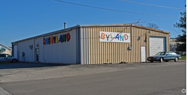
Property Detail
7480 County Road 107
Huntington-Ashland, WV-KY-OH
-00-00 10 PLANTATION ESTATES 0000.00A
18-243-3000-000
Lawrence
Commercialacreage
Ohio
AE The base floodplain where base flood elevations are provided. AE Zones are now used on new format FIRMs instead of A1-A30 Zones.
0.18 AC
2024
Lawrence County
2025
Huntington/Ashland
051401
NEARBY LISTINGS FOR SALE OR LEASE
DEMOGRAPHICS near 7480 County Road 107
1 mile
3 mile
5 mile
2025 Total Population
3,295
25,641
63,786
2030 Population
3,260
25,075
62,665
Pop Growth 2025-2030
(1.06%)
(2.21%)
(1.76%)
Average Age
43
42
40
2025 Total Households
1,421
11,297
27,360
HH Growth 2025-2030
(1.06%)
(2.34%)
(1.85%)
Median Household Inc
$63,434
$53,181
$54,228
Avg Household Size
2.30
2.20
2.20
2025 Avg HH Vehicles
2.00
2.00
2.00
Median Home Value
$145,524
$153,005
$172,314
Median Year Built
1973
1968
1966
Nearby Places
Map Layers
Map Styles
 Street
 Aerial
Layers
 Traffic
 Biking
Places
Listings with unknown addresses are not visible on the map
- Restaurants
- Banks
- Shops
- Fitness
- Groceries
PUBLIC TRANSPORTATION
COMMUTER RAIL
Drive
Walk
Distance
13 min
5.7 mi
AIRPORT
Tri-State/Milton J Ferguson Field
Drive
Walk
Distance
Tri-State/Milton J Ferguson Field
31 min
19.0 mi
Nearby Properties
Address
Land Use
TOTAL SIZE
Lot Size
Zoning
Address
Land Use
TOTAL SIZE
Lot Size
Zoning
6.13 AC
Address
Land Use
TOTAL SIZE
Lot Size
Zoning
83.50 AC
Address
Land Use
TOTAL SIZE
Lot Size
Zoning
29.35 AC
Address
Land Use
TOTAL SIZE
Lot Size
Zoning
1.41 AC
Address
Land Use
TOTAL SIZE
Lot Size
Zoning
2.29 AC
Address
Land Use
TOTAL SIZE
Lot Size
Zoning
49.03 AC
Address
Land Use
TOTAL SIZE
Lot Size
Zoning
141,812 SF
13.43 AC
Address
Land Use
TOTAL SIZE
Lot Size
Zoning
14.23 AC
Address
Land Use
TOTAL SIZE
Lot Size
Zoning
2,550 SF
5.47 AC
Address
Land Use
TOTAL SIZE
Lot Size
Zoning
12.40 AC
Address
Land Use
TOTAL SIZE
Lot Size
Zoning
Address
Land Use
TOTAL SIZE
Lot Size
Zoning
Address
Land Use
TOTAL SIZE
Lot Size
Zoning
62,336 SF
3.14 AC
Address
Land Use
TOTAL SIZE
Lot Size
Zoning
50.86 AC
Address
Land Use
TOTAL SIZE
Lot Size
Zoning
9.71 AC
Address
Land Use
TOTAL SIZE
Lot Size
Zoning
200.77 AC
Address
Land Use
TOTAL SIZE
Lot Size
Zoning
95,844 SF
6 AC
Address
Land Use
TOTAL SIZE
Lot Size
Zoning
14.10 AC
Address
Land Use
TOTAL SIZE
Lot Size
Zoning
74,627 SF
8.44 AC
Address
Land Use
TOTAL SIZE
Lot Size
Zoning
11.07 AC
Address
Land Use
TOTAL SIZE
Lot Size
Zoning
1.21 AC
Address
Land Use
TOTAL SIZE
Lot Size
Zoning
4.86 AC
Address
Land Use
TOTAL SIZE
Lot Size
Zoning
10.77 AC
Address
Land Use
TOTAL SIZE
Lot Size
Zoning
9.20 AC
Address
Land Use
TOTAL SIZE
Lot Size
Zoning
Address
Land Use
TOTAL SIZE
Lot Size
Zoning
Address
Land Use
TOTAL SIZE
Lot Size
Zoning
64,856 SF
2.52 AC
Address
Land Use
TOTAL SIZE
Lot Size
Zoning
0.25 AC
Address
Land Use
TOTAL SIZE
Lot Size
Zoning
1.19 AC
Address
Land Use
TOTAL SIZE
Lot Size
Zoning
0.85 AC
The World's #1 Commercial Real Estate Marketplace
Connect with us
© 2026 CoStar Group
The information above has been obtained from sources believed reliable. While we do not doubt its accuracy we have not verified it and make no guarantee, warranty or representation about it. It is your responsibility to independently confirm its accuracy and completeness. Any projections, opinions, assumptions, or estimates used are for example only and do not represent the current or future performance of the property. The value of this transaction to you depends on tax and other factors which should be evaluated by your tax, financial, and legal advisors. You and your advisors should conduct a careful, independent investigation of the property to determine to your satisfaction the suitability of the property for your needs.