Property Record
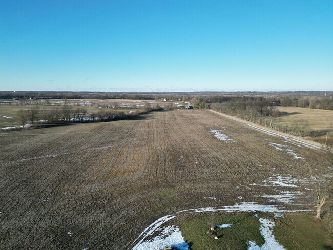
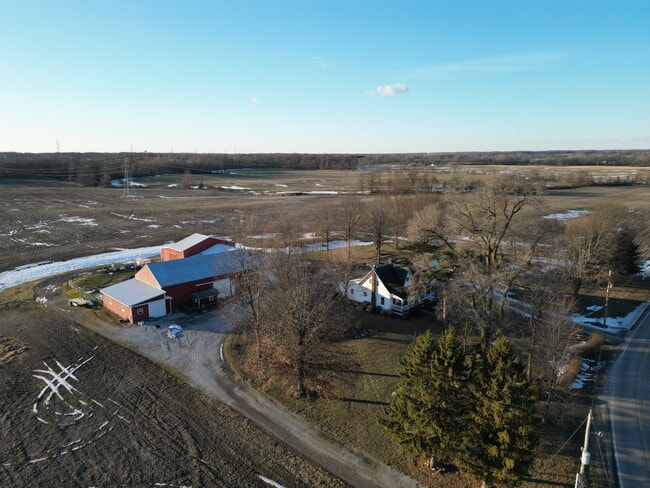
7482 Columbia Rd Sw, Pataskala, OH 43062
NEARBY LISTINGS FOR SALE OR LEASE
Property Detail
7482 Columbia Rd Sw
Columbus, OH
Se Quarter
064-152922-00.000
25.19 AC LOT 16 R15 T1 Q4
Agriculturalland
Licking
X
Ohio
39045C0050G
16
2024
106.39 AC
2024
Licking County
756500
Columbus
DEMOGRAPHICS near 7482 Columbia Rd Sw
1 Mile
3 Mile
5 Mile
2024 Total Population
1,326
19,355
63,725
2029 Population
1,417
20,401
66,321
Pop Growth 2024-2029
+ 6.86%
+ 5.40%
+ 4.07%
Average Age
39
40
39
2024 Total Households
486
7,135
22,499
HH Growth 2024-2029
+ 6.79%
+ 5.31%
+ 3.96%
Median Household Inc
$77,530
$90,078
$94,734
Avg Household Size
2.60
2.60
2.80
2024 Avg HH Vehicles
2.00
2.00
2.00
Median Home Value
$237,500
$235,667
$248,560
Median Year Built
1987
1995
1997
Nearby Places
Map Layers
Map Styles
 Street
 Aerial
- Restaurants
- Banks
- Shops
- Fitness
- Groceries
PUBLIC TRANSPORTATION
AIRPORT
John Glenn Columbus International
DRIVE
WALK
Distance
John Glenn Columbus International
27 min
14.3 mi
Rickenbacker International
DRIVE
WALK
Distance
Rickenbacker International
34 min
22.9 mi
Freight Ports
Port of Toledo
DRIVE
WALK
Distance
Port of Toledo
198 min
156.1 mi
Nearby Properties
Address
Land Use
TOTAL SIZE
Lot Size
Zoning
Address
Land Use
TOTAL SIZE
Lot Size
Zoning
2,556 SF
93.78 AC
Address
Land Use
TOTAL SIZE
Lot Size
Zoning
1,230,350 SF
78.26 AC
Address
Land Use
TOTAL SIZE
Lot Size
Zoning
1,191,656 SF
56.97 AC
Address
Land Use
TOTAL SIZE
Lot Size
Zoning
1,078,218 SF
63.12 AC
Address
Land Use
TOTAL SIZE
Lot Size
Zoning
1,091,997 SF
49.37 AC
Address
Land Use
TOTAL SIZE
Lot Size
Zoning
1,014,005 SF
101.26 AC
Address
Land Use
TOTAL SIZE
Lot Size
Zoning
855,000 SF
96 AC
Address
Land Use
TOTAL SIZE
Lot Size
Zoning
588,910 SF
52.23 AC
Address
Land Use
TOTAL SIZE
Lot Size
Zoning
437,569 SF
33 AC
Address
Land Use
TOTAL SIZE
Lot Size
Zoning
700,491 SF
92.80 AC
Address
Land Use
TOTAL SIZE
Lot Size
Zoning
699,016 SF
43.57 AC
Address
Land Use
TOTAL SIZE
Lot Size
Zoning
Address
Land Use
TOTAL SIZE
Lot Size
Zoning
756,333 SF
44.37 AC
Address
Land Use
TOTAL SIZE
Lot Size
Zoning
179.65 AC
Address
Land Use
TOTAL SIZE
Lot Size
Zoning
524,490 SF
25.40 AC
Address
Land Use
TOTAL SIZE
Lot Size
Zoning
524,494 SF
25.67 AC
Address
Land Use
TOTAL SIZE
Lot Size
Zoning
410,332 SF
21.81 AC
Address
Land Use
TOTAL SIZE
Lot Size
Zoning
512,267 SF
22.36 AC
Address
Land Use
TOTAL SIZE
Lot Size
Zoning
47.69 AC
Address
Land Use
TOTAL SIZE
Lot Size
Zoning
303,408 SF
29.74 AC
Address
Land Use
TOTAL SIZE
Lot Size
Zoning
252,322 SF
13.77 AC
Address
Land Use
TOTAL SIZE
Lot Size
Zoning
83,892 SF
15.80 AC
Address
Land Use
TOTAL SIZE
Lot Size
Zoning
105,628 SF
17.72 AC
Address
Land Use
TOTAL SIZE
Lot Size
Zoning
9,408 SF
12.53 AC
Address
Land Use
TOTAL SIZE
Lot Size
Zoning
78,136 SF
7.46 AC
Address
Land Use
TOTAL SIZE
Lot Size
Zoning
53,202 SF
38.44 AC
Address
Land Use
TOTAL SIZE
Lot Size
Zoning
14,592 SF
15.33 AC
Address
Land Use
TOTAL SIZE
Lot Size
Zoning
70,283 SF
11.36 AC
Address
Land Use
TOTAL SIZE
Lot Size
Zoning
10,419 SF
12.37 AC
Address
Land Use
TOTAL SIZE
Lot Size
Zoning
1,862 SF
105.97 AC
The World's #1 Commercial Real Estate Marketplace
Connect with us
© 2025 CoStar Group
The information above has been obtained from sources believed reliable. While we do not doubt its accuracy we have not verified it and make no guarantee, warranty or representation about it. It is your responsibility to independently confirm its accuracy and completeness. Any projections, opinions, assumptions, or estimates used are for example only and do not represent the current or future performance of the property. The value of this transaction to you depends on tax and other factors which should be evaluated by your tax, financial, and legal advisors. You and your advisors should conduct a careful, independent investigation of the property to determine to your satisfaction the suitability of the property for your needs.