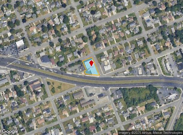
Property Record
749 Farmingdale Rd, West Babylon, NY 11704


NEARBY LISTINGS FOR SALE OR LEASE
Property Detail
749 Farmingdale Rd
Nassau County-Suffolk County, NY
Map Ezra Park
0100-129-00-01-00-083-003
FM 108 SEC 2 BL 11 LTS 10-19 INC
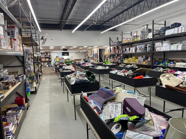
Commercialnec
Suffolk
X
New York
36103C0855H
83
2024
0.40 AC
2024
Southwest Suffolk
122408
Long Island (New York)
10,493 SF
DEMOGRAPHICS near 749 Farmingdale Rd
1 Mile
3 Mile
5 Mile
2024 Total Population
14,767
133,302
311,120
2029 Population
14,291
129,976
304,424
Pop Growth 2024-2029
(3.22%)
(2.50%)
(2.15%)
Average Age
40
40
41
2024 Total Households
4,726
41,935
102,594
HH Growth 2024-2029
(3.47%)
(2.70%)
(2.35%)
Median Household Inc
$110,903
$105,265
$115,365
Avg Household Size
3.10
3.00
2.90
2024 Avg HH Vehicles
2.00
2.00
2.00
Median Home Value
$428,041
$437,777
$479,697
Median Year Built
1958
1961
1959
Nearby Places
- Restaurants
- Banks
- Shops
- Fitness
- Groceries
PUBLIC TRANSPORTATION
COMMUTER RAIL
Pinelawn Station (Ronkonkoma Branch - Long Island Rail Road)
DRIVE
WALK
Distance
Pinelawn Station (Ronkonkoma Branch - Long Island Rail Road)
5 min
2.6 mi
Lindenhurst Station (Babylon Branch - Long Island Rail Road)
DRIVE
WALK
Distance
Lindenhurst Station (Babylon Branch - Long Island Rail Road)
6 min
3.0 mi
AIRPORT
Long Island MacArthur
DRIVE
WALK
Distance
Long Island MacArthur
28 min
19.0 mi
John F Kennedy International
DRIVE
WALK
Distance
John F Kennedy International
37 min
26.1 mi
LaGuardia
DRIVE
WALK
Distance
LaGuardia
47 min
33.0 mi
Freight Ports
NY - Red Hook Container Terminal
DRIVE
WALK
Distance
NY - Red Hook Container Terminal
57 min
37.5 mi
SALE & LEASE HISTORY
LISTING DATE
SALE/LEASE

Oct 15, 2018
For Sale
May 29, 2020
For Lease
May 11, 2022
For Lease
May 11, 2022
For Sale
Feb 02, 2023
For Lease
Feb 02, 2023
For Sale
Nearby Properties
Address
Land Use
TOTAL SIZE
Lot Size
Zoning
Address
Land Use
TOTAL SIZE
Lot Size
Zoning
9.95 AC
BUS3
Address
Land Use
TOTAL SIZE
Lot Size
Zoning
24.90 AC
B
Address
Land Use
TOTAL SIZE
Lot Size
Zoning
6.37 AC
BUS3
Address
Land Use
TOTAL SIZE
Lot Size
Zoning
336,442 SF
43.50 AC
G
Address
Land Use
TOTAL SIZE
Lot Size
Zoning
22.10 AC
Address
Land Use
TOTAL SIZE
Lot Size
Zoning
7.15 AC
Address
Land Use
TOTAL SIZE
Lot Size
Zoning
400 AC
A
Address
Land Use
TOTAL SIZE
Lot Size
Zoning
13.63 AC
B
Address
Land Use
TOTAL SIZE
Lot Size
Zoning
Address
Land Use
TOTAL SIZE
Lot Size
Zoning
44 AC
E
Address
Land Use
TOTAL SIZE
Lot Size
Zoning
9.68 AC
SC
Address
Land Use
TOTAL SIZE
Lot Size
Zoning
3.80 AC
BUS1
Address
Land Use
TOTAL SIZE
Lot Size
Zoning
74.90 AC
G
Address
Land Use
TOTAL SIZE
Lot Size
Zoning
157,191 SF
17.70 AC
G
Address
Land Use
TOTAL SIZE
Lot Size
Zoning
114.70 AC
A
Address
Land Use
TOTAL SIZE
Lot Size
Zoning
0.46 AC
R40
Address
Land Use
TOTAL SIZE
Lot Size
Zoning
292.40 AC
A
Address
Land Use
TOTAL SIZE
Lot Size
Zoning
248.60 AC
A
Address
Land Use
TOTAL SIZE
Lot Size
Zoning
49,004 SF
13.34 AC
Address
Land Use
TOTAL SIZE
Lot Size
Zoning
12.50 AC
C
Address
Land Use
TOTAL SIZE
Lot Size
Zoning
18.30 AC
Address
Land Use
TOTAL SIZE
Lot Size
Zoning
9.39 AC
SC
Address
Land Use
TOTAL SIZE
Lot Size
Zoning
Address
Land Use
TOTAL SIZE
Lot Size
Zoning
2,318 SF
73.46 AC
Address
Land Use
TOTAL SIZE
Lot Size
Zoning
135,605 SF
15.05 AC
E
Address
Land Use
TOTAL SIZE
Lot Size
Zoning
611,060 SF
22.85 AC
GA
Address
Land Use
TOTAL SIZE
Lot Size
Zoning
1,450 SF
0.08 AC
Address
Land Use
TOTAL SIZE
Lot Size
Zoning
207,937 SF
15.41 AC
Address
Land Use
TOTAL SIZE
Lot Size
Zoning
14,162 SF
8.15 AC
Address
Land Use
TOTAL SIZE
Lot Size
Zoning
10.10 AC
SC
The World's #1 Commercial Real Estate Marketplace
Connect with us
© 2025 CoStar Group
The information above has been obtained from sources believed reliable. While we do not doubt its accuracy we have not verified it and make no guarantee, warranty or representation about it. It is your responsibility to independently confirm its accuracy and completeness. Any projections, opinions, assumptions, or estimates used are for example only and do not represent the current or future performance of the property. The value of this transaction to you depends on tax and other factors which should be evaluated by your tax, financial, and legal advisors. You and your advisors should conduct a careful, independent investigation of the property to determine to your satisfaction the suitability of the property for your needs.