Property Record
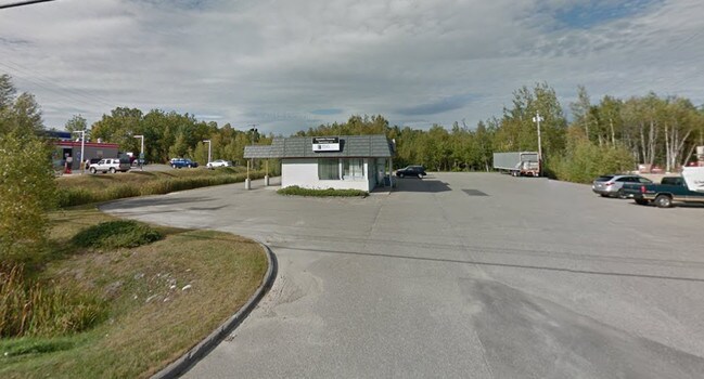
749 Central St, Millinocket, ME 04462

Property Detail
749 Central St
MLNK-000013-000000-000003U
Penobscot
Financialbuilding
Maine
HC
3
2025
1 AC
2025
Other Market Areas
030000
Bangor, ME
NEARBY LISTINGS FOR SALE OR LEASE
-
-
View all Millinocket listings for lease on LoopNet.com
DEMOGRAPHICS near 749 Central St
1 mile
3 mile
5 mile
2025 Total Population
3,073
4,797
4,800
2030 Population
3,182
4,979
4,982
Pop Growth 2025-2030
+ 3.55%
+ 3.79%
+ 3.79%
Average Age
52
51
51
2025 Total Households
1,518
2,394
2,396
HH Growth 2025-2030
+ 3.95%
+ 4.14%
+ 4.13%
Median Household Inc
$53,305
$48,314
$48,342
Avg Household Size
1.90
1.90
1.90
2025 Avg HH Vehicles
2.00
2.00
2.00
Median Home Value
$88,283
$80,331
$80,378
Median Year Built
1964
1960
1960
Nearby Places
Map Layers
Map Styles
 Street
 Aerial
Transit
 Traffic
 Biking
Places
Listings with unknown addresses are not visible on the map
- Restaurants
- Banks
- Shops
- Fitness
- Groceries
SALE & LEASE HISTORY
LISTING DATE
SALE/LEASE

Oct 02, 2017
For Sale
Nov 17, 2017
For Lease
Nearby Properties
Address
Land Use
TOTAL SIZE
Lot Size
Zoning
Address
Land Use
TOTAL SIZE
Lot Size
Zoning
2.30 AC
NC
Address
Land Use
TOTAL SIZE
Lot Size
Zoning
46.70 AC
OR
Address
Land Use
TOTAL SIZE
Lot Size
Zoning
1,225.19 AC
Address
Land Use
TOTAL SIZE
Lot Size
Zoning
1.43 AC
R1
Address
Land Use
TOTAL SIZE
Lot Size
Zoning
2.30 AC
R1
Address
Land Use
TOTAL SIZE
Lot Size
Zoning
7.15 AC
Address
Land Use
TOTAL SIZE
Lot Size
Zoning
8.90 AC
Address
Land Use
TOTAL SIZE
Lot Size
Zoning
2.96 AC
HC
Address
Land Use
TOTAL SIZE
Lot Size
Zoning
3.13 AC
HC
Address
Land Use
TOTAL SIZE
Lot Size
Zoning
7.26 AC
HC
Address
Land Use
TOTAL SIZE
Lot Size
Zoning
1.13 AC
Address
Land Use
TOTAL SIZE
Lot Size
Zoning
0.29 AC
DC
Address
Land Use
TOTAL SIZE
Lot Size
Zoning
1.66 AC
R1
Address
Land Use
TOTAL SIZE
Lot Size
Zoning
15.12 AC
ID
Address
Land Use
TOTAL SIZE
Lot Size
Zoning
2.30 AC
HC
Address
Land Use
TOTAL SIZE
Lot Size
Zoning
4.59 AC
HC
Address
Land Use
TOTAL SIZE
Lot Size
Zoning
0.32 AC
DC
Address
Land Use
TOTAL SIZE
Lot Size
Zoning
138.70 AC
Address
Land Use
TOTAL SIZE
Lot Size
Zoning
3.12 AC
HC
Address
Land Use
TOTAL SIZE
Lot Size
Zoning
8.27 AC
LS
Address
Land Use
TOTAL SIZE
Lot Size
Zoning
0.80 AC
NC
Address
Land Use
TOTAL SIZE
Lot Size
Zoning
2.30 AC
HC
Address
Land Use
TOTAL SIZE
Lot Size
Zoning
0.36 AC
R1
Address
Land Use
TOTAL SIZE
Lot Size
Zoning
3.02 AC
HC
Address
Land Use
TOTAL SIZE
Lot Size
Zoning
47 AC
ID
Address
Land Use
TOTAL SIZE
Lot Size
Zoning
3.77 AC
HC
Address
Land Use
TOTAL SIZE
Lot Size
Zoning
1.06 AC
Address
Land Use
TOTAL SIZE
Lot Size
Zoning
1.16 AC
HC
Address
Land Use
TOTAL SIZE
Lot Size
Zoning
0.44 AC
DC
Address
Land Use
TOTAL SIZE
Lot Size
Zoning
0.75 AC
DC
The World's #1 Commercial Real Estate Marketplace
Connect with us
© 2026 CoStar Group
The information above has been obtained from sources believed reliable. While we do not doubt its accuracy we have not verified it and make no guarantee, warranty or representation about it. It is your responsibility to independently confirm its accuracy and completeness. Any projections, opinions, assumptions, or estimates used are for example only and do not represent the current or future performance of the property. The value of this transaction to you depends on tax and other factors which should be evaluated by your tax, financial, and legal advisors. You and your advisors should conduct a careful, independent investigation of the property to determine to your satisfaction the suitability of the property for your needs.