Property Record
75 2Nd St, Coralville, IA 52241


Property Detail
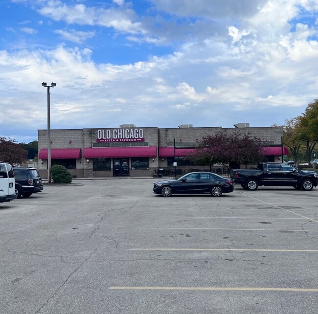
75 2Nd St
Iowa City, IA
MINARD'S PLAT NO 1 LOT 5 EXC THAT LAND DESC IN BK 1053 PG 183
1008103003
Johnson
Restaurantbuilding
Iowa
AE The base floodplain where base flood elevations are provided. AE Zones are now used on new format FIRMs instead of A1-A30 Zones.
5
2025
0.89 AC
2025
Iowa City/Waterloo
000200
Other Market Areas
8,166 SF
NEARBY LISTINGS FOR SALE OR LEASE
DEMOGRAPHICS near 75 2Nd St
1 mile
3 mile
5 mile
2025 Total Population
11,194
76,858
113,601
2030 Population
11,608
79,446
117,246
Pop Growth 2025-2030
+ 3.70%
+ 3.37%
+ 3.21%
Average Age
31
34
36
2025 Total Households
4,316
31,488
46,243
HH Growth 2025-2030
+ 4.05%
+ 3.58%
+ 3.42%
Median Household Inc
$48,222
$52,829
$61,450
Avg Household Size
1.80
2.10
2.20
2025 Avg HH Vehicles
1.00
2.00
2.00
Median Home Value
$353,880
$307,439
$295,736
Median Year Built
1990
1985
1989
Nearby Places
Map Layers
Map Styles
 Street
 Aerial
Layers
 Traffic
 Biking
Places
Listings with unknown addresses are not visible on the map
- Restaurants
- Banks
- Shops
- Fitness
- Groceries
PUBLIC TRANSPORTATION
AIRPORT
The Eastern Iowa
Drive
Walk
Distance
The Eastern Iowa
33 min
22.4 mi
SALE & LEASE HISTORY
LISTING DATE
SALE/LEASE

Oct 11, 2022
For Lease
Oct 11, 2022
For Sale
Aug 14, 2023
For Sale
Nearby Properties
Address
Land Use
TOTAL SIZE
Lot Size
Zoning
Address
Land Use
TOTAL SIZE
Lot Size
Zoning
111.68 AC
Address
Land Use
TOTAL SIZE
Lot Size
Zoning
390,706 SF
4.25 AC
Address
Land Use
TOTAL SIZE
Lot Size
Zoning
52.74 AC
Address
Land Use
TOTAL SIZE
Lot Size
Zoning
236.29 AC
Address
Land Use
TOTAL SIZE
Lot Size
Zoning
155.37 AC
Address
Land Use
TOTAL SIZE
Lot Size
Zoning
Address
Land Use
TOTAL SIZE
Lot Size
Zoning
79.70 AC
Address
Land Use
TOTAL SIZE
Lot Size
Zoning
4,000 SF
0.28 AC
Address
Land Use
TOTAL SIZE
Lot Size
Zoning
Address
Land Use
TOTAL SIZE
Lot Size
Zoning
41.20 AC
Address
Land Use
TOTAL SIZE
Lot Size
Zoning
249.02 AC
Address
Land Use
TOTAL SIZE
Lot Size
Zoning
99,365 SF
37.56 AC
Address
Land Use
TOTAL SIZE
Lot Size
Zoning
285,930 SF
16.28 AC
Address
Land Use
TOTAL SIZE
Lot Size
Zoning
0.96 AC
Address
Land Use
TOTAL SIZE
Lot Size
Zoning
10,037 SF
0.11 AC
Address
Land Use
TOTAL SIZE
Lot Size
Zoning
4.09 AC
Address
Land Use
TOTAL SIZE
Lot Size
Zoning
27.81 AC
Address
Land Use
TOTAL SIZE
Lot Size
Zoning
5.76 AC
Address
Land Use
TOTAL SIZE
Lot Size
Zoning
210,358 SF
7.71 AC
Address
Land Use
TOTAL SIZE
Lot Size
Zoning
182,724 SF
37.90 AC
Address
Land Use
TOTAL SIZE
Lot Size
Zoning
175,246 SF
15.09 AC
Address
Land Use
TOTAL SIZE
Lot Size
Zoning
Address
Land Use
TOTAL SIZE
Lot Size
Zoning
149,760 SF
1.31 AC
Address
Land Use
TOTAL SIZE
Lot Size
Zoning
145,042 SF
0.89 AC
Address
Land Use
TOTAL SIZE
Lot Size
Zoning
183,176 SF
6.24 AC
Address
Land Use
TOTAL SIZE
Lot Size
Zoning
109,299 SF
15.75 AC
Address
Land Use
TOTAL SIZE
Lot Size
Zoning
62,894 SF
4.05 AC
The World's #1 Commercial Real Estate Marketplace
Connect with us
© 2026 CoStar Group
The information above has been obtained from sources believed reliable. While we do not doubt its accuracy we have not verified it and make no guarantee, warranty or representation about it. It is your responsibility to independently confirm its accuracy and completeness. Any projections, opinions, assumptions, or estimates used are for example only and do not represent the current or future performance of the property. The value of this transaction to you depends on tax and other factors which should be evaluated by your tax, financial, and legal advisors. You and your advisors should conduct a careful, independent investigation of the property to determine to your satisfaction the suitability of the property for your needs.