Property Record
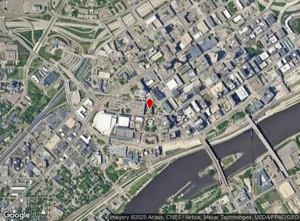
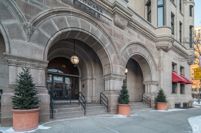
75 5Th St W, Saint Paul, MN 55102

NEARBY LISTINGS FOR SALE OR LEASE
Property Detail
75 5Th St W
Minneapolis-St. Paul-Bloomington, MN-WI
Rice&Irvines B1-25&42-45&54-56
06-28-22-21-0049
RICE&IRVINES B1-25&42-45&54-56 BLK 8
Countyproperty
Ramsey
X
Minnesota
27037C0050E
1
2024
0.87 AC
2025
St Paul CBD
034201
Minneapolis/St Paul
176,735 SF
DEMOGRAPHICS near 75 5Th St W
1 Mile
3 Mile
5 Mile
2024 Total Population
21,774
164,367
362,043
2029 Population
21,663
160,442
354,338
Pop Growth 2024-2029
(0.51%)
(2.39%)
(2.13%)
Average Age
41
36
37
2024 Total Households
12,106
64,381
143,067
HH Growth 2024-2029
(0.44%)
(2.37%)
(2.11%)
Median Household Inc
$58,437
$61,836
$66,862
Avg Household Size
1.60
2.40
2.40
2024 Avg HH Vehicles
1.00
2.00
2.00
Median Home Value
$286,393
$249,312
$273,651
Median Year Built
1971
1950
1957
Nearby Places
Map Layers
Map Styles
 Street
 Aerial
- Restaurants
- Banks
- Shops
- Fitness
- Groceries
PUBLIC TRANSPORTATION
AIRPORT
Minneapolis-St Paul International/Wold-Chamberlain
DRIVE
WALK
Distance
Minneapolis-St Paul International/Wold-Chamberlain
16 min
9.1 mi
SALE & LEASE HISTORY
LISTING DATE
SALE/LEASE

Apr 20, 2017
For Lease
Apr 08, 2022
For Lease
Nearby Properties
Address
Land Use
TOTAL SIZE
Lot Size
Zoning
Address
Land Use
TOTAL SIZE
Lot Size
Zoning
384,515 SF
18.04 AC
Address
Land Use
TOTAL SIZE
Lot Size
Zoning
384,515 SF
1.33 AC
Address
Land Use
TOTAL SIZE
Lot Size
Zoning
582,896 SF
14 AC
Address
Land Use
TOTAL SIZE
Lot Size
Zoning
825,463 SF
7.04 AC
Address
Land Use
TOTAL SIZE
Lot Size
Zoning
63.12 AC
Address
Land Use
TOTAL SIZE
Lot Size
Zoning
646,900 SF
7.66 AC
Address
Land Use
TOTAL SIZE
Lot Size
Zoning
32,854 SF
5.55 AC
Address
Land Use
TOTAL SIZE
Lot Size
Zoning
404,491 SF
27.01 AC
Address
Land Use
TOTAL SIZE
Lot Size
Zoning
408.23 AC
Address
Land Use
TOTAL SIZE
Lot Size
Zoning
420,177 SF
2.13 AC
Address
Land Use
TOTAL SIZE
Lot Size
Zoning
516,325 SF
16.81 AC
Address
Land Use
TOTAL SIZE
Lot Size
Zoning
759,622 SF
2.66 AC
Address
Land Use
TOTAL SIZE
Lot Size
Zoning
786,042 SF
2.10 AC
Address
Land Use
TOTAL SIZE
Lot Size
Zoning
643,305 SF
1.93 AC
Address
Land Use
TOTAL SIZE
Lot Size
Zoning
7.41 AC
Address
Land Use
TOTAL SIZE
Lot Size
Zoning
793,465 SF
1.93 AC
Address
Land Use
TOTAL SIZE
Lot Size
Zoning
3,050 SF
58.60 AC
Address
Land Use
TOTAL SIZE
Lot Size
Zoning
329,070 SF
5.75 AC
Address
Land Use
TOTAL SIZE
Lot Size
Zoning
160,800 SF
5.05 AC
Address
Land Use
TOTAL SIZE
Lot Size
Zoning
393,443 SF
3.75 AC
Address
Land Use
TOTAL SIZE
Lot Size
Zoning
260,739 SF
3.04 AC
Address
Land Use
TOTAL SIZE
Lot Size
Zoning
445,437 SF
7.80 AC
Address
Land Use
TOTAL SIZE
Lot Size
Zoning
265,736 SF
6.67 AC
Address
Land Use
TOTAL SIZE
Lot Size
Zoning
3.13 AC
Address
Land Use
TOTAL SIZE
Lot Size
Zoning
455,628 SF
2.81 AC
Address
Land Use
TOTAL SIZE
Lot Size
Zoning
207.61 AC
Address
Land Use
TOTAL SIZE
Lot Size
Zoning
364,480 SF
8.33 AC
Address
Land Use
TOTAL SIZE
Lot Size
Zoning
444,819 SF
0.86 AC
Address
Land Use
TOTAL SIZE
Lot Size
Zoning
290,482 SF
1.46 AC
Address
Land Use
TOTAL SIZE
Lot Size
Zoning
13.10 AC
The World's #1 Commercial Real Estate Marketplace
Connect with us
© 2025 CoStar Group
The information above has been obtained from sources believed reliable. While we do not doubt its accuracy we have not verified it and make no guarantee, warranty or representation about it. It is your responsibility to independently confirm its accuracy and completeness. Any projections, opinions, assumptions, or estimates used are for example only and do not represent the current or future performance of the property. The value of this transaction to you depends on tax and other factors which should be evaluated by your tax, financial, and legal advisors. You and your advisors should conduct a careful, independent investigation of the property to determine to your satisfaction the suitability of the property for your needs.