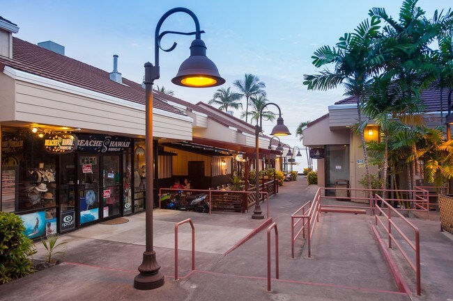
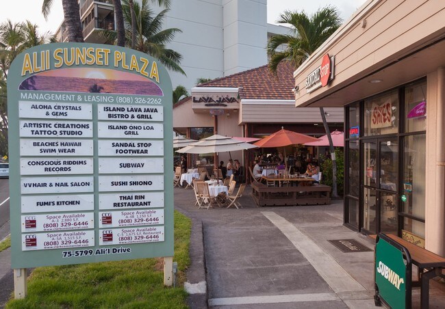
Property Record
75 Alii Dr, Kailua Kona, HI 96740

NEARBY LISTINGS FOR SALE OR LEASE
Property Detail
75 Alii Dr
3-7-5-009-031-0000
Hienaloli 6Th - Puaa 2Nd
Commercialnec
33343 SF MAP 1 LCAPP 1711
X
Hawaii
1551660738F
Hawaii
2024
1.15 AC
2025
Kailua-Kona
021605
Hawaii
23,230 SF
Hilo, HI
DEMOGRAPHICS near 75 Alii Dr
1 Mile
3 Mile
5 Mile
2024 Total Population
6,817
21,728
28,443
2029 Population
7,305
22,870
29,980
Pop Growth 2024-2029
+ 7.16%
+ 5.26%
+ 5.40%
Average Age
44
43
43
2024 Total Households
2,808
8,111
10,509
HH Growth 2024-2029
+ 7.94%
+ 5.83%
+ 5.74%
Median Household Inc
$63,142
$78,394
$79,631
Avg Household Size
2.30
2.50
2.60
2024 Avg HH Vehicles
2.00
2.00
2.00
Median Home Value
$451,402
$658,095
$700,464
Median Year Built
1983
1986
1986
Nearby Places
- Restaurants
- Banks
- Shops
- Fitness
- Groceries
PUBLIC TRANSPORTATION
AIRPORT
Ellison Onizuka Kona International at Keahole
DRIVE
WALK
Distance
Ellison Onizuka Kona International at Keahole
20 min
9.3 mi
SALE & LEASE HISTORY
LISTING DATE
SALE/LEASE

Sep 25, 2016
For Lease
Jan 20, 2017
For Lease
Nearby Properties
Address
Land Use
TOTAL SIZE
Lot Size
Zoning
Address
Land Use
TOTAL SIZE
Lot Size
Zoning
135,452 SF
10 AC
CG-10
Address
Land Use
TOTAL SIZE
Lot Size
Zoning
19.55 AC
CG-20
Address
Land Use
TOTAL SIZE
Lot Size
Zoning
4,135 SF
865.80 AC
OPEN
Address
Land Use
TOTAL SIZE
Lot Size
Zoning
134,941 SF
5.43 AC
V-.75
Address
Land Use
TOTAL SIZE
Lot Size
Zoning
203.01 AC
CG-10
Address
Land Use
TOTAL SIZE
Lot Size
Zoning
129,257 SF
10.63 AC
MCX-20
Address
Land Use
TOTAL SIZE
Lot Size
Zoning
162,628 SF
11.02 AC
MCX-20
Address
Land Use
TOTAL SIZE
Lot Size
Zoning
101,191 SF
40.34 AC
RM-4
Address
Land Use
TOTAL SIZE
Lot Size
Zoning
140,367 SF
13.15 AC
CG-20
Address
Land Use
TOTAL SIZE
Lot Size
Zoning
133,724 SF
10.69 AC
CG-20
Address
Land Use
TOTAL SIZE
Lot Size
Zoning
167,450 SF
1.81 AC
V-.75
Address
Land Use
TOTAL SIZE
Lot Size
Zoning
52,350 SF
102.98 AC
ML-20
Address
Land Use
TOTAL SIZE
Lot Size
Zoning
90,926 SF
9.47 AC
CG-20
Address
Land Use
TOTAL SIZE
Lot Size
Zoning
53,072 SF
5.21 AC
RM-1
Address
Land Use
TOTAL SIZE
Lot Size
Zoning
78,545 SF
7 AC
CG-20
Address
Land Use
TOTAL SIZE
Lot Size
Zoning
125,005 SF
11.35 AC
CG-10
Address
Land Use
TOTAL SIZE
Lot Size
Zoning
51,899 SF
4.81 AC
CG-10
Address
Land Use
TOTAL SIZE
Lot Size
Zoning
22,877 SF
9.27 AC
CG-10
Address
Land Use
TOTAL SIZE
Lot Size
Zoning
108,758 SF
7.69 AC
3M
Address
Land Use
TOTAL SIZE
Lot Size
Zoning
18,432 SF
1.44 AC
V-.75
Address
Land Use
TOTAL SIZE
Lot Size
Zoning
10.04 AC
V-1.25
Address
Land Use
TOTAL SIZE
Lot Size
Zoning
31,262 SF
2.74 AC
A-5a
Address
Land Use
TOTAL SIZE
Lot Size
Zoning
66,665 SF
2.94 AC
A-5a
Address
Land Use
TOTAL SIZE
Lot Size
Zoning
6,042 SF
5.50 AC
RM-4
Address
Land Use
TOTAL SIZE
Lot Size
Zoning
45,311 SF
6.09 AC
MG-1a
Address
Land Use
TOTAL SIZE
Lot Size
Zoning
97,056 SF
10.28 AC
RM-5
Address
Land Use
TOTAL SIZE
Lot Size
Zoning
69,016 SF
4.08 AC
V-.75
Address
Land Use
TOTAL SIZE
Lot Size
Zoning
40,428 SF
6.67 AC
MCX-20
The World's #1 Commercial Real Estate Marketplace
Connect with us
© 2025 CoStar Group
The information above has been obtained from sources believed reliable. While we do not doubt its accuracy we have not verified it and make no guarantee, warranty or representation about it. It is your responsibility to independently confirm its accuracy and completeness. Any projections, opinions, assumptions, or estimates used are for example only and do not represent the current or future performance of the property. The value of this transaction to you depends on tax and other factors which should be evaluated by your tax, financial, and legal advisors. You and your advisors should conduct a careful, independent investigation of the property to determine to your satisfaction the suitability of the property for your needs.