Property Record
75 Allentown Rd, Wolcott, CT 06716
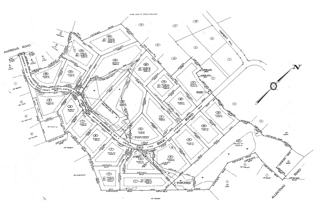

Property Detail
75 Allentown Rd
WOLC-000106-000005-000031C
NEW HAVEN
Privatepreserveopenspacevacantlandforestlandconservation
Connecticut
R-50
31c
B and X Area of moderate flood hazard, usually the area between the limits of the 100-year and 500-year floods.
29.30 AC
2024
Waterbury
2025
Westchester/So Connecticut
361200
New Haven, CT
NEARBY LISTINGS FOR SALE OR LEASE
DEMOGRAPHICS near 75 Allentown Rd
1 mile
3 mile
5 mile
2025 Total Population
2,220
22,810
121,151
2030 Population
2,281
23,421
124,149
Pop Growth 2025-2030
+ 2.75%
+ 2.68%
+ 2.47%
Average Age
43
42
40
2025 Total Households
801
8,721
47,705
HH Growth 2025-2030
+ 2.62%
+ 2.65%
+ 2.55%
Median Household Inc
$106,544
$95,283
$65,443
Avg Household Size
2.70
2.50
2.50
2025 Avg HH Vehicles
2.00
2.00
2.00
Median Home Value
$320,721
$284,101
$261,051
Median Year Built
1967
1975
1962
Nearby Places
Map Layers
Map Styles
 Street
 Aerial
Layers
 Traffic
 Biking
Places
Listings with unknown addresses are not visible on the map
- Restaurants
- Banks
- Shops
- Fitness
- Groceries
PUBLIC TRANSPORTATION
COMMUTER RAIL
Waterbury Station (New Haven Line - Metro-North Commuter Railroad Company (Metro-North))
Drive
Walk
Distance
Waterbury Station (New Haven Line - Metro-North Commuter Railroad Company (Metro-North))
18 min
8.1 mi
AIRPORT
Tweed/New Haven
Drive
Walk
Distance
Tweed/New Haven
55 min
32.1 mi
Bradley International
Drive
Walk
Distance
Bradley International
72 min
38.6 mi
Freight Ports
Port of New Haven
Drive
Walk
Distance
Port of New Haven
51 min
29.8 mi
SALE & LEASE HISTORY
LISTING DATE
SALE/LEASE

Sep 24, 2016
For Sale
Nearby Properties
Address
Land Use
TOTAL SIZE
Lot Size
Zoning
Address
Land Use
TOTAL SIZE
Lot Size
Zoning
276,286 SF
19.50 AC
IG80
Address
Land Use
TOTAL SIZE
Lot Size
Zoning
306,366 SF
84 AC
RS-12
Address
Land Use
TOTAL SIZE
Lot Size
Zoning
39 AC
RM
Address
Land Use
TOTAL SIZE
Lot Size
Zoning
50 AC
R-40
Address
Land Use
TOTAL SIZE
Lot Size
Zoning
24.49 AC
CA
Address
Land Use
TOTAL SIZE
Lot Size
Zoning
10 AC
RS-12
Address
Land Use
TOTAL SIZE
Lot Size
Zoning
125,520 SF
9 AC
CA
Address
Land Use
TOTAL SIZE
Lot Size
Zoning
85,155 SF
29.20 AC
R-30
Address
Land Use
TOTAL SIZE
Lot Size
Zoning
52,542 SF
6.82 AC
R-30
Address
Land Use
TOTAL SIZE
Lot Size
Zoning
29,068 SF
5.25 AC
RM
Address
Land Use
TOTAL SIZE
Lot Size
Zoning
26,224 SF
8.64 AC
RL
Address
Land Use
TOTAL SIZE
Lot Size
Zoning
17.44 AC
GC
Address
Land Use
TOTAL SIZE
Lot Size
Zoning
17 AC
RS
Address
Land Use
TOTAL SIZE
Lot Size
Zoning
3.48 AC
RM
Address
Land Use
TOTAL SIZE
Lot Size
Zoning
508.90 AC
RA1
Address
Land Use
TOTAL SIZE
Lot Size
Zoning
11.31 AC
GC
Address
Land Use
TOTAL SIZE
Lot Size
Zoning
6.50 AC
R-30
Address
Land Use
TOTAL SIZE
Lot Size
Zoning
1,703 SF
119.10 AC
R-40
Address
Land Use
TOTAL SIZE
Lot Size
Zoning
6.36 AC
R-30
Address
Land Use
TOTAL SIZE
Lot Size
Zoning
3,216 SF
6.61 AC
R-30
Address
Land Use
TOTAL SIZE
Lot Size
Zoning
33,786 SF
36.56 AC
EDD-2
Address
Land Use
TOTAL SIZE
Lot Size
Zoning
1.82 AC
R-25
Address
Land Use
TOTAL SIZE
Lot Size
Zoning
475.63 AC
R-30
Address
Land Use
TOTAL SIZE
Lot Size
Zoning
43,818 SF
8.44 AC
IG80
Address
Land Use
TOTAL SIZE
Lot Size
Zoning
11,342 SF
3.07 AC
GC
Address
Land Use
TOTAL SIZE
Lot Size
Zoning
52,574 SF
7.04 AC
IND
Address
Land Use
TOTAL SIZE
Lot Size
Zoning
10.54 AC
R-130
Address
Land Use
TOTAL SIZE
Lot Size
Zoning
13,000 SF
28.65 AC
RL
Address
Land Use
TOTAL SIZE
Lot Size
Zoning
320.40 AC
RS-12
Address
Land Use
TOTAL SIZE
Lot Size
Zoning
8 AC
R-30
The World's #1 Commercial Real Estate Marketplace
Connect with us
© 2026 CoStar Group
The information above has been obtained from sources believed reliable. While we do not doubt its accuracy we have not verified it and make no guarantee, warranty or representation about it. It is your responsibility to independently confirm its accuracy and completeness. Any projections, opinions, assumptions, or estimates used are for example only and do not represent the current or future performance of the property. The value of this transaction to you depends on tax and other factors which should be evaluated by your tax, financial, and legal advisors. You and your advisors should conduct a careful, independent investigation of the property to determine to your satisfaction the suitability of the property for your needs.