Property Record
134 Montague Rd, Amherst, MA 01002


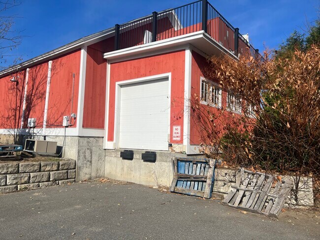
Property Detail
134 Montague Rd
AMHE-000005A-000000-000139
HAMPSHIRE
Commercialofficeresidentialmixeduse
Massachusetts
B and X Area of moderate flood hazard, usually the area between the limits of the 100-year and 500-year floods.
139
2025
12.40 AC
2025
Hampshire County
820300
Hartford
4,391 SF
Amherst Town-Northampton, MA
NEARBY LISTINGS FOR SALE OR LEASE
DEMOGRAPHICS near 134 Montague Rd
1 mile
3 mile
5 mile
2025 Total Population
4,902
31,745
49,955
2030 Population
4,932
31,931
50,164
Pop Growth 2025-2030
+ 0.61%
+ 0.59%
+ 0.42%
Average Age
34
29
33
2025 Total Households
1,853
6,392
13,714
HH Growth 2025-2030
+ 0.54%
+ 0.81%
+ 0.47%
Median Household Inc
$61,875
$62,620
$68,279
Avg Household Size
2.30
2.20
2.20
2025 Avg HH Vehicles
2.00
2.00
2.00
Median Home Value
$553,906
$518,803
$462,374
Median Year Built
1978
1973
1973
Nearby Places
Map Layers
Map Styles
 Street
 Aerial
Transit
 Traffic
 Biking
Places
Listings with unknown addresses are not visible on the map
- Restaurants
- Banks
- Shops
- Fitness
- Groceries
SALE & LEASE HISTORY
LISTING DATE
SALE/LEASE

Nov 30, 2023
For Lease
Nearby Properties
Address
Land Use
TOTAL SIZE
Lot Size
Zoning
Address
Land Use
TOTAL SIZE
Lot Size
Zoning
258,531 SF
17.10 AC
Address
Land Use
TOTAL SIZE
Lot Size
Zoning
197,000 SF
22.53 AC
Address
Land Use
TOTAL SIZE
Lot Size
Zoning
1,344 SF
284.31 AC
Address
Land Use
TOTAL SIZE
Lot Size
Zoning
168,500 SF
18.25 AC
C+I
Address
Land Use
TOTAL SIZE
Lot Size
Zoning
108,000 SF
14.34 AC
Address
Land Use
TOTAL SIZE
Lot Size
Zoning
46,138 SF
0.96 AC
Address
Land Use
TOTAL SIZE
Lot Size
Zoning
103,694 SF
0.81 AC
Address
Land Use
TOTAL SIZE
Lot Size
Zoning
23,690 SF
13.98 AC
Address
Land Use
TOTAL SIZE
Lot Size
Zoning
99,483 SF
1.04 AC
Address
Land Use
TOTAL SIZE
Lot Size
Zoning
10,248 SF
26.17 AC
Address
Land Use
TOTAL SIZE
Lot Size
Zoning
12,032 SF
5.11 AC
Address
Land Use
TOTAL SIZE
Lot Size
Zoning
77,397 SF
0.53 AC
Address
Land Use
TOTAL SIZE
Lot Size
Zoning
5,182 SF
20.70 AC
Address
Land Use
TOTAL SIZE
Lot Size
Zoning
13,426 SF
16 AC
Address
Land Use
TOTAL SIZE
Lot Size
Zoning
11,657 SF
4.26 AC
Address
Land Use
TOTAL SIZE
Lot Size
Zoning
94,560 SF
1.65 AC
Address
Land Use
TOTAL SIZE
Lot Size
Zoning
31.73 AC
Address
Land Use
TOTAL SIZE
Lot Size
Zoning
51,018 SF
0.32 AC
Address
Land Use
TOTAL SIZE
Lot Size
Zoning
2,295.68 AC
Address
Land Use
TOTAL SIZE
Lot Size
Zoning
16,841 SF
0.88 AC
Address
Land Use
TOTAL SIZE
Lot Size
Zoning
18,520 SF
0.56 AC
Address
Land Use
TOTAL SIZE
Lot Size
Zoning
9.65 AC
C+I
Address
Land Use
TOTAL SIZE
Lot Size
Zoning
74,959 SF
Address
Land Use
TOTAL SIZE
Lot Size
Zoning
37,635 SF
1.06 AC
Address
Land Use
TOTAL SIZE
Lot Size
Zoning
32,592 SF
0.35 AC
Address
Land Use
TOTAL SIZE
Lot Size
Zoning
10,080 SF
0.61 AC
Address
Land Use
TOTAL SIZE
Lot Size
Zoning
10,584 SF
7.17 AC
Address
Land Use
TOTAL SIZE
Lot Size
Zoning
31,860 SF
0.42 AC
Address
Land Use
TOTAL SIZE
Lot Size
Zoning
32,045 SF
3.98 AC
Address
Land Use
TOTAL SIZE
Lot Size
Zoning
3,954 SF
2.01 AC
The World's #1 Commercial Real Estate Marketplace
Connect with us
© 2026 CoStar Group
The information above has been obtained from sources believed reliable. While we do not doubt its accuracy we have not verified it and make no guarantee, warranty or representation about it. It is your responsibility to independently confirm its accuracy and completeness. Any projections, opinions, assumptions, or estimates used are for example only and do not represent the current or future performance of the property. The value of this transaction to you depends on tax and other factors which should be evaluated by your tax, financial, and legal advisors. You and your advisors should conduct a careful, independent investigation of the property to determine to your satisfaction the suitability of the property for your needs.