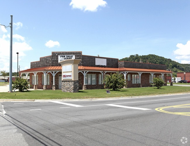
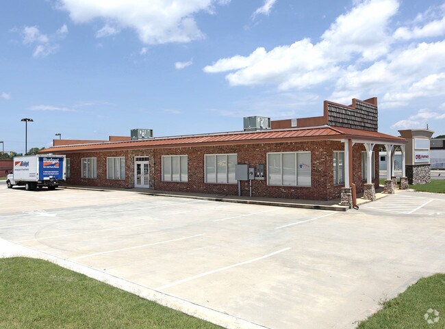
Property Record
75 Douthit Ferry Rd, Cartersville, GA 30120
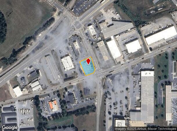
NEARBY LISTINGS FOR SALE OR LEASE
Property Detail
75 Douthit Ferry Rd
C022-0004-021
Com - West/Highway 113
Commercialnec
LL633 LD4 TR 3 PLAT 70-137 WELLSTAR
X
Bartow
13015C0264H
Georgia
2024
0.48 AC
2024
Bartow/Cartersville
960601
Atlanta
4,195 SF
Atlanta-Sandy Springs-Roswell, GA
DEMOGRAPHICS near 75 Douthit Ferry Rd
1 Mile
3 Mile
5 Mile
2024 Total Population
2,791
23,530
47,969
2029 Population
3,060
25,779
52,479
Pop Growth 2024-2029
+ 9.64%
+ 9.56%
+ 9.40%
Average Age
39
39
39
2024 Total Households
1,109
8,814
18,090
HH Growth 2024-2029
+ 9.38%
+ 9.31%
+ 9.15%
Median Household Inc
$65,691
$70,326
$68,669
Avg Household Size
2.40
2.60
2.50
2024 Avg HH Vehicles
2.00
2.00
2.00
Median Home Value
$313,390
$254,811
$234,186
Median Year Built
1990
1987
1990
Nearby Places
Map Layers
Map Styles
 Street
 Aerial
- Restaurants
- Banks
- Shops
- Fitness
- Groceries
Nearby Properties
Address
Land Use
TOTAL SIZE
Lot Size
Zoning
Address
Land Use
TOTAL SIZE
Lot Size
Zoning
226,108 SF
33.73 AC
Address
Land Use
TOTAL SIZE
Lot Size
Zoning
196,710 SF
149.63 AC
Address
Land Use
TOTAL SIZE
Lot Size
Zoning
134,528 SF
4.71 AC
IN
Address
Land Use
TOTAL SIZE
Lot Size
Zoning
Address
Land Use
TOTAL SIZE
Lot Size
Zoning
Address
Land Use
TOTAL SIZE
Lot Size
Zoning
194,306 SF
126.40 AC
A1
Address
Land Use
TOTAL SIZE
Lot Size
Zoning
104,757 SF
45 AC
IN
Address
Land Use
TOTAL SIZE
Lot Size
Zoning
149,158 SF
46.23 AC
IN
Address
Land Use
TOTAL SIZE
Lot Size
Zoning
Address
Land Use
TOTAL SIZE
Lot Size
Zoning
1,200 SF
25.69 AC
IN
Address
Land Use
TOTAL SIZE
Lot Size
Zoning
1,800 SF
102.03 AC
A1
Address
Land Use
TOTAL SIZE
Lot Size
Zoning
194,368 SF
25.02 AC
IN
Address
Land Use
TOTAL SIZE
Lot Size
Zoning
88,974 SF
5.42 AC
IN
Address
Land Use
TOTAL SIZE
Lot Size
Zoning
Address
Land Use
TOTAL SIZE
Lot Size
Zoning
57,164 SF
4.88 AC
Address
Land Use
TOTAL SIZE
Lot Size
Zoning
13.86 AC
IN
Address
Land Use
TOTAL SIZE
Lot Size
Zoning
470,504 SF
22.66 AC
IN
Address
Land Use
TOTAL SIZE
Lot Size
Zoning
29,629 SF
21.90 AC
IN
Address
Land Use
TOTAL SIZE
Lot Size
Zoning
9,272 SF
8 AC
IN
Address
Land Use
TOTAL SIZE
Lot Size
Zoning
66,606 SF
6.74 AC
IN
Address
Land Use
TOTAL SIZE
Lot Size
Zoning
Address
Land Use
TOTAL SIZE
Lot Size
Zoning
128.74 AC
A1
Address
Land Use
TOTAL SIZE
Lot Size
Zoning
61,132 SF
5.39 AC
Address
Land Use
TOTAL SIZE
Lot Size
Zoning
170,445 SF
6.12 AC
IN
Address
Land Use
TOTAL SIZE
Lot Size
Zoning
6,909 SF
10 AC
IN
Address
Land Use
TOTAL SIZE
Lot Size
Zoning
70,987 SF
7.45 AC
IN
Address
Land Use
TOTAL SIZE
Lot Size
Zoning
70,122 SF
6.10 AC
Address
Land Use
TOTAL SIZE
Lot Size
Zoning
211,879 SF
23.57 AC
IN
Address
Land Use
TOTAL SIZE
Lot Size
Zoning
92,072 SF
11.77 AC
IN
Address
Land Use
TOTAL SIZE
Lot Size
Zoning
8,816 SF
5.20 AC
IN
The World's #1 Commercial Real Estate Marketplace
Connect with us
© 2025 CoStar Group
The information above has been obtained from sources believed reliable. While we do not doubt its accuracy we have not verified it and make no guarantee, warranty or representation about it. It is your responsibility to independently confirm its accuracy and completeness. Any projections, opinions, assumptions, or estimates used are for example only and do not represent the current or future performance of the property. The value of this transaction to you depends on tax and other factors which should be evaluated by your tax, financial, and legal advisors. You and your advisors should conduct a careful, independent investigation of the property to determine to your satisfaction the suitability of the property for your needs.