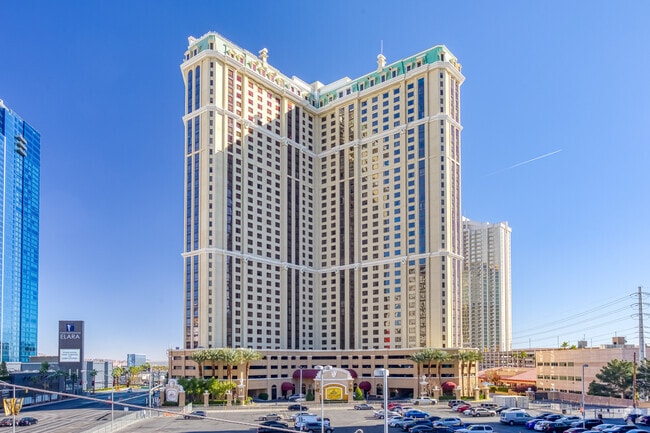
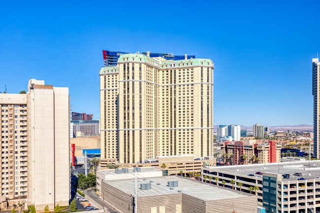
Property Record
75 E Harmon Ave, Las Vegas, NV 89109
Property Detail
75 E Harmon Ave
162-21-314-003
GRAND CHATEAU PLAT BOOK 117 PAGE 20 PT LOT 1
Hotel
Clark
H1
Nevada
B and X Area of moderate flood hazard, usually the area between the limits of the 100-year and 500-year floods.
1
2026
1.08 AC
2026
Las Vegas Strip
006700
Las Vegas
527,044 SF
Las Vegas-Henderson-North Las Vegas, NV
NEARBY LISTINGS FOR SALE OR LEASE
DEMOGRAPHICS near 75 E Harmon Ave
1 mile
3 mile
5 mile
2025 Total Population
9,605
154,436
386,304
2030 Population
10,650
164,568
407,424
Pop Growth 2025-2030
+ 10.88%
+ 6.56%
+ 5.47%
Average Age
45
39
41
2025 Total Households
5,915
70,479
162,643
HH Growth 2025-2030
+ 10.70%
+ 6.52%
+ 5.55%
Median Household Inc
$82,100
$48,215
$56,980
Avg Household Size
1.60
2.10
2.30
2025 Avg HH Vehicles
1.00
1.00
1.00
Median Home Value
$880,281
$374,862
$389,623
Median Year Built
2002
1985
1984
Nearby Places
Map Layers
Map Styles
 Street
 Aerial
Transit
 Traffic
 Biking
Places
Listings with unknown addresses are not visible on the map
- Restaurants
- Banks
- Shops
- Fitness
- Groceries
PUBLIC TRANSPORTATION
TRANSIT/SUBWAY
Bally's/Paris Las Vegas Station (Las Vegas Monorail - Las Vegas Monorail (The Monorail))
Drive
Walk
Distance
Bally's/Paris Las Vegas Station (Las Vegas Monorail - Las Vegas Monorail (The Monorail))
2 min
11 min
0.5 mi
Mgm Grand Station (Las Vegas Monorail - Las Vegas Monorail (The Monorail))
Drive
Walk
Distance
Mgm Grand Station (Las Vegas Monorail - Las Vegas Monorail (The Monorail))
3 min
10 min
0.5 mi
Flamingo/Caesars Palace Station (Las Vegas Monorail - Las Vegas Monorail (The Monorail))
Drive
Walk
Distance
Flamingo/Caesars Palace Station (Las Vegas Monorail - Las Vegas Monorail (The Monorail))
3 min
18 min
0.9 mi
AIRPORT
Harry Reid International
Drive
Walk
Distance
Harry Reid International
7 min
3.0 mi
Boulder City Municipal
Drive
Walk
Distance
Boulder City Municipal
34 min
24.0 mi
Freight Ports
Port of Long Beach
Drive
Walk
Distance
Port of Long Beach
313 min
279.4 mi
Nearby Properties
Address
Land Use
TOTAL SIZE
Lot Size
Zoning
Address
Land Use
TOTAL SIZE
Lot Size
Zoning
2,000,377 SF
118.89 AC
Address
Land Use
TOTAL SIZE
Lot Size
Zoning
3,693,440 SF
43.59 AC
Address
Land Use
TOTAL SIZE
Lot Size
Zoning
3,391,505 SF
68.52 AC
Address
Land Use
TOTAL SIZE
Lot Size
Zoning
1,546,466 SF
61.43 AC
H1
Address
Land Use
TOTAL SIZE
Lot Size
Zoning
1,172,527 SF
19.67 AC
H1
Address
Land Use
TOTAL SIZE
Lot Size
Zoning
2,207,746 SF
74.17 AC
Address
Land Use
TOTAL SIZE
Lot Size
Zoning
1,044,724 SF
56.56 AC
Address
Land Use
TOTAL SIZE
Lot Size
Zoning
2,828,726 SF
101.88 AC
Address
Land Use
TOTAL SIZE
Lot Size
Zoning
937,376 SF
59.19 AC
Address
Land Use
TOTAL SIZE
Lot Size
Zoning
820,224 SF
59.80 AC
H1
Address
Land Use
TOTAL SIZE
Lot Size
Zoning
8,805 SF
45.63 AC
Address
Land Use
TOTAL SIZE
Lot Size
Zoning
1,447,338 SF
65.25 AC
H1
Address
Land Use
TOTAL SIZE
Lot Size
Zoning
2,414,853 SF
16.59 AC
H1
Address
Land Use
TOTAL SIZE
Lot Size
Zoning
74,148 SF
18.51 AC
Address
Land Use
TOTAL SIZE
Lot Size
Zoning
1,166,098 SF
57.58 AC
Address
Land Use
TOTAL SIZE
Lot Size
Zoning
763,204 SF
10.47 AC
H1
Address
Land Use
TOTAL SIZE
Lot Size
Zoning
225,512 SF
50.14 AC
Address
Land Use
TOTAL SIZE
Lot Size
Zoning
112,160 SF
20.60 AC
Address
Land Use
TOTAL SIZE
Lot Size
Zoning
742,547 SF
19.87 AC
H1
Address
Land Use
TOTAL SIZE
Lot Size
Zoning
248,689 SF
19.45 AC
H1
Address
Land Use
TOTAL SIZE
Lot Size
Zoning
318,755 SF
29.92 AC
Address
Land Use
TOTAL SIZE
Lot Size
Zoning
171,303 SF
17.87 AC
H1
Address
Land Use
TOTAL SIZE
Lot Size
Zoning
1,911,901 SF
1.24 AC
Address
Land Use
TOTAL SIZE
Lot Size
Zoning
299,144 SF
19.37 AC
Address
Land Use
TOTAL SIZE
Lot Size
Zoning
79.03 AC
PF
Address
Land Use
TOTAL SIZE
Lot Size
Zoning
777,838 SF
36.14 AC
H1
Address
Land Use
TOTAL SIZE
Lot Size
Zoning
3,200 SF
16.74 AC
Address
Land Use
TOTAL SIZE
Lot Size
Zoning
1,744,547 SF
8.25 AC
Address
Land Use
TOTAL SIZE
Lot Size
Zoning
659,669 SF
24.79 AC
H1
Address
Land Use
TOTAL SIZE
Lot Size
Zoning
873,377 SF
28.08 AC
The World's #1 Commercial Real Estate Marketplace
Connect with us
© 2026 CoStar Group
The information above has been obtained from sources believed reliable. While we do not doubt its accuracy we have not verified it and make no guarantee, warranty or representation about it. It is your responsibility to independently confirm its accuracy and completeness. Any projections, opinions, assumptions, or estimates used are for example only and do not represent the current or future performance of the property. The value of this transaction to you depends on tax and other factors which should be evaluated by your tax, financial, and legal advisors. You and your advisors should conduct a careful, independent investigation of the property to determine to your satisfaction the suitability of the property for your needs.