Property Record
75 E Main St, Merrimac, MA 01860
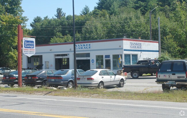

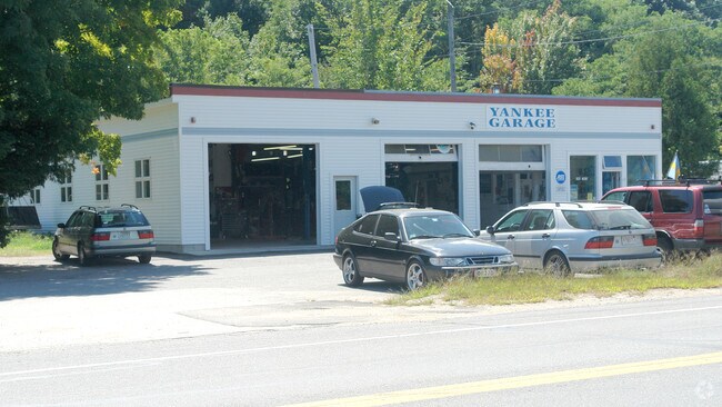
Property Detail
75 E Main St
MERR-000039-000001-000005
ESSEX
Autorepair
Massachusetts
RH
5
B and X Area of moderate flood hazard, usually the area between the limits of the 100-year and 500-year floods.
0.69 AC
2025
Amesbury/Ipswich
2025
Boston
262100
Boston-Cambridge-Newton, MA-NH
2,724 SF
NEARBY LISTINGS FOR SALE OR LEASE
DEMOGRAPHICS near 75 E Main St
1 mile
3 mile
5 mile
2025 Total Population
4,484
16,911
51,374
2030 Population
4,660
17,426
52,628
Pop Growth 2025-2030
+ 3.93%
+ 3.05%
+ 2.44%
Average Age
45
44
44
2025 Total Households
1,836
6,561
20,319
HH Growth 2025-2030
+ 3.92%
+ 2.99%
+ 2.38%
Median Household Inc
$96,825
$118,036
$118,934
Avg Household Size
2.40
2.50
2.50
2025 Avg HH Vehicles
2.00
2.00
2.00
Median Home Value
$560,653
$624,198
$614,770
Median Year Built
1987
1984
1977
Nearby Places
Map Layers
Map Styles
 Street
 Aerial
Transit
 Traffic
 Biking
Places
Listings with unknown addresses are not visible on the map
- Restaurants
- Banks
- Shops
- Fitness
- Groceries
PUBLIC TRANSPORTATION
COMMUTER RAIL
Haverhill (Haverhill Line - Massachusetts Bay Transportation Authority Commuter Rail (Purple Line))
Drive
Walk
Distance
Haverhill (Haverhill Line - Massachusetts Bay Transportation Authority Commuter Rail (Purple Line))
13 min
7.8 mi
Bradford (Haverhill Line - Massachusetts Bay Transportation Authority Commuter Rail (Purple Line))
Drive
Walk
Distance
Bradford (Haverhill Line - Massachusetts Bay Transportation Authority Commuter Rail (Purple Line))
14 min
8.3 mi
AIRPORT
Portsmouth International at Pease
Drive
Walk
Distance
Portsmouth International at Pease
34 min
24.2 mi
Manchester Boston Regional
Drive
Walk
Distance
Manchester Boston Regional
54 min
37.6 mi
General Edward Lawrence Logan International
Drive
Walk
Distance
General Edward Lawrence Logan International
58 min
44.6 mi
Nearby Properties
Address
Land Use
TOTAL SIZE
Lot Size
Zoning
Address
Land Use
TOTAL SIZE
Lot Size
Zoning
26.44 AC
OP
Address
Land Use
TOTAL SIZE
Lot Size
Zoning
481,367 SF
166.72 AC
Address
Land Use
TOTAL SIZE
Lot Size
Zoning
176,157 SF
25.53 AC
OSC
Address
Land Use
TOTAL SIZE
Lot Size
Zoning
4.30 AC
R40
Address
Land Use
TOTAL SIZE
Lot Size
Zoning
129.11 AC
RC
Address
Land Use
TOTAL SIZE
Lot Size
Zoning
147,462 SF
10.60 AC
I
Address
Land Use
TOTAL SIZE
Lot Size
Zoning
8.54 AC
RH
Address
Land Use
TOTAL SIZE
Lot Size
Zoning
63,258 SF
8.01 AC
RH
Address
Land Use
TOTAL SIZE
Lot Size
Zoning
61,320 SF
35.32 AC
OSC
Address
Land Use
TOTAL SIZE
Lot Size
Zoning
74,516 SF
13.40 AC
VR
Address
Land Use
TOTAL SIZE
Lot Size
Zoning
14.35 AC
R20
Address
Land Use
TOTAL SIZE
Lot Size
Zoning
424,000 SF
42.54 AC
I
Address
Land Use
TOTAL SIZE
Lot Size
Zoning
49.70 AC
I
Address
Land Use
TOTAL SIZE
Lot Size
Zoning
77,498 SF
23.60 AC
I
Address
Land Use
TOTAL SIZE
Lot Size
Zoning
6.80 AC
RH
Address
Land Use
TOTAL SIZE
Lot Size
Zoning
78 AC
RES
Address
Land Use
TOTAL SIZE
Lot Size
Zoning
2,520 SF
16.61 AC
OSC
Address
Land Use
TOTAL SIZE
Lot Size
Zoning
10.75 AC
OSC
Address
Land Use
TOTAL SIZE
Lot Size
Zoning
123,024 SF
22.96 AC
I
Address
Land Use
TOTAL SIZE
Lot Size
Zoning
87,720 SF
22.37 AC
OI
Address
Land Use
TOTAL SIZE
Lot Size
Zoning
84,180 SF
6.92 AC
I
Address
Land Use
TOTAL SIZE
Lot Size
Zoning
52,802 SF
12.50 AC
SR
Address
Land Use
TOTAL SIZE
Lot Size
Zoning
84,171 SF
6.07 AC
I
Address
Land Use
TOTAL SIZE
Lot Size
Zoning
2.72 AC
R80
Address
Land Use
TOTAL SIZE
Lot Size
Zoning
27,648 SF
2.16 AC
VR
Address
Land Use
TOTAL SIZE
Lot Size
Zoning
17.92 AC
OP
Address
Land Use
TOTAL SIZE
Lot Size
Zoning
34,502 SF
5.71 AC
R8
Address
Land Use
TOTAL SIZE
Lot Size
Zoning
14,572 SF
5.96 AC
RH
Address
Land Use
TOTAL SIZE
Lot Size
Zoning
53,600 SF
3.75 AC
I
Address
Land Use
TOTAL SIZE
Lot Size
Zoning
706 SF
67 AC
RB
The World's #1 Commercial Real Estate Marketplace
Connect with us
© 2026 CoStar Group
The information above has been obtained from sources believed reliable. While we do not doubt its accuracy we have not verified it and make no guarantee, warranty or representation about it. It is your responsibility to independently confirm its accuracy and completeness. Any projections, opinions, assumptions, or estimates used are for example only and do not represent the current or future performance of the property. The value of this transaction to you depends on tax and other factors which should be evaluated by your tax, financial, and legal advisors. You and your advisors should conduct a careful, independent investigation of the property to determine to your satisfaction the suitability of the property for your needs.