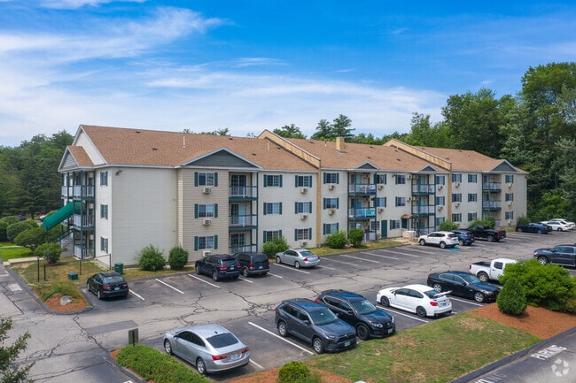
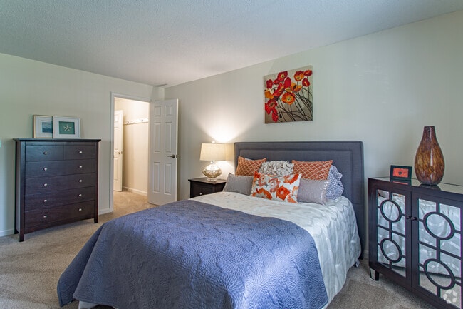
Property Record
75 Greenview Dr, Manchester, NH 03102
NEARBY LISTINGS FOR SALE OR LEASE
Property Detail
75 Greenview Dr
MNCH-000767C-000000-000004
Hillsborough
Apartment
New Hampshire
X
4
33013C0686E
3.74 AC
2024
Northwest Manchester
2024
Boston
000203
Manchester-Nashua, NH
42,008 SF
DEMOGRAPHICS near 75 Greenview Dr
1 Mile
3 Mile
5 Mile
2024 Total Population
6,146
45,972
125,026
2029 Population
6,310
47,186
127,407
Pop Growth 2024-2029
+ 2.67%
+ 2.64%
+ 1.90%
Average Age
41
41
40
2024 Total Households
2,929
19,864
51,751
HH Growth 2024-2029
+ 2.94%
+ 2.72%
+ 1.96%
Median Household Inc
$76,597
$80,260
$73,956
Avg Household Size
1.90
2.20
2.20
2024 Avg HH Vehicles
2.00
2.00
2.00
Median Home Value
$340,765
$342,290
$319,176
Median Year Built
1986
1977
1969
Nearby Places
Map Layers
Map Styles
 Street
 Aerial
- Restaurants
- Banks
- Shops
- Fitness
- Groceries
PUBLIC TRANSPORTATION
AIRPORT
Manchester Boston Regional
DRIVE
WALK
Distance
Manchester Boston Regional
23 min
10.7 mi
Freight Ports
Port of Boston
DRIVE
WALK
Distance
Port of Boston
88 min
60.5 mi
Nearby Properties
Address
Land Use
TOTAL SIZE
Lot Size
Zoning
Address
Land Use
TOTAL SIZE
Lot Size
Zoning
58,227 SF
66.52 AC
Address
Land Use
TOTAL SIZE
Lot Size
Zoning
26,232 SF
39.97 AC
Address
Land Use
TOTAL SIZE
Lot Size
Zoning
12.60 AC
PZ
Address
Land Use
TOTAL SIZE
Lot Size
Zoning
135,686 SF
30.23 AC
Address
Land Use
TOTAL SIZE
Lot Size
Zoning
36,070 SF
141.66 AC
MUD4
Address
Land Use
TOTAL SIZE
Lot Size
Zoning
250,905 SF
1.16 AC
Address
Land Use
TOTAL SIZE
Lot Size
Zoning
8,064 SF
33.49 AC
Address
Land Use
TOTAL SIZE
Lot Size
Zoning
26,125 SF
150.66 AC
Address
Land Use
TOTAL SIZE
Lot Size
Zoning
143,630 SF
57.86 AC
Address
Land Use
TOTAL SIZE
Lot Size
Zoning
16,464 SF
15.19 AC
Address
Land Use
TOTAL SIZE
Lot Size
Zoning
16,000 SF
58.17 AC
Address
Land Use
TOTAL SIZE
Lot Size
Zoning
51.32 AC
MUD4
Address
Land Use
TOTAL SIZE
Lot Size
Zoning
154,363 SF
17.25 AC
MUD3
Address
Land Use
TOTAL SIZE
Lot Size
Zoning
264,671 SF
4.04 AC
Address
Land Use
TOTAL SIZE
Lot Size
Zoning
206,478 SF
3.91 AC
Address
Land Use
TOTAL SIZE
Lot Size
Zoning
44,301 SF
71.24 AC
Address
Land Use
TOTAL SIZE
Lot Size
Zoning
224,859 SF
17.70 AC
Address
Land Use
TOTAL SIZE
Lot Size
Zoning
8,530 SF
26.33 AC
Address
Land Use
TOTAL SIZE
Lot Size
Zoning
Address
Land Use
TOTAL SIZE
Lot Size
Zoning
27,450 SF
9.10 AC
Address
Land Use
TOTAL SIZE
Lot Size
Zoning
72,932 SF
44.26 AC
Address
Land Use
TOTAL SIZE
Lot Size
Zoning
367,086 SF
3.65 AC
Address
Land Use
TOTAL SIZE
Lot Size
Zoning
41,252 SF
6.87 AC
Address
Land Use
TOTAL SIZE
Lot Size
Zoning
107,144 SF
8.75 AC
Address
Land Use
TOTAL SIZE
Lot Size
Zoning
82,670 SF
27.76 AC
PZ
Address
Land Use
TOTAL SIZE
Lot Size
Zoning
5,150 SF
13.50 AC
Address
Land Use
TOTAL SIZE
Lot Size
Zoning
1,621 SF
8.24 AC
Address
Land Use
TOTAL SIZE
Lot Size
Zoning
146,177 SF
1.35 AC
Address
Land Use
TOTAL SIZE
Lot Size
Zoning
69,339 SF
39.63 AC
IND
Address
Land Use
TOTAL SIZE
Lot Size
Zoning
96,192 SF
17.42 AC
IND
The World's #1 Commercial Real Estate Marketplace
Connect with us
© 2025 CoStar Group
The information above has been obtained from sources believed reliable. While we do not doubt its accuracy we have not verified it and make no guarantee, warranty or representation about it. It is your responsibility to independently confirm its accuracy and completeness. Any projections, opinions, assumptions, or estimates used are for example only and do not represent the current or future performance of the property. The value of this transaction to you depends on tax and other factors which should be evaluated by your tax, financial, and legal advisors. You and your advisors should conduct a careful, independent investigation of the property to determine to your satisfaction the suitability of the property for your needs.