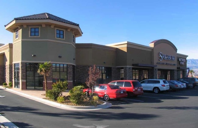
Property Record
75 N 2000 W, Hurricane, UT 84737

Property Detail
75 N 2000 W
0075450
S: 33 T: 41S R: 13W BEG AT PT S0*1151 E ALG C/S/L 35.16 FT FM W1/4 COR SEC 33 T41S R13W, SD PT BEING ON 386.0 FT RAD NON-TNGT CUR LFT HAV RAD N3*5651 E SD CUR BEING SLY R/W OF 200 NORTH STREET; TH CONT ALG SD R/W ELY 26.38 FT ALG ARC OF SD CUR THRU C
Commercialnec
WASHINGTON
HC
Utah
B and X Area of moderate flood hazard, usually the area between the limits of the 100-year and 500-year floods.
6.46 AC
2024
Cedar City & St George
2025
Other Market Areas
270904
St. George, UT
20,139 SF
NEARBY LISTINGS FOR SALE OR LEASE
DEMOGRAPHICS near 75 N 2000 W
1 mile
3 mile
5 mile
2025 Total Population
4,241
16,856
28,413
2030 Population
4,677
18,353
30,973
Pop Growth 2025-2030
+ 10.28%
+ 8.88%
+ 9.01%
Average Age
44
41
41
2025 Total Households
1,649
5,869
9,874
HH Growth 2025-2030
+ 10.55%
+ 9.29%
+ 9.33%
Median Household Inc
$74,827
$72,418
$74,145
Avg Household Size
2.50
2.80
2.80
2025 Avg HH Vehicles
2.00
2.00
2.00
Median Home Value
$527,825
$466,443
$468,432
Median Year Built
2009
2003
2002
Nearby Places
Map Layers
Map Styles
 Street
 Aerial
Layers
 Traffic
 Biking
Places
Listings with unknown addresses are not visible on the map
- Restaurants
- Banks
- Shops
- Fitness
- Groceries
PUBLIC TRANSPORTATION
AIRPORT
St George Regional
Drive
Walk
Distance
St George Regional
27 min
18.4 mi
Freight Ports
Port of Long Beach
Drive
Walk
Distance
Port of Long Beach
460 min
417.6 mi
Nearby Properties
Address
Land Use
TOTAL SIZE
Lot Size
Zoning
Address
Land Use
TOTAL SIZE
Lot Size
Zoning
500.58 AC
Address
Land Use
TOTAL SIZE
Lot Size
Zoning
163,468 SF
19.73 AC
HC
Address
Land Use
TOTAL SIZE
Lot Size
Zoning
48,529 SF
26.71 AC
M1
Address
Land Use
TOTAL SIZE
Lot Size
Zoning
93,494 SF
23.97 AC
PF
Address
Land Use
TOTAL SIZE
Lot Size
Zoning
55,676 SF
8.90 AC
PF
Address
Land Use
TOTAL SIZE
Lot Size
Zoning
57,202 SF
2.50 AC
Address
Land Use
TOTAL SIZE
Lot Size
Zoning
48,863 SF
1.72 AC
HC
Address
Land Use
TOTAL SIZE
Lot Size
Zoning
38,940 SF
1.03 AC
Address
Land Use
TOTAL SIZE
Lot Size
Zoning
1,155 SF
68.88 AC
APO
Address
Land Use
TOTAL SIZE
Lot Size
Zoning
30,643 SF
26.13 AC
PDO
Address
Land Use
TOTAL SIZE
Lot Size
Zoning
7,254 SF
6.15 AC
HC
Address
Land Use
TOTAL SIZE
Lot Size
Zoning
134,714 SF
14.80 AC
M-1
Address
Land Use
TOTAL SIZE
Lot Size
Zoning
42,267 SF
3.09 AC
HC
Address
Land Use
TOTAL SIZE
Lot Size
Zoning
22,080 SF
6.82 AC
HC
Address
Land Use
TOTAL SIZE
Lot Size
Zoning
4,913 SF
37.50 AC
A5
Address
Land Use
TOTAL SIZE
Lot Size
Zoning
49,953 SF
1.83 AC
HC
Address
Land Use
TOTAL SIZE
Lot Size
Zoning
1,708 SF
47.04 AC
RA1
Address
Land Use
TOTAL SIZE
Lot Size
Zoning
30,519 SF
5.76 AC
HC
Address
Land Use
TOTAL SIZE
Lot Size
Zoning
22,576 SF
5.35 AC
Address
Land Use
TOTAL SIZE
Lot Size
Zoning
23,586 SF
3.52 AC
HC
Address
Land Use
TOTAL SIZE
Lot Size
Zoning
48,990 SF
24.69 AC
PF
Address
Land Use
TOTAL SIZE
Lot Size
Zoning
34,486 SF
3.03 AC
HC
Address
Land Use
TOTAL SIZE
Lot Size
Zoning
1 SF
9.10 AC
HC
The World's #1 Commercial Real Estate Marketplace
Connect with us
© 2026 CoStar Group
The information above has been obtained from sources believed reliable. While we do not doubt its accuracy we have not verified it and make no guarantee, warranty or representation about it. It is your responsibility to independently confirm its accuracy and completeness. Any projections, opinions, assumptions, or estimates used are for example only and do not represent the current or future performance of the property. The value of this transaction to you depends on tax and other factors which should be evaluated by your tax, financial, and legal advisors. You and your advisors should conduct a careful, independent investigation of the property to determine to your satisfaction the suitability of the property for your needs.