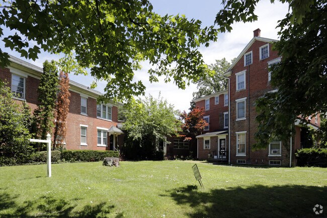
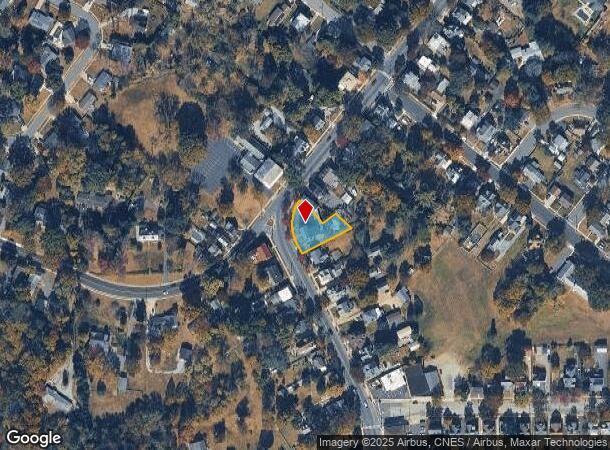
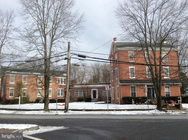
Property Record
75 N Main St, Woodstown, NJ 08098
NEARBY LISTINGS FOR SALE OR LEASE
-
-
View all Woodstown listings for sale on LoopNet.com
Property Detail
75 N Main St
15-00020-0000-00001
Salem
Officebuilding
New Jersey
X
1
34033C0089C
0.33 AC
2024
Salem County
2025
Philadelphia
020800
Philadelphia-Camden-Wilmington, PA-NJ-DE-MD
4,873 SF
DEMOGRAPHICS near 75 N Main St
1 Mile
3 Mile
5 Mile
2024 Total Population
4,701
7,224
13,104
2029 Population
4,819
7,319
13,330
Pop Growth 2024-2029
+ 2.51%
+ 1.32%
+ 1.72%
Average Age
41
42
41
2024 Total Households
1,949
2,885
4,829
HH Growth 2024-2029
+ 2.72%
+ 1.49%
+ 1.70%
Median Household Inc
$94,233
$103,729
$111,087
Avg Household Size
2.40
2.40
2.60
2024 Avg HH Vehicles
2.00
2.00
2.00
Median Home Value
$253,668
$281,638
$328,426
Median Year Built
1972
1973
1979
Nearby Places
Map Layers
Map Styles
 Street
 Aerial
- Restaurants
- Banks
- Shops
- Fitness
- Groceries
PUBLIC TRANSPORTATION
AIRPORT
Philadelphia International
DRIVE
WALK
Distance
Philadelphia International
41 min
24.1 mi
Freight Ports
Port of Wilmington, RI
DRIVE
WALK
Distance
Port of Wilmington, RI
28 min
16.7 mi
SALE & LEASE HISTORY
LISTING DATE
SALE/LEASE

Jun 20, 2019
For Sale
Feb 12, 2020
For Sale
Dec 21, 2020
For Sale
Nearby Properties
Address
Land Use
TOTAL SIZE
Lot Size
Zoning
Address
Land Use
TOTAL SIZE
Lot Size
Zoning
3.60 AC
Address
Land Use
TOTAL SIZE
Lot Size
Zoning
42 AC
R6
Address
Land Use
TOTAL SIZE
Lot Size
Zoning
1.40 AC
CONS
Address
Land Use
TOTAL SIZE
Lot Size
Zoning
10.22 AC
AR
Address
Land Use
TOTAL SIZE
Lot Size
Zoning
72.46 AC
Address
Land Use
TOTAL SIZE
Lot Size
Zoning
32.71 AC
A
Address
Land Use
TOTAL SIZE
Lot Size
Zoning
Address
Land Use
TOTAL SIZE
Lot Size
Zoning
6.30 AC
Address
Land Use
TOTAL SIZE
Lot Size
Zoning
57.94 AC
Address
Land Use
TOTAL SIZE
Lot Size
Zoning
6.97 AC
Address
Land Use
TOTAL SIZE
Lot Size
Zoning
12 AC
R1
Address
Land Use
TOTAL SIZE
Lot Size
Zoning
4.05 AC
R6
Address
Land Use
TOTAL SIZE
Lot Size
Zoning
11.13 AC
LI
Address
Land Use
TOTAL SIZE
Lot Size
Zoning
135.10 AC
Address
Land Use
TOTAL SIZE
Lot Size
Zoning
6.23 AC
A
Address
Land Use
TOTAL SIZE
Lot Size
Zoning
2.50 AC
RR
Address
Land Use
TOTAL SIZE
Lot Size
Zoning
2.46 AC
S1
Address
Land Use
TOTAL SIZE
Lot Size
Zoning
8.03 AC
Address
Land Use
TOTAL SIZE
Lot Size
Zoning
22,892 SF
5.76 AC
Address
Land Use
TOTAL SIZE
Lot Size
Zoning
7.38 AC
Address
Land Use
TOTAL SIZE
Lot Size
Zoning
2.15 AC
Address
Land Use
TOTAL SIZE
Lot Size
Zoning
0.59 AC
C2
Address
Land Use
TOTAL SIZE
Lot Size
Zoning
12.66 AC
R7
Address
Land Use
TOTAL SIZE
Lot Size
Zoning
Address
Land Use
TOTAL SIZE
Lot Size
Zoning
2.59 AC
Address
Land Use
TOTAL SIZE
Lot Size
Zoning
174.23 AC
Address
Land Use
TOTAL SIZE
Lot Size
Zoning
Address
Land Use
TOTAL SIZE
Lot Size
Zoning
0.08 AC
C1
Address
Land Use
TOTAL SIZE
Lot Size
Zoning
54.60 AC
Address
Land Use
TOTAL SIZE
Lot Size
Zoning
22,832 SF
25.61 AC
The World's #1 Commercial Real Estate Marketplace
Connect with us
© 2025 CoStar Group
The information above has been obtained from sources believed reliable. While we do not doubt its accuracy we have not verified it and make no guarantee, warranty or representation about it. It is your responsibility to independently confirm its accuracy and completeness. Any projections, opinions, assumptions, or estimates used are for example only and do not represent the current or future performance of the property. The value of this transaction to you depends on tax and other factors which should be evaluated by your tax, financial, and legal advisors. You and your advisors should conduct a careful, independent investigation of the property to determine to your satisfaction the suitability of the property for your needs.