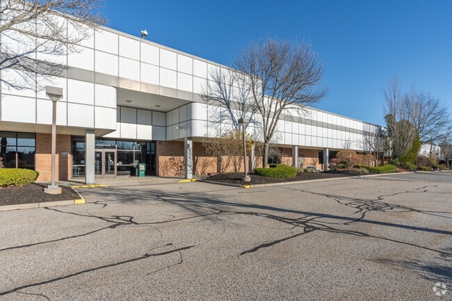
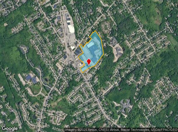
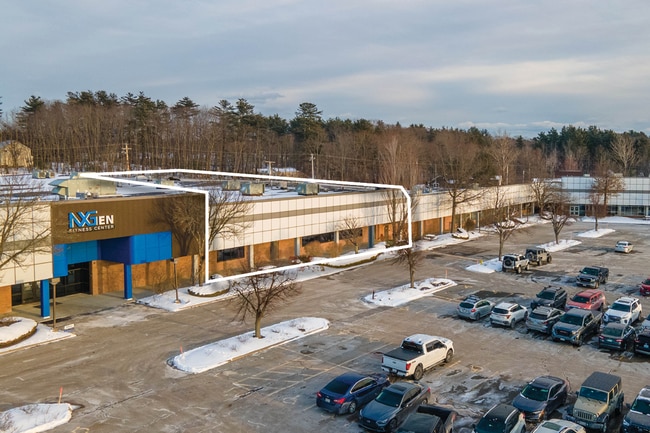
Property Record
27 Northport Dr, Portland, ME 04103
NEARBY LISTINGS FOR SALE OR LEASE
Property Detail
27 Northport Dr
Governmentalpublicusegeneral
Cumberland
X
Maine
23005C0683F
Bayside
2023
Portland/South Portland
2024
Portland-South Portland, ME
002200
PTLD-000401-000000-A005027
32,532 SF
DEMOGRAPHICS near 27 Northport Dr
1 Mile
3 Mile
5 Mile
2024 Total Population
10,174
52,410
108,621
2029 Population
10,462
53,793
112,034
Pop Growth 2024-2029
+ 2.83%
+ 2.64%
+ 3.14%
Average Age
43
42
41
2024 Total Households
4,355
22,966
49,735
HH Growth 2024-2029
+ 2.85%
+ 2.66%
+ 3.22%
Median Household Inc
$84,015
$79,776
$71,588
Avg Household Size
2.20
2.20
2.10
2024 Avg HH Vehicles
2.00
2.00
2.00
Median Home Value
$382,322
$402,325
$403,183
Median Year Built
1975
1959
1956
Nearby Places
- Restaurants
- Banks
- Shops
- Fitness
- Groceries
PUBLIC TRANSPORTATION
COMMUTER RAIL
Portland (Downeaster - Amtrak)
DRIVE
WALK
Distance
Portland (Downeaster - Amtrak)
8 min
3.9 mi
AIRPORT
Portland International Jetport
DRIVE
WALK
Distance
Portland International Jetport
12 min
4.7 mi
Freight Ports
Portland, ME
DRIVE
WALK
Distance
Portland, ME
9 min
4.8 mi
SALE & LEASE HISTORY
LISTING DATE
SALE/LEASE

Oct 18, 2021
For Sale
Nearby Properties
Address
Land Use
TOTAL SIZE
Lot Size
Zoning
Address
Land Use
TOTAL SIZE
Lot Size
Zoning
8.11 AC
Address
Land Use
TOTAL SIZE
Lot Size
Zoning
12.51 AC
Address
Land Use
TOTAL SIZE
Lot Size
Zoning
32.33 AC
Address
Land Use
TOTAL SIZE
Lot Size
Zoning
41 AC
FF
Address
Land Use
TOTAL SIZE
Lot Size
Zoning
5.13 AC
Address
Land Use
TOTAL SIZE
Lot Size
Zoning
26,584 SF
2.79 AC
Address
Land Use
TOTAL SIZE
Lot Size
Zoning
238,150 SF
1.37 AC
Address
Land Use
TOTAL SIZE
Lot Size
Zoning
285,570 SF
1.37 AC
Address
Land Use
TOTAL SIZE
Lot Size
Zoning
135,968 SF
7.02 AC
Address
Land Use
TOTAL SIZE
Lot Size
Zoning
9.11 AC
Address
Land Use
TOTAL SIZE
Lot Size
Zoning
141,420 SF
11.27 AC
TIF
Address
Land Use
TOTAL SIZE
Lot Size
Zoning
25.12 AC
Address
Land Use
TOTAL SIZE
Lot Size
Zoning
217 SF
8.65 AC
Address
Land Use
TOTAL SIZE
Lot Size
Zoning
173,617 SF
15.28 AC
Address
Land Use
TOTAL SIZE
Lot Size
Zoning
125,719 SF
18.79 AC
Address
Land Use
TOTAL SIZE
Lot Size
Zoning
238,301 SF
1.33 AC
Address
Land Use
TOTAL SIZE
Lot Size
Zoning
78,396 SF
8.60 AC
Address
Land Use
TOTAL SIZE
Lot Size
Zoning
19.08 AC
Address
Land Use
TOTAL SIZE
Lot Size
Zoning
9.23 AC
Address
Land Use
TOTAL SIZE
Lot Size
Zoning
137,037 SF
18.32 AC
Address
Land Use
TOTAL SIZE
Lot Size
Zoning
20.72 AC
Address
Land Use
TOTAL SIZE
Lot Size
Zoning
33.07 AC
Address
Land Use
TOTAL SIZE
Lot Size
Zoning
63,569 SF
3.72 AC
Address
Land Use
TOTAL SIZE
Lot Size
Zoning
39,946 SF
48.10 AC
RB
Address
Land Use
TOTAL SIZE
Lot Size
Zoning
206,165 SF
25.75 AC
Address
Land Use
TOTAL SIZE
Lot Size
Zoning
10.84 AC
Address
Land Use
TOTAL SIZE
Lot Size
Zoning
115 SF
19.07 AC
Address
Land Use
TOTAL SIZE
Lot Size
Zoning
11.94 AC
Address
Land Use
TOTAL SIZE
Lot Size
Zoning
161,948 SF
1.52 AC
Address
Land Use
TOTAL SIZE
Lot Size
Zoning
10.16 AC
The World's #1 Commercial Real Estate Marketplace
Connect with us
© 2025 CoStar Group
The information above has been obtained from sources believed reliable. While we do not doubt its accuracy we have not verified it and make no guarantee, warranty or representation about it. It is your responsibility to independently confirm its accuracy and completeness. Any projections, opinions, assumptions, or estimates used are for example only and do not represent the current or future performance of the property. The value of this transaction to you depends on tax and other factors which should be evaluated by your tax, financial, and legal advisors. You and your advisors should conduct a careful, independent investigation of the property to determine to your satisfaction the suitability of the property for your needs.