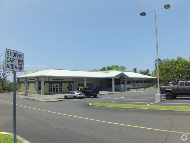
Property Record
75 Palani Rd, Kailua Kona, HI 96740


NEARBY LISTINGS FOR SALE OR LEASE
Property Detail
75 Palani Rd
Hilo-Kailua, HI
Lanihau 1St - Hienaloli 1St
3-7-5-004-010-0000
LOT 1-A 9.471 AC DES POR RP 6851, 7456, 1861:2, 2035 LCAW 8452:12 & 8559-B:11 SUBJ ESMTS
Commercialnec
Hawaii
X
Hawaii
1551660738F
1-a
2024
9.47 AC
2025
Kailua-Kona
021605
Hawaii
92,036 SF
DEMOGRAPHICS near 75 Palani Rd
1 Mile
3 Mile
5 Mile
2024 Total Population
4,430
19,233
29,157
2029 Population
4,657
20,290
30,501
Pop Growth 2024-2029
+ 5.12%
+ 5.50%
+ 4.61%
Average Age
42
43
43
2024 Total Households
1,703
7,225
10,784
HH Growth 2024-2029
+ 5.46%
+ 6.16%
+ 4.94%
Median Household Inc
$64,816
$77,230
$79,467
Avg Household Size
2.40
2.50
2.60
2024 Avg HH Vehicles
2.00
2.00
2.00
Median Home Value
$469,823
$621,070
$708,149
Median Year Built
1986
1986
1988
Nearby Places
Map Layers
Map Styles
 Street
 Aerial
- Restaurants
- Banks
- Shops
- Fitness
- Groceries
PUBLIC TRANSPORTATION
AIRPORT
Ellison Onizuka Kona International at Keahole
DRIVE
WALK
Distance
Ellison Onizuka Kona International at Keahole
19 min
8.4 mi
SALE & LEASE HISTORY
LISTING DATE
SALE/LEASE

Sep 25, 2016
For Lease
Sep 18, 2017
For Lease
Nov 07, 2024
For Lease
Mar 28, 2017
For Lease
Nearby Properties
Address
Land Use
TOTAL SIZE
Lot Size
Zoning
Address
Land Use
TOTAL SIZE
Lot Size
Zoning
135,452 SF
10 AC
CG-10
Address
Land Use
TOTAL SIZE
Lot Size
Zoning
19.55 AC
CG-20
Address
Land Use
TOTAL SIZE
Lot Size
Zoning
4,135 SF
865.80 AC
MCX-20
Address
Land Use
TOTAL SIZE
Lot Size
Zoning
134,941 SF
5.43 AC
V-.75
Address
Land Use
TOTAL SIZE
Lot Size
Zoning
203.01 AC
CG-10
Address
Land Use
TOTAL SIZE
Lot Size
Zoning
129,257 SF
10.63 AC
MCX-20
Address
Land Use
TOTAL SIZE
Lot Size
Zoning
162,628 SF
11.02 AC
MCX-20
Address
Land Use
TOTAL SIZE
Lot Size
Zoning
101,191 SF
40.34 AC
RM-4
Address
Land Use
TOTAL SIZE
Lot Size
Zoning
140,367 SF
13.15 AC
CG-20
Address
Land Use
TOTAL SIZE
Lot Size
Zoning
133,724 SF
10.69 AC
CG-20
Address
Land Use
TOTAL SIZE
Lot Size
Zoning
167,450 SF
1.81 AC
V-.75
Address
Land Use
TOTAL SIZE
Lot Size
Zoning
52,350 SF
102.98 AC
ML-20
Address
Land Use
TOTAL SIZE
Lot Size
Zoning
53,072 SF
5.21 AC
RM-1
Address
Land Use
TOTAL SIZE
Lot Size
Zoning
78,545 SF
7 AC
CG-20
Address
Land Use
TOTAL SIZE
Lot Size
Zoning
125,005 SF
11.35 AC
CG-10
Address
Land Use
TOTAL SIZE
Lot Size
Zoning
51,899 SF
4.81 AC
CG-10
Address
Land Use
TOTAL SIZE
Lot Size
Zoning
37,635 SF
9.90 AC
MCX-20
Address
Land Use
TOTAL SIZE
Lot Size
Zoning
22,877 SF
9.27 AC
CG-10
Address
Land Use
TOTAL SIZE
Lot Size
Zoning
108,758 SF
7.69 AC
CV-10
Address
Land Use
TOTAL SIZE
Lot Size
Zoning
18,432 SF
1.44 AC
V-.75
Address
Land Use
TOTAL SIZE
Lot Size
Zoning
31,262 SF
2.74 AC
A-5a
Address
Land Use
TOTAL SIZE
Lot Size
Zoning
66,665 SF
2.94 AC
A-5a
Address
Land Use
TOTAL SIZE
Lot Size
Zoning
6,042 SF
5.50 AC
RM-4
Address
Land Use
TOTAL SIZE
Lot Size
Zoning
45,311 SF
6.09 AC
MG-1a
Address
Land Use
TOTAL SIZE
Lot Size
Zoning
97,056 SF
10.28 AC
RM-5
Address
Land Use
TOTAL SIZE
Lot Size
Zoning
69,016 SF
4.08 AC
V-.75
Address
Land Use
TOTAL SIZE
Lot Size
Zoning
40,428 SF
6.67 AC
MCX-20
The World's #1 Commercial Real Estate Marketplace
Connect with us
© 2026 CoStar Group
The information above has been obtained from sources believed reliable. While we do not doubt its accuracy we have not verified it and make no guarantee, warranty or representation about it. It is your responsibility to independently confirm its accuracy and completeness. Any projections, opinions, assumptions, or estimates used are for example only and do not represent the current or future performance of the property. The value of this transaction to you depends on tax and other factors which should be evaluated by your tax, financial, and legal advisors. You and your advisors should conduct a careful, independent investigation of the property to determine to your satisfaction the suitability of the property for your needs.