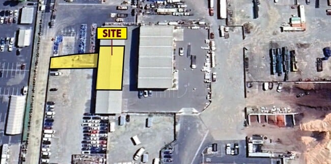
Property Record
75 Paseo Adelanto, Perris, CA 92570


NEARBY LISTINGS FOR SALE OR LEASE
Property Detail
75 Paseo Adelanto
Riverside-San Bernardino-Ontario, CA
Ehrmans Sub
330-100-012
12.14 ACRES M/L IN POR LOTS 3 & 4 MB 011/544 SD EHRMANS SUB
Lightindustrial
Riverside
AE
California
06065C1440H
4
2024
12.14 AC
2025
Moreno Valley/Perris
042907
Inland Empire (California)
77,850 SF
DEMOGRAPHICS near 75 Paseo Adelanto
1 mile
3 mile
5 mile
2024 Total Population
4,396
52,450
124,153
2029 Population
4,811
55,991
131,258
Pop Growth 2024-2029
+ 9.44%
+ 6.75%
+ 5.72%
Average Age
31
35
37
2024 Total Households
1,081
13,993
35,520
HH Growth 2024-2029
+ 9.34%
+ 6.47%
+ 5.34%
Median Household Inc
$69,413
$67,573
$66,782
Avg Household Size
3.90
3.60
3.40
2024 Avg HH Vehicles
3.00
2.00
2.00
Median Home Value
$305,960
$346,575
$356,855
Median Year Built
1989
1993
1989
Nearby Places
Map Layers
Map Styles
 Street
 Aerial
Transit
 Traffic
 Biking
Places
Listings with unknown addresses are not visible on the map
- Restaurants
- Banks
- Shops
- Fitness
- Groceries
PUBLIC TRANSPORTATION
COMMUTER RAIL
Perris Downtown (Metrolink 91-Perris Valley Line - Metrolink Trains)
Drive
Walk
Distance
Perris Downtown (Metrolink 91-Perris Valley Line - Metrolink Trains)
4 min
2.1 mi
South Perris (Metrolink 91-Perris Valley Line - Metrolink Trains)
Drive
Walk
Distance
South Perris (Metrolink 91-Perris Valley Line - Metrolink Trains)
3 min
2.2 mi
AIRPORT
Ontario International
Drive
Walk
Distance
Ontario International
45 min
35.9 mi
Freight Ports
Port of Long Beach
Drive
Walk
Distance
Port of Long Beach
95 min
70.7 mi
SALE & LEASE HISTORY
LISTING DATE
SALE/LEASE

May 05, 2017
For Lease
Aug 25, 2017
For Lease
Apr 21, 2025
For Lease
Nearby Properties
Address
Land Use
TOTAL SIZE
Lot Size
Zoning
Address
Land Use
TOTAL SIZE
Lot Size
Zoning
28.13 AC
RR
Address
Land Use
TOTAL SIZE
Lot Size
Zoning
57,600 SF
51.69 AC
Address
Land Use
TOTAL SIZE
Lot Size
Zoning
32,709 SF
4.61 AC
C2
Address
Land Use
TOTAL SIZE
Lot Size
Zoning
104,208 SF
10.96 AC
Address
Land Use
TOTAL SIZE
Lot Size
Zoning
89,409 SF
6.18 AC
Address
Land Use
TOTAL SIZE
Lot Size
Zoning
22,119 SF
4.59 AC
R3
Address
Land Use
TOTAL SIZE
Lot Size
Zoning
75,109 SF
9.39 AC
Address
Land Use
TOTAL SIZE
Lot Size
Zoning
1,080 SF
9.53 AC
A02
Address
Land Use
TOTAL SIZE
Lot Size
Zoning
122,824 SF
5.18 AC
CC
Address
Land Use
TOTAL SIZE
Lot Size
Zoning
13.95 AC
Address
Land Use
TOTAL SIZE
Lot Size
Zoning
50,000 SF
5.36 AC
CC
Address
Land Use
TOTAL SIZE
Lot Size
Zoning
1,018,178 SF
57.91 AC
Address
Land Use
TOTAL SIZE
Lot Size
Zoning
3,750 SF
37.79 AC
GI
Address
Land Use
TOTAL SIZE
Lot Size
Zoning
97,942 SF
11 AC
Address
Land Use
TOTAL SIZE
Lot Size
Zoning
4,804 SF
3.85 AC
Address
Land Use
TOTAL SIZE
Lot Size
Zoning
59.85 AC
Address
Land Use
TOTAL SIZE
Lot Size
Zoning
7,250 SF
2.35 AC
Address
Land Use
TOTAL SIZE
Lot Size
Zoning
35,600 SF
3.19 AC
Address
Land Use
TOTAL SIZE
Lot Size
Zoning
41,840 SF
8.92 AC
Address
Land Use
TOTAL SIZE
Lot Size
Zoning
13,489 SF
6.18 AC
R3
Address
Land Use
TOTAL SIZE
Lot Size
Zoning
114,400 SF
9.88 AC
The World's #1 Commercial Real Estate Marketplace
Connect with us
© 2026 CoStar Group
The information above has been obtained from sources believed reliable. While we do not doubt its accuracy we have not verified it and make no guarantee, warranty or representation about it. It is your responsibility to independently confirm its accuracy and completeness. Any projections, opinions, assumptions, or estimates used are for example only and do not represent the current or future performance of the property. The value of this transaction to you depends on tax and other factors which should be evaluated by your tax, financial, and legal advisors. You and your advisors should conduct a careful, independent investigation of the property to determine to your satisfaction the suitability of the property for your needs.