Property Record
75 Reed Rd, Hudson, MA 01749
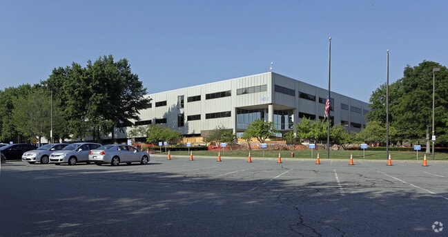

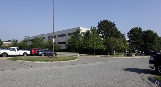

Property Detail
75 Reed Rd
HUDS-000041-000000-000033
MIDDLESEX
Industrialgeneral
Massachusetts
M6
33
C and X Area of minimal flood hazard, usually depicted on FIRMs as above the 500-year flood level.
148.66 AC
2024
Concord/Maynard
2025
Boston
322200
Boston-Cambridge-Newton, MA-NH
NEARBY LISTINGS FOR SALE OR LEASE
DEMOGRAPHICS near 75 Reed Rd
1 mile
3 mile
5 mile
2025 Total Population
6,494
53,941
80,626
2030 Population
6,728
55,746
83,636
Pop Growth 2025-2030
+ 3.60%
+ 3.35%
+ 3.73%
Average Age
44
42
42
2025 Total Households
2,736
21,362
31,751
HH Growth 2025-2030
+ 3.69%
+ 3.43%
+ 3.87%
Median Household Inc
$118,612
$103,066
$111,799
Avg Household Size
2.40
2.50
2.50
2025 Avg HH Vehicles
2.00
2.00
2.00
Median Home Value
$513,103
$556,369
$599,367
Median Year Built
1977
1970
1975
Nearby Places
Map Layers
Map Styles
 Street
 Aerial
Transit
 Traffic
 Biking
Places
Listings with unknown addresses are not visible on the map
- Restaurants
- Banks
- Shops
- Fitness
- Groceries
PUBLIC TRANSPORTATION
COMMUTER RAIL
South Acton (Fitchburg/South Acton Line - Massachusetts Bay Transportation Authority Commuter Rail (Purple Line))
Drive
Walk
Distance
South Acton (Fitchburg/South Acton Line - Massachusetts Bay Transportation Authority Commuter Rail (Purple Line))
22 min
8.9 mi
Southborough (Framingham/Worcester Line - Massachusetts Bay Transportation Authority Commuter Rail (Purple Line))
Drive
Walk
Distance
Southborough (Framingham/Worcester Line - Massachusetts Bay Transportation Authority Commuter Rail (Purple Line))
20 min
9.1 mi
AIRPORT
Worcester Regional
Drive
Walk
Distance
Worcester Regional
33 min
21.2 mi
General Edward Lawrence Logan International
Drive
Walk
Distance
General Edward Lawrence Logan International
56 min
36.3 mi
Freight Ports
Port of Boston
Drive
Walk
Distance
Port of Boston
54 min
34.7 mi
SALE & LEASE HISTORY
LISTING DATE
SALE/LEASE

Sep 24, 2016
For Sale
Nearby Properties
Address
Land Use
TOTAL SIZE
Lot Size
Zoning
Address
Land Use
TOTAL SIZE
Lot Size
Zoning
21.41 AC
LI
Address
Land Use
TOTAL SIZE
Lot Size
Zoning
284,231 SF
62.04 AC
A2
Address
Land Use
TOTAL SIZE
Lot Size
Zoning
71.70 AC
LI
Address
Land Use
TOTAL SIZE
Lot Size
Zoning
23,890 SF
36.39 AC
A3
Address
Land Use
TOTAL SIZE
Lot Size
Zoning
13.86 AC
SB
Address
Land Use
TOTAL SIZE
Lot Size
Zoning
54.67 AC
LI
Address
Land Use
TOTAL SIZE
Lot Size
Zoning
4,188 SF
23.20 AC
B
Address
Land Use
TOTAL SIZE
Lot Size
Zoning
267,805 SF
30.74 AC
A2
Address
Land Use
TOTAL SIZE
Lot Size
Zoning
14.80 AC
M6
Address
Land Use
TOTAL SIZE
Lot Size
Zoning
121,434 SF
21.35 AC
SA8
Address
Land Use
TOTAL SIZE
Lot Size
Zoning
188,882 SF
19.37 AC
A3
Address
Land Use
TOTAL SIZE
Lot Size
Zoning
22.74 AC
A1
Address
Land Use
TOTAL SIZE
Lot Size
Zoning
91,722 SF
8.38 AC
A2
Address
Land Use
TOTAL SIZE
Lot Size
Zoning
12.42 AC
M1
Address
Land Use
TOTAL SIZE
Lot Size
Zoning
118,126 SF
82.89 AC
Address
Land Use
TOTAL SIZE
Lot Size
Zoning
283,750 SF
27.03 AC
LI
Address
Land Use
TOTAL SIZE
Lot Size
Zoning
9.66 AC
A1
Address
Land Use
TOTAL SIZE
Lot Size
Zoning
99,619 SF
1.56 AC
B
Address
Land Use
TOTAL SIZE
Lot Size
Zoning
119,850 SF
49.66 AC
LC1
Address
Land Use
TOTAL SIZE
Lot Size
Zoning
21.17 AC
A1
Address
Land Use
TOTAL SIZE
Lot Size
Zoning
85,958 SF
13.52 AC
A3
Address
Land Use
TOTAL SIZE
Lot Size
Zoning
10,338 SF
4.76 AC
CA
Address
Land Use
TOTAL SIZE
Lot Size
Zoning
215,936 SF
15.63 AC
I
Address
Land Use
TOTAL SIZE
Lot Size
Zoning
196,145 SF
10.18 AC
LI
Address
Land Use
TOTAL SIZE
Lot Size
Zoning
128,838 SF
4.27 AC
RC
Address
Land Use
TOTAL SIZE
Lot Size
Zoning
120,146 SF
7.33 AC
LI
Address
Land Use
TOTAL SIZE
Lot Size
Zoning
16.84 AC
M5
Address
Land Use
TOTAL SIZE
Lot Size
Zoning
182,509 SF
11.35 AC
A2
Address
Land Use
TOTAL SIZE
Lot Size
Zoning
9.90 AC
C12
Address
Land Use
TOTAL SIZE
Lot Size
Zoning
75,542 SF
3.23 AC
SB
The World's #1 Commercial Real Estate Marketplace
Connect with us
© 2026 CoStar Group
The information above has been obtained from sources believed reliable. While we do not doubt its accuracy we have not verified it and make no guarantee, warranty or representation about it. It is your responsibility to independently confirm its accuracy and completeness. Any projections, opinions, assumptions, or estimates used are for example only and do not represent the current or future performance of the property. The value of this transaction to you depends on tax and other factors which should be evaluated by your tax, financial, and legal advisors. You and your advisors should conduct a careful, independent investigation of the property to determine to your satisfaction the suitability of the property for your needs.