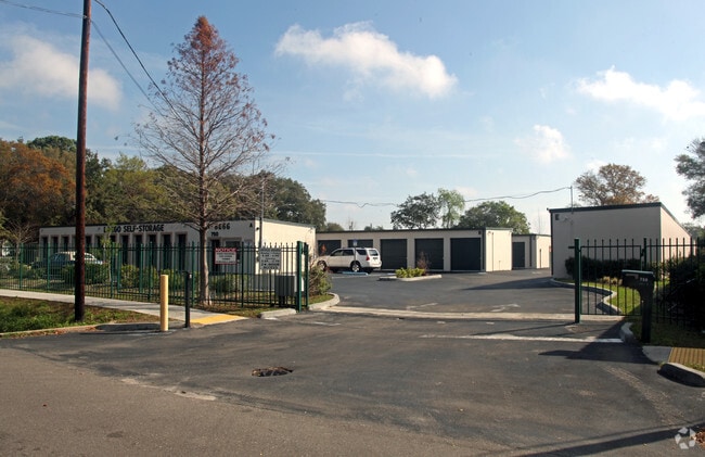
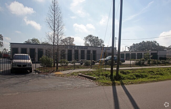
Property Record
750 4Th St Nw, Largo, FL 33770

NEARBY LISTINGS FOR SALE OR LEASE
Property Detail
750 4Th St Nw
34-29-15-00000-210-0200
Beg At Nw Cor Of Ne 1/4 Of
Publicstorage
BEG AT NW COR OF NE 1/4 OF NW 1/4 TH S89D1021E 260.96FT TO WLY R/W OF RR TH S12D2836E 205.51FT ALG W/LY R/W OF RR TH N89D1021W 307.5FT TO E R/W OF 4TH ST NW TH N00D 3646E 200FT TO POB CONT 1.31AC
X
Pinellas
12103C0116J
Florida
2024
1.33 AC
2025
Mid-Pinellas
025602
Tampa/St Petersburg
13,180 SF
Tampa-St. Petersburg-Clearwater, FL
DEMOGRAPHICS near 750 4Th St Nw
1 Mile
3 Mile
5 Mile
2024 Total Population
15,693
103,519
247,111
2029 Population
15,852
103,981
249,830
Pop Growth 2024-2029
+ 1.01%
+ 0.45%
+ 1.10%
Average Age
44
47
47
2024 Total Households
7,284
48,146
113,049
HH Growth 2024-2029
+ 0.76%
+ 0.32%
+ 1.12%
Median Household Inc
$46,164
$54,175
$58,568
Avg Household Size
2.10
2.00
2.10
2024 Avg HH Vehicles
1.00
1.00
2.00
Median Home Value
$185,422
$250,650
$274,119
Median Year Built
1972
1974
1976
Nearby Places
Map Layers
Map Styles
 Street
 Aerial
- Restaurants
- Banks
- Shops
- Fitness
- Groceries
PUBLIC TRANSPORTATION
AIRPORT
St Pete-Clearwater International
DRIVE
WALK
Distance
St Pete-Clearwater International
15 min
7.2 mi
Tampa International
DRIVE
WALK
Distance
Tampa International
37 min
20.6 mi
Freight Ports
Port of Tampa Bay
DRIVE
WALK
Distance
Port of Tampa Bay
48 min
27.4 mi
Nearby Properties
Address
Land Use
TOTAL SIZE
Lot Size
Zoning
Address
Land Use
TOTAL SIZE
Lot Size
Zoning
374,560 SF
2.13 AC
Address
Land Use
TOTAL SIZE
Lot Size
Zoning
839,480 SF
12.93 AC
Address
Land Use
TOTAL SIZE
Lot Size
Zoning
537,958 SF
41.61 AC
C2
Address
Land Use
TOTAL SIZE
Lot Size
Zoning
480,260 SF
5.12 AC
Address
Land Use
TOTAL SIZE
Lot Size
Zoning
529,506 SF
23.06 AC
Address
Land Use
TOTAL SIZE
Lot Size
Zoning
520,871 SF
29 AC
R6
Address
Land Use
TOTAL SIZE
Lot Size
Zoning
367,081 SF
13.80 AC
Address
Land Use
TOTAL SIZE
Lot Size
Zoning
333,425 SF
33.66 AC
Address
Land Use
TOTAL SIZE
Lot Size
Zoning
305,592 SF
9.65 AC
C2
Address
Land Use
TOTAL SIZE
Lot Size
Zoning
588,657 SF
33 AC
Address
Land Use
TOTAL SIZE
Lot Size
Zoning
509,129 SF
18.74 AC
Address
Land Use
TOTAL SIZE
Lot Size
Zoning
290,269 SF
8.49 AC
Address
Land Use
TOTAL SIZE
Lot Size
Zoning
321,140 SF
18.02 AC
Address
Land Use
TOTAL SIZE
Lot Size
Zoning
545,062 SF
8.37 AC
Address
Land Use
TOTAL SIZE
Lot Size
Zoning
318,555 SF
6.60 AC
Address
Land Use
TOTAL SIZE
Lot Size
Zoning
235,506 SF
9.95 AC
Address
Land Use
TOTAL SIZE
Lot Size
Zoning
296,919 SF
39.10 AC
Address
Land Use
TOTAL SIZE
Lot Size
Zoning
228,892 SF
2.52 AC
Address
Land Use
TOTAL SIZE
Lot Size
Zoning
241,547 SF
9.27 AC
Address
Land Use
TOTAL SIZE
Lot Size
Zoning
198,688 SF
11.99 AC
Address
Land Use
TOTAL SIZE
Lot Size
Zoning
290,213 SF
2.32 AC
Address
Land Use
TOTAL SIZE
Lot Size
Zoning
280,129 SF
Address
Land Use
TOTAL SIZE
Lot Size
Zoning
319,725 SF
9.14 AC
Address
Land Use
TOTAL SIZE
Lot Size
Zoning
84,057 SF
34.26 AC
Address
Land Use
TOTAL SIZE
Lot Size
Zoning
261,486 SF
30.21 AC
RPD20
Address
Land Use
TOTAL SIZE
Lot Size
Zoning
176,716 SF
14.20 AC
Address
Land Use
TOTAL SIZE
Lot Size
Zoning
129,600 SF
7.09 AC
Address
Land Use
TOTAL SIZE
Lot Size
Zoning
170,064 SF
1.80 AC
Address
Land Use
TOTAL SIZE
Lot Size
Zoning
157,904 SF
0.57 AC
Address
Land Use
TOTAL SIZE
Lot Size
Zoning
186,391 SF
11.86 AC
The World's #1 Commercial Real Estate Marketplace
Connect with us
© 2026 CoStar Group
The information above has been obtained from sources believed reliable. While we do not doubt its accuracy we have not verified it and make no guarantee, warranty or representation about it. It is your responsibility to independently confirm its accuracy and completeness. Any projections, opinions, assumptions, or estimates used are for example only and do not represent the current or future performance of the property. The value of this transaction to you depends on tax and other factors which should be evaluated by your tax, financial, and legal advisors. You and your advisors should conduct a careful, independent investigation of the property to determine to your satisfaction the suitability of the property for your needs.