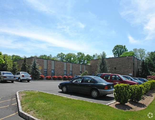
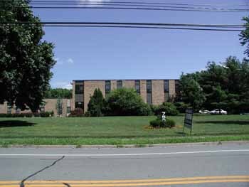
Property Record
750 Chestnut Ridge Rd, Spring Valley, NY 10977

Current Lease Availabilities
NEARBY LISTINGS FOR SALE OR LEASE
Property Detail
750 Chestnut Ridge Rd
392615-063-013-0002-001-000-0000
Rockland
Industrialgeneral
New York
X
1.0
34003C0083H
4.67 AC
2023
Ramapo
2024
Northern New Jersey
012503
New York-Jersey City-White Plains, NY-NJ
33,280 SF
DEMOGRAPHICS near 750 Chestnut Ridge Rd
1 Mile
3 Mile
5 Mile
2024 Total Population
6,733
130,933
253,425
2029 Population
6,702
130,065
252,621
Pop Growth 2024-2029
(0.46%)
(0.66%)
(0.32%)
Average Age
33
33
36
2024 Total Households
1,693
35,942
75,111
HH Growth 2024-2029
(0.71%)
(0.60%)
(0.26%)
Median Household Inc
$96,765
$84,722
$107,474
Avg Household Size
3.70
3.40
3.20
2024 Avg HH Vehicles
2.00
2.00
2.00
Median Home Value
$653,468
$607,579
$643,816
Median Year Built
1966
1972
1971
Nearby Places
Map Layers
Map Styles
 Street
 Aerial
- Restaurants
- Banks
- Shops
- Fitness
- Groceries
PUBLIC TRANSPORTATION
COMMUTER RAIL
Spring Valley (Pascack Valley Line - NJ Transit Commuter Rail (NJ Transit))
DRIVE
WALK
Distance
Spring Valley (Pascack Valley Line - NJ Transit Commuter Rail (NJ Transit))
4 min
2.0 mi
Nanuet (Pascack Valley Line - NJ Transit Commuter Rail (NJ Transit))
DRIVE
WALK
Distance
Nanuet (Pascack Valley Line - NJ Transit Commuter Rail (NJ Transit))
8 min
2.9 mi
AIRPORT
Westchester County
DRIVE
WALK
Distance
Westchester County
39 min
26.4 mi
LaGuardia
DRIVE
WALK
Distance
LaGuardia
49 min
31.8 mi
Newark Liberty International
DRIVE
WALK
Distance
Newark Liberty International
42 min
32.2 mi
Freight Ports
Maher Terminal
DRIVE
WALK
Distance
Maher Terminal
50 min
34.7 mi
Nearby Properties
Address
Land Use
TOTAL SIZE
Lot Size
Zoning
Address
Land Use
TOTAL SIZE
Lot Size
Zoning
402,385 SF
23.10 AC
LI
Address
Land Use
TOTAL SIZE
Lot Size
Zoning
63,621 SF
180.20 AC
LI
Address
Land Use
TOTAL SIZE
Lot Size
Zoning
Address
Land Use
TOTAL SIZE
Lot Size
Zoning
22.75 AC
Address
Land Use
TOTAL SIZE
Lot Size
Zoning
11.48 AC
OR-3
Address
Land Use
TOTAL SIZE
Lot Size
Zoning
9.29 AC
SED
Address
Land Use
TOTAL SIZE
Lot Size
Zoning
17 AC
OR1
Address
Land Use
TOTAL SIZE
Lot Size
Zoning
36.49 AC
OR-2
Address
Land Use
TOTAL SIZE
Lot Size
Zoning
31.79 AC
OR2
Address
Land Use
TOTAL SIZE
Lot Size
Zoning
37,600 SF
31.41 AC
Address
Land Use
TOTAL SIZE
Lot Size
Zoning
24.45 AC
R40
Address
Land Use
TOTAL SIZE
Lot Size
Zoning
9.19 AC
OR2
Address
Land Use
TOTAL SIZE
Lot Size
Zoning
116,650 SF
39.20 AC
05
Address
Land Use
TOTAL SIZE
Lot Size
Zoning
132,614 SF
15.74 AC
OR3
Address
Land Use
TOTAL SIZE
Lot Size
Zoning
11.50 AC
OR1
Address
Land Use
TOTAL SIZE
Lot Size
Zoning
28.49 AC
SP
Address
Land Use
TOTAL SIZE
Lot Size
Zoning
107,043 SF
11 AC
OR3
Address
Land Use
TOTAL SIZE
Lot Size
Zoning
152,854 SF
18.75 AC
RS
Address
Land Use
TOTAL SIZE
Lot Size
Zoning
26.37 AC
SP
Address
Land Use
TOTAL SIZE
Lot Size
Zoning
Address
Land Use
TOTAL SIZE
Lot Size
Zoning
119,025 SF
16.57 AC
OR3
Address
Land Use
TOTAL SIZE
Lot Size
Zoning
13 AC
R40
Address
Land Use
TOTAL SIZE
Lot Size
Zoning
9.89 AC
OR2
Address
Land Use
TOTAL SIZE
Lot Size
Zoning
11.24 AC
SED
Address
Land Use
TOTAL SIZE
Lot Size
Zoning
270,962 SF
21.80 AC
CS
Address
Land Use
TOTAL SIZE
Lot Size
Zoning
9.29 AC
OR3
Address
Land Use
TOTAL SIZE
Lot Size
Zoning
33.50 AC
Address
Land Use
TOTAL SIZE
Lot Size
Zoning
67,962 SF
8.30 AC
02 - SINGL
Address
Land Use
TOTAL SIZE
Lot Size
Zoning
11.20 AC
OR2
Address
Land Use
TOTAL SIZE
Lot Size
Zoning
11.28 AC
SED
The World's #1 Commercial Real Estate Marketplace
Connect with us
© 2026 CoStar Group
The information above has been obtained from sources believed reliable. While we do not doubt its accuracy we have not verified it and make no guarantee, warranty or representation about it. It is your responsibility to independently confirm its accuracy and completeness. Any projections, opinions, assumptions, or estimates used are for example only and do not represent the current or future performance of the property. The value of this transaction to you depends on tax and other factors which should be evaluated by your tax, financial, and legal advisors. You and your advisors should conduct a careful, independent investigation of the property to determine to your satisfaction the suitability of the property for your needs.