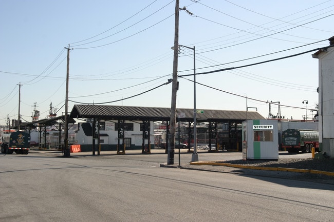
Property Record
750 Court St, Brooklyn, NY 11231
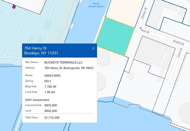
NEARBY LISTINGS FOR SALE OR LEASE
Property Detail
750 Court St
00623-0001
DOCID-2021122000810005
Commercialnec
Kings
AE
New York
3604970192F
93
2024
5.01 AC
2025
North Brooklyn
006500
Long Island (New York)
2,410 SF
New York-Jersey City-White Plains, NY-NJ
DEMOGRAPHICS near 750 Court St
1 Mile
3 Mile
5 Mile
2024 Total Population
49,205
815,303
2,419,479
2029 Population
46,149
767,250
2,277,269
Pop Growth 2024-2029
(6.21%)
(5.89%)
(5.88%)
Average Age
38
38
38
2024 Total Households
20,181
317,697
954,651
HH Growth 2024-2029
(6.73%)
(6.03%)
(6.13%)
Median Household Inc
$106,298
$92,618
$80,399
Avg Household Size
2.30
2.40
2.40
2024 Avg HH Vehicles
1.00
.00
.00
Median Home Value
$1,075,148
$1,023,135
$914,483
Median Year Built
1947
1947
1948
Nearby Places
- Restaurants
- Banks
- Shops
- Fitness
- Groceries
PUBLIC TRANSPORTATION
TRANSIT/SUBWAY
Smith-9 Streets (F - New York MTA Subway (The Subway), G - New York MTA Subway (The Subway))
DRIVE
WALK
Distance
Smith-9 Streets (F - New York MTA Subway (The Subway), G - New York MTA Subway (The Subway))
2 min
13 min
0.7 mi
COMMUTER RAIL
Atlantic Terminal (Babylon Branch - Long Island Rail Road, City Terminal Zone - Long Island Rail Road, Hempstead Branch - Long Island Rail Road, West Hempstead Branch - Long Island Rail Road)
DRIVE
WALK
Distance
Atlantic Terminal (Babylon Branch - Long Island Rail Road, City Terminal Zone - Long Island Rail Road, Hempstead Branch - Long Island Rail Road, West Hempstead Branch - Long Island Rail Road)
9 min
2.7 mi
Nostrand Avenue Station (Far Rockaway Branch - Long Island Rail Road, Hempstead Branch - Long Island Rail Road, Long Beach Branch - Long Island Rail Road, West Hempstead Branch - Long Island Rail Road)
DRIVE
WALK
Distance
Nostrand Avenue Station (Far Rockaway Branch - Long Island Rail Road, Hempstead Branch - Long Island Rail Road, Long Beach Branch - Long Island Rail Road, West Hempstead Branch - Long Island Rail Road)
12 min
4.2 mi
AIRPORT
LaGuardia
DRIVE
WALK
Distance
LaGuardia
23 min
12.5 mi
John F Kennedy International
DRIVE
WALK
Distance
John F Kennedy International
29 min
15.3 mi
Newark Liberty International
DRIVE
WALK
Distance
Newark Liberty International
27 min
16.0 mi
Freight Ports
NY - Red Hook Container Terminal
DRIVE
WALK
Distance
NY - Red Hook Container Terminal
3 min
1.4 mi
Nearby Properties
Address
Land Use
TOTAL SIZE
Lot Size
Zoning
Address
Land Use
TOTAL SIZE
Lot Size
Zoning
1,780,030 SF
5.07 AC
BPC
Address
Land Use
TOTAL SIZE
Lot Size
Zoning
869,038 SF
1.53 AC
M1-1
Address
Land Use
TOTAL SIZE
Lot Size
Zoning
92,440 SF
466.23 AC
R5
Address
Land Use
TOTAL SIZE
Lot Size
Zoning
2,210,200 SF
2.58 AC
C5-5
Address
Land Use
TOTAL SIZE
Lot Size
Zoning
1,362,190 SF
C5-5
Address
Land Use
TOTAL SIZE
Lot Size
Zoning
1,499,568 SF
1.66 AC
C5-5
Address
Land Use
TOTAL SIZE
Lot Size
Zoning
1,440,960 SF
2.17 AC
BPC
Address
Land Use
TOTAL SIZE
Lot Size
Zoning
1,617,206 SF
1.23 AC
C5-5
Address
Land Use
TOTAL SIZE
Lot Size
Zoning
2,542,066 SF
174.49 AC
R3-2
Address
Land Use
TOTAL SIZE
Lot Size
Zoning
1,075,808 SF
1.12 AC
C5-5
Address
Land Use
TOTAL SIZE
Lot Size
Zoning
1,141,276 SF
1.21 AC
C5-5
Address
Land Use
TOTAL SIZE
Lot Size
Zoning
393.54 AC
PARK
Address
Land Use
TOTAL SIZE
Lot Size
Zoning
945,425 SF
21.70 AC
PARK
Address
Land Use
TOTAL SIZE
Lot Size
Zoning
1,289,243 SF
1.14 AC
C5-5
Address
Land Use
TOTAL SIZE
Lot Size
Zoning
577,381 SF
3.19 AC
R6
Address
Land Use
TOTAL SIZE
Lot Size
Zoning
890,142 SF
2.22 AC
R7-1
Address
Land Use
TOTAL SIZE
Lot Size
Zoning
1,079,361 SF
1.07 AC
C5-3
Address
Land Use
TOTAL SIZE
Lot Size
Zoning
902,000 SF
6.44 AC
M3-1
Address
Land Use
TOTAL SIZE
Lot Size
Zoning
603,130 SF
63.46 AC
R3-2
Address
Land Use
TOTAL SIZE
Lot Size
Zoning
943,802 SF
0.97 AC
C6-9
Address
Land Use
TOTAL SIZE
Lot Size
Zoning
1,258,851 SF
2.20 AC
C6-4
Address
Land Use
TOTAL SIZE
Lot Size
Zoning
830,879 SF
1 AC
C5-4
Address
Land Use
TOTAL SIZE
Lot Size
Zoning
1,021,351 SF
1.24 AC
C5-5
Address
Land Use
TOTAL SIZE
Lot Size
Zoning
990,250 SF
1.12 AC
C6-9
Address
Land Use
TOTAL SIZE
Lot Size
Zoning
1,007,569 SF
0.98 AC
C5-5
Address
Land Use
TOTAL SIZE
Lot Size
Zoning
460,000 SF
3.21 AC
R6
Address
Land Use
TOTAL SIZE
Lot Size
Zoning
1,094,861 SF
0.84 AC
C5-5
Address
Land Use
TOTAL SIZE
Lot Size
Zoning
579,404 SF
4.80 AC
R6
Address
Land Use
TOTAL SIZE
Lot Size
Zoning
974,958 SF
1.03 AC
C5-5
Address
Land Use
TOTAL SIZE
Lot Size
Zoning
756,138 SF
0.77 AC
C5-5
The World's #1 Commercial Real Estate Marketplace
Connect with us
© 2025 CoStar Group
The information above has been obtained from sources believed reliable. While we do not doubt its accuracy we have not verified it and make no guarantee, warranty or representation about it. It is your responsibility to independently confirm its accuracy and completeness. Any projections, opinions, assumptions, or estimates used are for example only and do not represent the current or future performance of the property. The value of this transaction to you depends on tax and other factors which should be evaluated by your tax, financial, and legal advisors. You and your advisors should conduct a careful, independent investigation of the property to determine to your satisfaction the suitability of the property for your needs.