Property Record
801 E Michigan St, Evansville, IN 47711


NEARBY LISTINGS FOR SALE OR LEASE
Property Detail
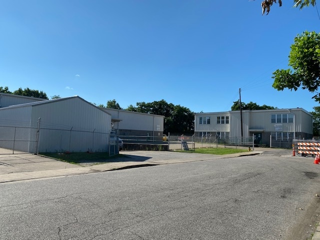
801 E Michigan St
Evansville, IN-KY
Goodge S Resubdivision
82-06-20-024-100.013-029
LTS 1-6 GOODGES RESUB & VACATED ALLEY & PT VAC MICHIGAN ST & PT SE SE 20-6-10; LTS 1-6, 9-21 BL 4 SHANKLINS ENL; PT LT 4 JACK
Warehouse
Vanderburgh
X
Indiana
18163C0181E
15
2024
3.79 AC
2024
Northside/Airport
002100
Evansville
12,180 SF
DEMOGRAPHICS near 801 E Michigan St
1 Mile
3 Mile
5 Mile
2024 Total Population
12,875
72,876
133,903
2029 Population
13,308
73,903
134,569
Pop Growth 2024-2029
+ 3.36%
+ 1.41%
+ 0.50%
Average Age
38
39
40
2024 Total Households
5,123
31,320
58,726
HH Growth 2024-2029
+ 3.59%
+ 1.47%
+ 0.51%
Median Household Inc
$36,610
$45,100
$48,980
Avg Household Size
2.30
2.20
2.20
2024 Avg HH Vehicles
1.00
2.00
2.00
Median Home Value
$57,541
$89,282
$123,883
Median Year Built
1948
1952
1963
Nearby Places
Map Layers
Map Styles
 Street
 Aerial
- Restaurants
- Banks
- Shops
- Fitness
- Groceries
PUBLIC TRANSPORTATION
AIRPORT
Evansville Regional
DRIVE
WALK
Distance
Evansville Regional
10 min
4.8 mi
Freight Ports
Port of Toledo
DRIVE
WALK
Distance
Port of Toledo
458 min
393.1 mi
SALE & LEASE HISTORY
LISTING DATE
SALE/LEASE

Jan 28, 2022
For Lease
Aug 14, 2020
For Sale
Apr 19, 2021
For Lease
Apr 19, 2021
For Lease
Nearby Properties
Address
Land Use
TOTAL SIZE
Lot Size
Zoning
Address
Land Use
TOTAL SIZE
Lot Size
Zoning
84,660 SF
12.95 AC
Address
Land Use
TOTAL SIZE
Lot Size
Zoning
20,964 SF
1.35 AC
Address
Land Use
TOTAL SIZE
Lot Size
Zoning
15,233 SF
3.31 AC
Address
Land Use
TOTAL SIZE
Lot Size
Zoning
169,860 SF
20.33 AC
Address
Land Use
TOTAL SIZE
Lot Size
Zoning
51,342 SF
4.43 AC
Address
Land Use
TOTAL SIZE
Lot Size
Zoning
117,580 SF
1.74 AC
Address
Land Use
TOTAL SIZE
Lot Size
Zoning
21,831 SF
3.03 AC
Address
Land Use
TOTAL SIZE
Lot Size
Zoning
165,472 SF
1.38 AC
Address
Land Use
TOTAL SIZE
Lot Size
Zoning
992,266 SF
116.92 AC
Address
Land Use
TOTAL SIZE
Lot Size
Zoning
23,108 SF
2.92 AC
Address
Land Use
TOTAL SIZE
Lot Size
Zoning
92,132 SF
1.68 AC
Address
Land Use
TOTAL SIZE
Lot Size
Zoning
223,202 SF
2.28 AC
Address
Land Use
TOTAL SIZE
Lot Size
Zoning
784,971 SF
15.37 AC
Address
Land Use
TOTAL SIZE
Lot Size
Zoning
235,153 SF
2.61 AC
Address
Land Use
TOTAL SIZE
Lot Size
Zoning
87,099 SF
2.28 AC
Address
Land Use
TOTAL SIZE
Lot Size
Zoning
25,595 SF
14.99 AC
Address
Land Use
TOTAL SIZE
Lot Size
Zoning
82,488 SF
1.90 AC
8
Address
Land Use
TOTAL SIZE
Lot Size
Zoning
20,286 SF
4.57 AC
Address
Land Use
TOTAL SIZE
Lot Size
Zoning
61,652 SF
15.02 AC
Address
Land Use
TOTAL SIZE
Lot Size
Zoning
311,804 SF
31.94 AC
Address
Land Use
TOTAL SIZE
Lot Size
Zoning
159,074 SF
1.07 AC
Address
Land Use
TOTAL SIZE
Lot Size
Zoning
331,588 SF
0.96 AC
Address
Land Use
TOTAL SIZE
Lot Size
Zoning
83,218 SF
1.83 AC
Address
Land Use
TOTAL SIZE
Lot Size
Zoning
8,920 SF
2.62 AC
Address
Land Use
TOTAL SIZE
Lot Size
Zoning
4,160 SF
9.22 AC
Address
Land Use
TOTAL SIZE
Lot Size
Zoning
75,109 SF
1.64 AC
Address
Land Use
TOTAL SIZE
Lot Size
Zoning
94,551 SF
6.17 AC
Address
Land Use
TOTAL SIZE
Lot Size
Zoning
39,264 SF
45.28 AC
Address
Land Use
TOTAL SIZE
Lot Size
Zoning
229,140 SF
1.03 AC
Address
Land Use
TOTAL SIZE
Lot Size
Zoning
77,019 SF
0.42 AC
The World's #1 Commercial Real Estate Marketplace
Connect with us
© 2026 CoStar Group
The information above has been obtained from sources believed reliable. While we do not doubt its accuracy we have not verified it and make no guarantee, warranty or representation about it. It is your responsibility to independently confirm its accuracy and completeness. Any projections, opinions, assumptions, or estimates used are for example only and do not represent the current or future performance of the property. The value of this transaction to you depends on tax and other factors which should be evaluated by your tax, financial, and legal advisors. You and your advisors should conduct a careful, independent investigation of the property to determine to your satisfaction the suitability of the property for your needs.