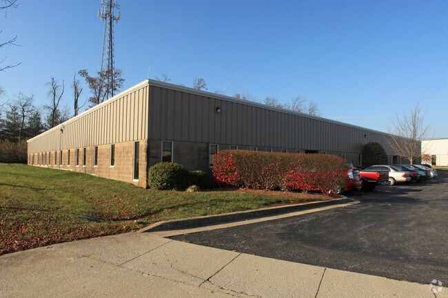
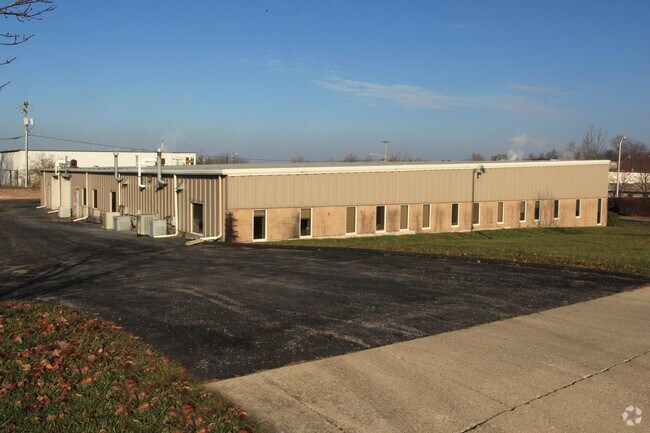
Property Record
750 Enterprise Dr, Lexington, KY 40510
NEARBY LISTINGS FOR SALE OR LEASE
Property Detail
750 Enterprise Dr
Lexington-Fayette, KY
Enterprise Indust. Park
20112080
I-253 ENTERPRISE INDUST. PARK LOT 1; BOOK: 3581 PAGE: 87
Multipleuses
Fayette
X
Kentucky
2100670116E
1
2025
0.99 AC
2025
West Lexington/Fayette
003702
Lexington/Fayette
13,498 SF
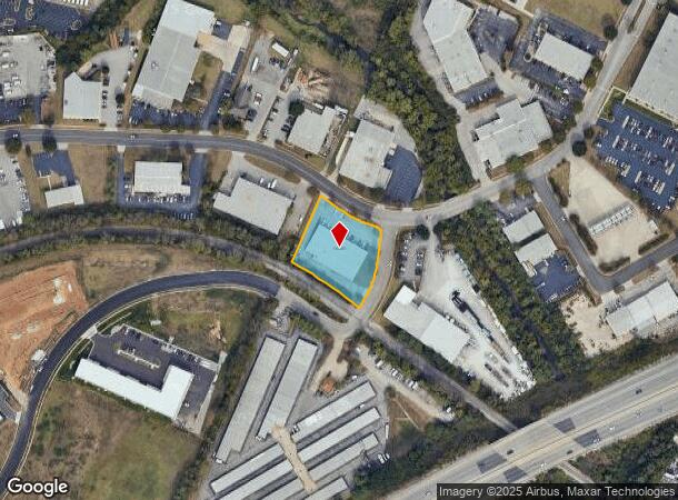
DEMOGRAPHICS near 750 Enterprise Dr
1 Mile
3 Mile
5 Mile
2024 Total Population
6,924
66,927
152,584
2029 Population
6,981
67,443
153,095
Pop Growth 2024-2029
+ 0.82%
+ 0.77%
+ 0.33%
Average Age
35
36
38
2024 Total Households
2,627
28,193
62,763
HH Growth 2024-2029
+ 0.69%
+ 0.75%
+ 0.36%
Median Household Inc
$43,338
$50,319
$56,658
Avg Household Size
2.50
2.20
2.20
2024 Avg HH Vehicles
2.00
2.00
2.00
Median Home Value
$158,357
$209,453
$249,163
Median Year Built
1971
1986
1973
Nearby Places
Map Layers
Map Styles
 Street
 Aerial
- Restaurants
- Banks
- Shops
- Fitness
- Groceries
PUBLIC TRANSPORTATION
AIRPORT
Blue Grass
DRIVE
WALK
Distance
Blue Grass
13 min
6.5 mi
SALE & LEASE HISTORY
LISTING DATE
SALE/LEASE

Sep 25, 2016
For Lease
Nearby Properties
Address
Land Use
TOTAL SIZE
Lot Size
Zoning
Address
Land Use
TOTAL SIZE
Lot Size
Zoning
3,896 SF
0.49 AC
B-4
Address
Land Use
TOTAL SIZE
Lot Size
Zoning
14.90 AC
B-2B
Address
Land Use
TOTAL SIZE
Lot Size
Zoning
510,633 SF
15.10 AC
P-1
Address
Land Use
TOTAL SIZE
Lot Size
Zoning
Address
Land Use
TOTAL SIZE
Lot Size
Zoning
87 SF
R-4
Address
Land Use
TOTAL SIZE
Lot Size
Zoning
Address
Land Use
TOTAL SIZE
Lot Size
Zoning
292,730 SF
3.18 AC
R-1C
Address
Land Use
TOTAL SIZE
Lot Size
Zoning
394,590 SF
14.76 AC
R-4
Address
Land Use
TOTAL SIZE
Lot Size
Zoning
1,344 SF
150.76 AC
A-U
Address
Land Use
TOTAL SIZE
Lot Size
Zoning
1.25 AC
B-2B
Address
Land Use
TOTAL SIZE
Lot Size
Zoning
29,480 SF
4.60 AC
MU-3
Address
Land Use
TOTAL SIZE
Lot Size
Zoning
134,783 SF
1.36 AC
B-1
Address
Land Use
TOTAL SIZE
Lot Size
Zoning
8,078 SF
10.61 AC
R-5
Address
Land Use
TOTAL SIZE
Lot Size
Zoning
26,672 SF
1.24 AC
B-1
Address
Land Use
TOTAL SIZE
Lot Size
Zoning
384,037 SF
9.52 AC
P-1
Address
Land Use
TOTAL SIZE
Lot Size
Zoning
2,545 SF
14 AC
R-4
Address
Land Use
TOTAL SIZE
Lot Size
Zoning
Address
Land Use
TOTAL SIZE
Lot Size
Zoning
9,774 SF
798.32 AC
A-R
Address
Land Use
TOTAL SIZE
Lot Size
Zoning
61,965 SF
46.96 AC
A-U
Address
Land Use
TOTAL SIZE
Lot Size
Zoning
8,880 SF
7.39 AC
R-4
Address
Land Use
TOTAL SIZE
Lot Size
Zoning
278,944 SF
0.75 AC
B-2B
Address
Land Use
TOTAL SIZE
Lot Size
Zoning
340,698 SF
B-2B
Address
Land Use
TOTAL SIZE
Lot Size
Zoning
63,509 SF
2.24 AC
B-1
Address
Land Use
TOTAL SIZE
Lot Size
Zoning
46,470 SF
4.91 AC
R-3
Address
Land Use
TOTAL SIZE
Lot Size
Zoning
2,968 SF
14.26 AC
R-3
Address
Land Use
TOTAL SIZE
Lot Size
Zoning
97,729 SF
4.22 AC
P-1
Address
Land Use
TOTAL SIZE
Lot Size
Zoning
357,373 SF
2.43 AC
B-2B
Address
Land Use
TOTAL SIZE
Lot Size
Zoning
374,910 SF
0.78 AC
B-2B
Address
Land Use
TOTAL SIZE
Lot Size
Zoning
14,292 SF
11.32 AC
R-4
Address
Land Use
TOTAL SIZE
Lot Size
Zoning
2,480 SF
9.12 AC
R-3
The World's #1 Commercial Real Estate Marketplace
Connect with us
© 2025 CoStar Group
The information above has been obtained from sources believed reliable. While we do not doubt its accuracy we have not verified it and make no guarantee, warranty or representation about it. It is your responsibility to independently confirm its accuracy and completeness. Any projections, opinions, assumptions, or estimates used are for example only and do not represent the current or future performance of the property. The value of this transaction to you depends on tax and other factors which should be evaluated by your tax, financial, and legal advisors. You and your advisors should conduct a careful, independent investigation of the property to determine to your satisfaction the suitability of the property for your needs.