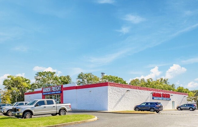
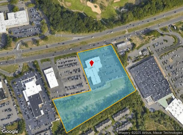
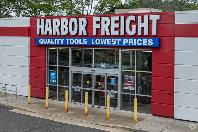
Property Record
750 Highway 36, Eatontown, NJ 07724
NEARBY LISTINGS FOR SALE OR LEASE
Property Detail
750 Highway 36
12-02801-0000-00004
Monmouth
Vehiclerentalsvehiclesales
New Jersey
X
4
34025C0191F
7.70 AC
2024
Eastern Monmouth
2025
Northern New Jersey
805100
New York-Jersey City-White Plains, NY-NJ
18,345 SF
DEMOGRAPHICS near 750 Highway 36
1 Mile
3 Mile
5 Mile
2024 Total Population
6,720
69,141
161,784
2029 Population
6,552
68,638
161,859
Pop Growth 2024-2029
(2.50%)
(0.73%)
+ 0.05%
Average Age
44
41
42
2024 Total Households
2,693
26,064
64,071
HH Growth 2024-2029
(3.19%)
(1.12%)
(0.11%)
Median Household Inc
$87,081
$91,347
$95,804
Avg Household Size
2.40
2.50
2.40
2024 Avg HH Vehicles
2.00
2.00
2.00
Median Home Value
$438,264
$524,600
$562,757
Median Year Built
1975
1971
1970
Nearby Places
Map Layers
Map Styles
 Street
 Aerial
- Restaurants
- Banks
- Shops
- Fitness
- Groceries
PUBLIC TRANSPORTATION
COMMUTER RAIL
Monmouth Park (North Jersey Coast Line - NJ Transit Commuter Rail (NJ Transit))
DRIVE
WALK
Distance
Monmouth Park (North Jersey Coast Line - NJ Transit Commuter Rail (NJ Transit))
5 min
2.9 mi
Little Silver (North Jersey Coast Line - NJ Transit Commuter Rail (NJ Transit))
DRIVE
WALK
Distance
Little Silver (North Jersey Coast Line - NJ Transit Commuter Rail (NJ Transit))
7 min
4.1 mi
AIRPORT
Newark Liberty International
DRIVE
WALK
Distance
Newark Liberty International
57 min
47.0 mi
Freight Ports
New York Container Terminal
DRIVE
WALK
Distance
New York Container Terminal
51 min
39.1 mi
SALE & LEASE HISTORY
LISTING DATE
SALE/LEASE

Oct 29, 2021
For Sale
Nearby Properties
Address
Land Use
TOTAL SIZE
Lot Size
Zoning
Address
Land Use
TOTAL SIZE
Lot Size
Zoning
13.75 AC
M
Address
Land Use
TOTAL SIZE
Lot Size
Zoning
221.56 AC
P1
Address
Land Use
TOTAL SIZE
Lot Size
Zoning
75.16 AC
R-7
Address
Land Use
TOTAL SIZE
Lot Size
Zoning
89,939 SF
51.49 AC
I
Address
Land Use
TOTAL SIZE
Lot Size
Zoning
35.50 AC
R-7
Address
Land Use
TOTAL SIZE
Lot Size
Zoning
Address
Land Use
TOTAL SIZE
Lot Size
Zoning
136.40 AC
B2
Address
Land Use
TOTAL SIZE
Lot Size
Zoning
22,877 SF
10.35 AC
IC
Address
Land Use
TOTAL SIZE
Lot Size
Zoning
84,653 SF
20.79 AC
B-2
Address
Land Use
TOTAL SIZE
Lot Size
Zoning
2,446 SF
21.62 AC
R-5
Address
Land Use
TOTAL SIZE
Lot Size
Zoning
293,262 SF
28.40 AC
HC
Address
Land Use
TOTAL SIZE
Lot Size
Zoning
1,100 SF
37.83 AC
C-2
Address
Land Use
TOTAL SIZE
Lot Size
Zoning
24.45 AC
R10A
Address
Land Use
TOTAL SIZE
Lot Size
Zoning
314,569 SF
22.05 AC
R-4
Address
Land Use
TOTAL SIZE
Lot Size
Zoning
194,812 SF
55.01 AC
R-4
Address
Land Use
TOTAL SIZE
Lot Size
Zoning
35.98 AC
R10A
Address
Land Use
TOTAL SIZE
Lot Size
Zoning
178,315 SF
24.54 AC
3713
Address
Land Use
TOTAL SIZE
Lot Size
Zoning
27 AC
R10A
Address
Land Use
TOTAL SIZE
Lot Size
Zoning
201,455 SF
79.34 AC
R-1
Address
Land Use
TOTAL SIZE
Lot Size
Zoning
20.62 AC
AR3P
Address
Land Use
TOTAL SIZE
Lot Size
Zoning
153,160 SF
10.12 AC
BP2
Address
Land Use
TOTAL SIZE
Lot Size
Zoning
14.23 AC
R-4
Address
Land Use
TOTAL SIZE
Lot Size
Zoning
181,867 SF
31.90 AC
RA
Address
Land Use
TOTAL SIZE
Lot Size
Zoning
77.36 AC
B2
Address
Land Use
TOTAL SIZE
Lot Size
Zoning
1,178 SF
21.78 AC
R-7
Address
Land Use
TOTAL SIZE
Lot Size
Zoning
157,580 SF
14.95 AC
R-4
Address
Land Use
TOTAL SIZE
Lot Size
Zoning
258,088 SF
27.90 AC
IO20
Address
Land Use
TOTAL SIZE
Lot Size
Zoning
40.82 AC
I
Address
Land Use
TOTAL SIZE
Lot Size
Zoning
14.99 AC
R10A
Address
Land Use
TOTAL SIZE
Lot Size
Zoning
108,629 SF
12.05 AC
HC
The World's #1 Commercial Real Estate Marketplace
Connect with us
© 2025 CoStar Group
The information above has been obtained from sources believed reliable. While we do not doubt its accuracy we have not verified it and make no guarantee, warranty or representation about it. It is your responsibility to independently confirm its accuracy and completeness. Any projections, opinions, assumptions, or estimates used are for example only and do not represent the current or future performance of the property. The value of this transaction to you depends on tax and other factors which should be evaluated by your tax, financial, and legal advisors. You and your advisors should conduct a careful, independent investigation of the property to determine to your satisfaction the suitability of the property for your needs.