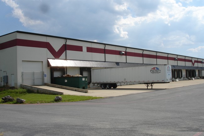
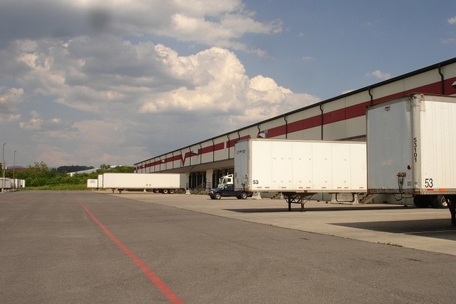
Property Record
750 Interstate View Dr, Rockingham, VA 22801

Property Detail
750 Interstate View Dr
124F-5-L3B
PLEASANT VALLEY COMMERCIAL PK S 3
Commercialnec
ROCKINGHAM
I1
Virginia
AE The base floodplain where base flood elevations are provided. AE Zones are now used on new format FIRMs instead of A1-A30 Zones.
19.20 AC
2025
Staunton & Harrisonburg
2025
Other Market Areas
011700
Harrisonburg, VA
216,800 SF
NEARBY LISTINGS FOR SALE OR LEASE
DEMOGRAPHICS near 750 Interstate View Dr
1 mile
3 mile
5 mile
2025 Total Population
253
17,738
67,493
2030 Population
264
18,243
68,791
Pop Growth 2025-2030
+ 4.35%
+ 2.85%
+ 1.92%
Average Age
38
35
35
2025 Total Households
97
6,782
22,975
HH Growth 2025-2030
+ 4.12%
+ 2.92%
+ 2.20%
Median Household Inc
$81,818
$61,991
$72,851
Avg Household Size
2.60
2.50
2.50
2025 Avg HH Vehicles
2.00
2.00
2.00
Median Home Value
$371,428
$347,351
$366,542
Median Year Built
1999
1997
1992
Nearby Places
Map Layers
Map Styles
 Street
 Aerial
Layers
 Traffic
 Biking
Places
Listings with unknown addresses are not visible on the map
- Restaurants
- Banks
- Shops
- Fitness
- Groceries
PUBLIC TRANSPORTATION
AIRPORT
Charlottesville-Albemarle
Drive
Walk
Distance
Charlottesville-Albemarle
74 min
49.1 mi
Nearby Properties
Address
Land Use
TOTAL SIZE
Lot Size
Zoning
Address
Land Use
TOTAL SIZE
Lot Size
Zoning
126,552 SF
49.87 AC
GENERAL BU
Address
Land Use
TOTAL SIZE
Lot Size
Zoning
57.92 AC
I1
Address
Land Use
TOTAL SIZE
Lot Size
Zoning
199.08 AC
I1
Address
Land Use
TOTAL SIZE
Lot Size
Zoning
11.56 AC
B1
Address
Land Use
TOTAL SIZE
Lot Size
Zoning
260,792 SF
27.98 AC
P1
Address
Land Use
TOTAL SIZE
Lot Size
Zoning
225,359 SF
33.32 AC
I1
Address
Land Use
TOTAL SIZE
Lot Size
Zoning
11.11 AC
R3
Address
Land Use
TOTAL SIZE
Lot Size
Zoning
6.10 AC
PMF
Address
Land Use
TOTAL SIZE
Lot Size
Zoning
130,426 SF
19.11 AC
R1
Address
Land Use
TOTAL SIZE
Lot Size
Zoning
295,543 SF
33.23 AC
I1
Address
Land Use
TOTAL SIZE
Lot Size
Zoning
9,440 SF
17.31 AC
R3
Address
Land Use
TOTAL SIZE
Lot Size
Zoning
905,215 SF
26.54 AC
M1
Address
Land Use
TOTAL SIZE
Lot Size
Zoning
15,432 SF
132 AC
MULTI DWEL
Address
Land Use
TOTAL SIZE
Lot Size
Zoning
13,578 SF
180 AC
HIGH DENSI
Address
Land Use
TOTAL SIZE
Lot Size
Zoning
15,432 SF
108 AC
MULTI DWEL
Address
Land Use
TOTAL SIZE
Lot Size
Zoning
25,020 SF
3.80 AC
COMMERCIAL
Address
Land Use
TOTAL SIZE
Lot Size
Zoning
13,986 SF
9.87 AC
R3
Address
Land Use
TOTAL SIZE
Lot Size
Zoning
84,000 SF
17 AC
GENERAL IN
Address
Land Use
TOTAL SIZE
Lot Size
Zoning
153,180 SF
19.26 AC
B1
Address
Land Use
TOTAL SIZE
Lot Size
Zoning
348,800 SF
26.90 AC
I1
Address
Land Use
TOTAL SIZE
Lot Size
Zoning
172,194 SF
4.24 AC
B1
Address
Land Use
TOTAL SIZE
Lot Size
Zoning
2,145 SF
2.71 AC
PMF
Address
Land Use
TOTAL SIZE
Lot Size
Zoning
21.42 AC
I1
Address
Land Use
TOTAL SIZE
Lot Size
Zoning
4.82 AC
B1
Address
Land Use
TOTAL SIZE
Lot Size
Zoning
3,876 SF
8.86 AC
R3
Address
Land Use
TOTAL SIZE
Lot Size
Zoning
73,000 SF
22.26 AC
SINGLE FAM
Address
Land Use
TOTAL SIZE
Lot Size
Zoning
34,466 SF
16.29 AC
A2
Address
Land Use
TOTAL SIZE
Lot Size
Zoning
15.50 AC
GENERAL IN
Address
Land Use
TOTAL SIZE
Lot Size
Zoning
74,032 SF
20.64 AC
R3
Address
Land Use
TOTAL SIZE
Lot Size
Zoning
172,510 SF
12.96 AC
GENERAL IN
The World's #1 Commercial Real Estate Marketplace
Connect with us
© 2026 CoStar Group
The information above has been obtained from sources believed reliable. While we do not doubt its accuracy we have not verified it and make no guarantee, warranty or representation about it. It is your responsibility to independently confirm its accuracy and completeness. Any projections, opinions, assumptions, or estimates used are for example only and do not represent the current or future performance of the property. The value of this transaction to you depends on tax and other factors which should be evaluated by your tax, financial, and legal advisors. You and your advisors should conduct a careful, independent investigation of the property to determine to your satisfaction the suitability of the property for your needs.