Property Record
750 Laurel St, Florence, OR 97439
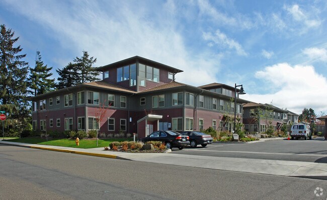

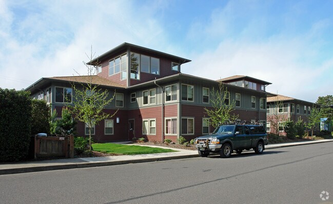
Property Detail
750 Laurel St
Eugene-Springfield, OR
TL 01800
0800282
Lane
Multifamilydwelling
Oregon
M-F
1800
B and X Area of moderate flood hazard, usually the area between the limits of the 100-year and 500-year floods.
0.55 AC
0
West Lane County
2025
Portland
000705
NEARBY LISTINGS FOR SALE OR LEASE
-
-
View all Florence listings for sale on LoopNet.com
DEMOGRAPHICS near 750 Laurel St
1 mile
3 mile
5 mile
2025 Total Population
4,897
11,459
15,296
2030 Population
4,911
11,560
15,555
Pop Growth 2025-2030
+ 0.29%
+ 0.88%
+ 1.69%
Average Age
51
54
54
2025 Total Households
2,365
5,575
7,437
HH Growth 2025-2030
+ 0.30%
+ 0.86%
+ 1.72%
Median Household Inc
$46,655
$55,570
$59,729
Avg Household Size
2.00
2.00
2.00
2025 Avg HH Vehicles
2.00
2.00
2.00
Median Home Value
$329,243
$370,593
$400,166
Median Year Built
1981
1990
1990
Nearby Places
Map Layers
Map Styles
 Street
 Aerial
Transit
 Traffic
 Biking
Places
Listings with unknown addresses are not visible on the map
- Restaurants
- Banks
- Shops
- Fitness
- Groceries
Nearby Properties
Address
Land Use
TOTAL SIZE
Lot Size
Zoning
Address
Land Use
TOTAL SIZE
Lot Size
Zoning
87.30 AC
M-F
Address
Land Use
TOTAL SIZE
Lot Size
Zoning
0.46 AC
R
Address
Land Use
TOTAL SIZE
Lot Size
Zoning
10.54 AC
NC
Address
Land Use
TOTAL SIZE
Lot Size
Zoning
2.66 AC
POI
Address
Land Use
TOTAL SIZE
Lot Size
Zoning
2.46 AC
H
Address
Land Use
TOTAL SIZE
Lot Size
Zoning
104.62 AC
F2
Address
Land Use
TOTAL SIZE
Lot Size
Zoning
2.61 AC
POI
Address
Land Use
TOTAL SIZE
Lot Size
Zoning
3.71 AC
MAA
Address
Land Use
TOTAL SIZE
Lot Size
Zoning
46.11 AC
C
Address
Land Use
TOTAL SIZE
Lot Size
Zoning
5.27 AC
R
Address
Land Use
TOTAL SIZE
Lot Size
Zoning
1.96 AC
POI
Address
Land Use
TOTAL SIZE
Lot Size
Zoning
4.12 AC
MAA
Address
Land Use
TOTAL SIZE
Lot Size
Zoning
9.07 AC
M-F
Address
Land Use
TOTAL SIZE
Lot Size
Zoning
5 AC
PR
Address
Land Use
TOTAL SIZE
Lot Size
Zoning
1.47 AC
H
Address
Land Use
TOTAL SIZE
Lot Size
Zoning
2.45 AC
POI
Address
Land Use
TOTAL SIZE
Lot Size
Zoning
80 AC
CV
Address
Land Use
TOTAL SIZE
Lot Size
Zoning
2.75 AC
M-F
Address
Land Use
TOTAL SIZE
Lot Size
Zoning
1.77 AC
C
Address
Land Use
TOTAL SIZE
Lot Size
Zoning
5 AC
RR2
Address
Land Use
TOTAL SIZE
Lot Size
Zoning
49.68 AC
M
Address
Land Use
TOTAL SIZE
Lot Size
Zoning
1.17 AC
H
Address
Land Use
TOTAL SIZE
Lot Size
Zoning
142.14 AC
M-F
Address
Land Use
TOTAL SIZE
Lot Size
Zoning
1.20 AC
OTAA
Address
Land Use
TOTAL SIZE
Lot Size
Zoning
1.55 AC
M-F
Address
Land Use
TOTAL SIZE
Lot Size
Zoning
0.36 AC
POI
Address
Land Use
TOTAL SIZE
Lot Size
Zoning
3.24 AC
H
Address
Land Use
TOTAL SIZE
Lot Size
Zoning
26.49 AC
Address
Land Use
TOTAL SIZE
Lot Size
Zoning
4.54 AC
H
Address
Land Use
TOTAL SIZE
Lot Size
Zoning
0.66 AC
R
The World's #1 Commercial Real Estate Marketplace
Connect with us
© 2026 CoStar Group
The information above has been obtained from sources believed reliable. While we do not doubt its accuracy we have not verified it and make no guarantee, warranty or representation about it. It is your responsibility to independently confirm its accuracy and completeness. Any projections, opinions, assumptions, or estimates used are for example only and do not represent the current or future performance of the property. The value of this transaction to you depends on tax and other factors which should be evaluated by your tax, financial, and legal advisors. You and your advisors should conduct a careful, independent investigation of the property to determine to your satisfaction the suitability of the property for your needs.