Property Record
750 Maxham Rd, Lithia Springs, GA 30122

NEARBY LISTINGS FOR SALE OR LEASE
Property Detail
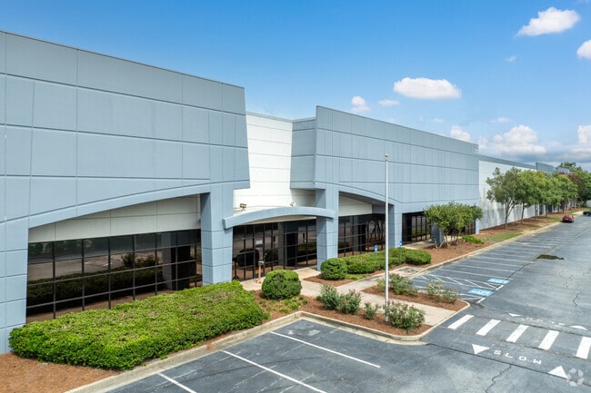
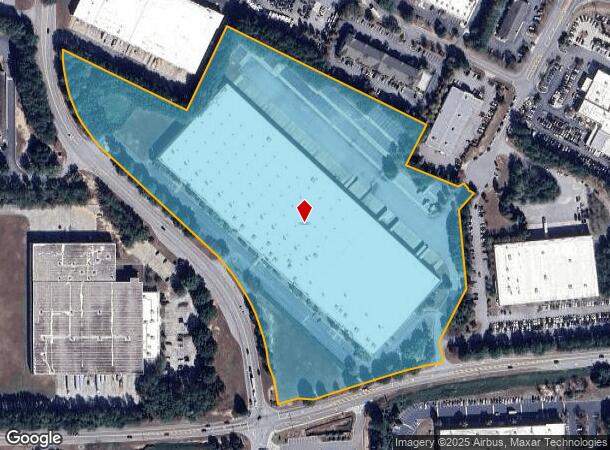
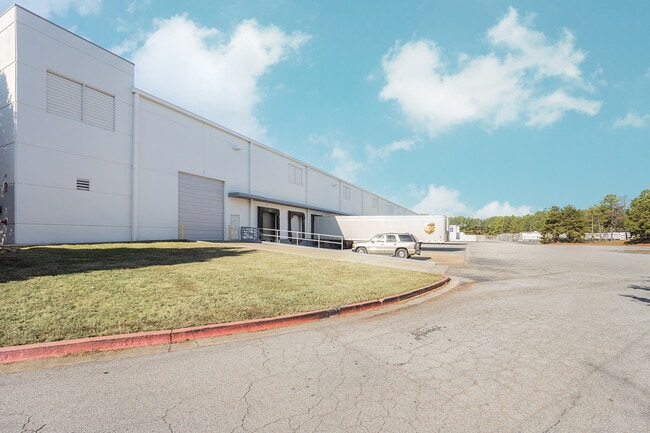
750 Maxham Rd
Atlanta-Sandy Springs-Roswell, GA
Westfork Sub
0182-04-8-0-015
BLDG/19.7911 AC, LOT A5, WESTFORK S/D, PH V
Warehouse
Douglas
X
Georgia
13067C0211H
a5
2024
19.79 AC
2024
I-20 W/Douglasville
031322
Atlanta
312,093 SF
DEMOGRAPHICS near 750 Maxham Rd
1 Mile
3 Mile
5 Mile
2024 Total Population
6,354
44,348
109,650
2029 Population
6,561
45,761
112,912
Pop Growth 2024-2029
+ 3.26%
+ 3.19%
+ 2.97%
Average Age
34
37
37
2024 Total Households
2,803
16,816
40,938
HH Growth 2024-2029
+ 3.42%
+ 3.22%
+ 2.98%
Median Household Inc
$44,652
$56,633
$61,567
Avg Household Size
2.20
2.60
2.60
2024 Avg HH Vehicles
2.00
2.00
2.00
Median Home Value
$148,591
$187,050
$209,834
Median Year Built
1994
1988
1987
Nearby Places
Map Layers
Map Styles
 Street
 Aerial
- Restaurants
- Banks
- Shops
- Fitness
- Groceries
PUBLIC TRANSPORTATION
AIRPORT
Hartsfield - Jackson Atlanta International
DRIVE
WALK
Distance
Hartsfield - Jackson Atlanta International
35 min
23.4 mi
SALE & LEASE HISTORY
LISTING DATE
SALE/LEASE

Sep 24, 2016
For Lease
Oct 13, 2020
For Lease
Nearby Properties
Address
Land Use
TOTAL SIZE
Lot Size
Zoning
Address
Land Use
TOTAL SIZE
Lot Size
Zoning
454,000 SF
68.17 AC
LI-R
Address
Land Use
TOTAL SIZE
Lot Size
Zoning
840,110 SF
53.36 AC
PUD
Address
Land Use
TOTAL SIZE
Lot Size
Zoning
320,073 SF
38.78 AC
R-MF
Address
Land Use
TOTAL SIZE
Lot Size
Zoning
789,717 SF
68.55 AC
LI
Address
Land Use
TOTAL SIZE
Lot Size
Zoning
417,860 SF
40.32 AC
LI
Address
Land Use
TOTAL SIZE
Lot Size
Zoning
913,620 SF
58.88 AC
Address
Land Use
TOTAL SIZE
Lot Size
Zoning
330,754 SF
27.25 AC
R-6
Address
Land Use
TOTAL SIZE
Lot Size
Zoning
603,096 SF
38.38 AC
HI
Address
Land Use
TOTAL SIZE
Lot Size
Zoning
318,456 SF
30.91 AC
R-MF
Address
Land Use
TOTAL SIZE
Lot Size
Zoning
222,846 SF
50.74 AC
R-6
Address
Land Use
TOTAL SIZE
Lot Size
Zoning
307,169 SF
30.13 AC
LI
Address
Land Use
TOTAL SIZE
Lot Size
Zoning
285,933 SF
46.22 AC
R-MF
Address
Land Use
TOTAL SIZE
Lot Size
Zoning
290,784 SF
21.09 AC
RM-12
Address
Land Use
TOTAL SIZE
Lot Size
Zoning
494,858 SF
43.29 AC
IL
Address
Land Use
TOTAL SIZE
Lot Size
Zoning
281,844 SF
38.66 AC
R-MF
Address
Land Use
TOTAL SIZE
Lot Size
Zoning
603,952 SF
37.71 AC
IL
Address
Land Use
TOTAL SIZE
Lot Size
Zoning
538,748 SF
35.64 AC
LI
Address
Land Use
TOTAL SIZE
Lot Size
Zoning
245,812 SF
30.90 AC
DCD
Address
Land Use
TOTAL SIZE
Lot Size
Zoning
490,726 SF
50.62 AC
LI-R
Address
Land Use
TOTAL SIZE
Lot Size
Zoning
567,480 SF
44.13 AC
LI
Address
Land Use
TOTAL SIZE
Lot Size
Zoning
70.12 AC
Address
Land Use
TOTAL SIZE
Lot Size
Zoning
527,000 SF
30.38 AC
LI
Address
Land Use
TOTAL SIZE
Lot Size
Zoning
240,612 SF
23.22 AC
R-6
Address
Land Use
TOTAL SIZE
Lot Size
Zoning
635,664 SF
35.94 AC
5
Address
Land Use
TOTAL SIZE
Lot Size
Zoning
428,974 SF
26.57 AC
LI-R
Address
Land Use
TOTAL SIZE
Lot Size
Zoning
351,845 SF
29.99 AC
LI-R
Address
Land Use
TOTAL SIZE
Lot Size
Zoning
400,000 SF
66.21 AC
IL
Address
Land Use
TOTAL SIZE
Lot Size
Zoning
311,073 SF
56.51 AC
LI
Address
Land Use
TOTAL SIZE
Lot Size
Zoning
350,840 SF
22.90 AC
LI
Address
Land Use
TOTAL SIZE
Lot Size
Zoning
380,000 SF
33.97 AC
IL
The World's #1 Commercial Real Estate Marketplace
Connect with us
© 2025 CoStar Group
The information above has been obtained from sources believed reliable. While we do not doubt its accuracy we have not verified it and make no guarantee, warranty or representation about it. It is your responsibility to independently confirm its accuracy and completeness. Any projections, opinions, assumptions, or estimates used are for example only and do not represent the current or future performance of the property. The value of this transaction to you depends on tax and other factors which should be evaluated by your tax, financial, and legal advisors. You and your advisors should conduct a careful, independent investigation of the property to determine to your satisfaction the suitability of the property for your needs.