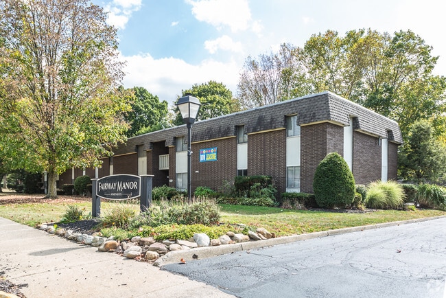
Property Record
750 Mull Ave, Akron, OH 44313


Property Detail
750 Mull Ave
Akron, OH
J E GOOD LOTS 256 THRU 280 ALL INCL & 297 ALL & PT VAC STS
67-54991
Summit
Apartment
Ohio
2023
257
2025
5.70 AC
506100
West Akron
80,198 SF
Cleveland
NEARBY LISTINGS FOR SALE OR LEASE
DEMOGRAPHICS near 750 Mull Ave
1 mile
3 mile
5 mile
2025 Total Population
8,019
68,794
168,489
2030 Population
7,973
68,907
169,014
Pop Growth 2025-2030
(0.57%)
+ 0.16%
+ 0.31%
Average Age
43
42
40
2025 Total Households
3,867
31,624
73,025
HH Growth 2025-2030
(0.59%)
+ 0.12%
+ 0.30%
Median Household Inc
$49,608
$56,926
$55,238
Avg Household Size
2.00
2.10
2.20
2025 Avg HH Vehicles
2.00
1.00
2.00
Median Home Value
$158,094
$179,359
$167,892
Median Year Built
1953
1955
1955
Nearby Places
Map Layers
Map Styles
 Street
 Aerial
Layers
 Traffic
 Biking
Places
Listings with unknown addresses are not visible on the map
- Restaurants
- Banks
- Shops
- Fitness
- Groceries
PUBLIC TRANSPORTATION
COMMUTER RAIL
Akron Northside (National Park Scenic Railway - Cuyahoga Valley Scenic Railroad)
Drive
Walk
Distance
Akron Northside (National Park Scenic Railway - Cuyahoga Valley Scenic Railroad)
10 min
3.6 mi
Big Bend (National Park Scenic Railway - Cuyahoga Valley Scenic Railroad)
Drive
Walk
Distance
Big Bend (National Park Scenic Railway - Cuyahoga Valley Scenic Railroad)
10 min
4.2 mi
AIRPORT
Akron-Canton Regional
Drive
Walk
Distance
Akron-Canton Regional
26 min
18.7 mi
Cleveland-Hopkins International
Drive
Walk
Distance
Cleveland-Hopkins International
50 min
35.8 mi
Freight Ports
Port of Toledo
Drive
Walk
Distance
Port of Toledo
154 min
131.0 mi
Nearby Properties
Address
Land Use
TOTAL SIZE
Lot Size
Zoning
Address
Land Use
TOTAL SIZE
Lot Size
Zoning
1,004,220 SF
3.84 AC
Address
Land Use
TOTAL SIZE
Lot Size
Zoning
Address
Land Use
TOTAL SIZE
Lot Size
Zoning
348,519 SF
7.45 AC
Address
Land Use
TOTAL SIZE
Lot Size
Zoning
282,490 SF
20.76 AC
Address
Land Use
TOTAL SIZE
Lot Size
Zoning
472,380 SF
4.55 AC
Address
Land Use
TOTAL SIZE
Lot Size
Zoning
194,508 SF
30.87 AC
Address
Land Use
TOTAL SIZE
Lot Size
Zoning
92,152 SF
1.69 AC
Address
Land Use
TOTAL SIZE
Lot Size
Zoning
91,104 SF
17.30 AC
Address
Land Use
TOTAL SIZE
Lot Size
Zoning
311,093 SF
32.53 AC
Address
Land Use
TOTAL SIZE
Lot Size
Zoning
246,312 SF
17.50 AC
Address
Land Use
TOTAL SIZE
Lot Size
Zoning
231,968 SF
29.14 AC
Address
Land Use
TOTAL SIZE
Lot Size
Zoning
10 AC
Address
Land Use
TOTAL SIZE
Lot Size
Zoning
10.78 AC
Address
Land Use
TOTAL SIZE
Lot Size
Zoning
233,762 SF
3.56 AC
Address
Land Use
TOTAL SIZE
Lot Size
Zoning
12.46 AC
Address
Land Use
TOTAL SIZE
Lot Size
Zoning
43,574 SF
3.67 AC
Address
Land Use
TOTAL SIZE
Lot Size
Zoning
76,560 SF
6.07 AC
Address
Land Use
TOTAL SIZE
Lot Size
Zoning
10.26 AC
Address
Land Use
TOTAL SIZE
Lot Size
Zoning
167,495 SF
12.64 AC
Address
Land Use
TOTAL SIZE
Lot Size
Zoning
113,059 SF
7.46 AC
Address
Land Use
TOTAL SIZE
Lot Size
Zoning
97,322 SF
1.42 AC
Address
Land Use
TOTAL SIZE
Lot Size
Zoning
59,270 SF
1.23 AC
Address
Land Use
TOTAL SIZE
Lot Size
Zoning
327,798 SF
116.80 AC
Address
Land Use
TOTAL SIZE
Lot Size
Zoning
123,800 SF
76.50 AC
Address
Land Use
TOTAL SIZE
Lot Size
Zoning
54,398 SF
8.10 AC
Address
Land Use
TOTAL SIZE
Lot Size
Zoning
58,639 SF
2.29 AC
Address
Land Use
TOTAL SIZE
Lot Size
Zoning
Address
Land Use
TOTAL SIZE
Lot Size
Zoning
Address
Land Use
TOTAL SIZE
Lot Size
Zoning
209,183 SF
36.34 AC
Address
Land Use
TOTAL SIZE
Lot Size
Zoning
123,367 SF
8.81 AC
The World's #1 Commercial Real Estate Marketplace
Connect with us
© 2026 CoStar Group
The information above has been obtained from sources believed reliable. While we do not doubt its accuracy we have not verified it and make no guarantee, warranty or representation about it. It is your responsibility to independently confirm its accuracy and completeness. Any projections, opinions, assumptions, or estimates used are for example only and do not represent the current or future performance of the property. The value of this transaction to you depends on tax and other factors which should be evaluated by your tax, financial, and legal advisors. You and your advisors should conduct a careful, independent investigation of the property to determine to your satisfaction the suitability of the property for your needs.