Property Record
750 Timber Dr, Garner, NC 27529


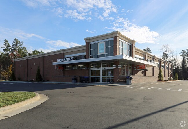
Property Detail
750 Timber Dr
1710.10-45-1089-000
LO2B REDIVISION OF HEATHER HILLS OFFICE
Supermarket
WAKE
CMX-C
North Carolina
B and X Area of moderate flood hazard, usually the area between the limits of the 100-year and 500-year floods.
2b
2025
2.94 AC
2025
Southeast Wake County
052812
Raleigh/Durham
16,410 SF
Raleigh-Cary, NC
NEARBY LISTINGS FOR SALE OR LEASE
DEMOGRAPHICS near 750 Timber Dr
1 mile
3 mile
5 mile
2025 Total Population
8,739
39,019
99,878
2030 Population
9,409
42,473
108,689
Pop Growth 2025-2030
+ 7.67%
+ 8.85%
+ 8.82%
Average Age
44
41
39
2025 Total Households
3,655
15,760
37,768
HH Growth 2025-2030
+ 8.10%
+ 9.26%
+ 9.26%
Median Household Inc
$93,571
$86,405
$82,545
Avg Household Size
2.30
2.40
2.60
2025 Avg HH Vehicles
2.00
2.00
2.00
Median Home Value
$365,870
$383,441
$359,153
Median Year Built
1993
1996
2000
Nearby Places
Map Layers
Map Styles
 Street
 Aerial
Layers
 Traffic
 Biking
Places
Listings with unknown addresses are not visible on the map
- Restaurants
- Banks
- Shops
- Fitness
- Groceries
PUBLIC TRANSPORTATION
COMMUTER RAIL
Raleigh Union Station (Piedmont - North Carolina by Train (NC Train))
Drive
Walk
Distance
Raleigh Union Station (Piedmont - North Carolina by Train (NC Train))
15 min
7.8 mi
AIRPORT
Raleigh-Durham International
Drive
Walk
Distance
Raleigh-Durham International
33 min
20.8 mi
Freight Ports
Port of Wilmington
Drive
Walk
Distance
Port of Wilmington
146 min
127.4 mi
Nearby Properties
Address
Land Use
TOTAL SIZE
Lot Size
Zoning
Address
Land Use
TOTAL SIZE
Lot Size
Zoning
2,583,746 SF
87.16 AC
HI
Address
Land Use
TOTAL SIZE
Lot Size
Zoning
654,170 SF
16.14 AC
CMX-C
Address
Land Use
TOTAL SIZE
Lot Size
Zoning
323,031 SF
57.73 AC
R4
Address
Land Use
TOTAL SIZE
Lot Size
Zoning
435,270 SF
57.90 AC
CMX
Address
Land Use
TOTAL SIZE
Lot Size
Zoning
390,672 SF
30.23 AC
CMX
Address
Land Use
TOTAL SIZE
Lot Size
Zoning
288,761 SF
19.61 AC
MF-B
Address
Land Use
TOTAL SIZE
Lot Size
Zoning
275,019 SF
17.04 AC
MF-A
Address
Land Use
TOTAL SIZE
Lot Size
Zoning
298,563 SF
24.19 AC
CMX
Address
Land Use
TOTAL SIZE
Lot Size
Zoning
279,123 SF
22.91 AC
CMX
Address
Land Use
TOTAL SIZE
Lot Size
Zoning
304,813 SF
19.08 AC
MF-A
Address
Land Use
TOTAL SIZE
Lot Size
Zoning
203,766 SF
14.18 AC
MF-A
Address
Land Use
TOTAL SIZE
Lot Size
Zoning
220,352 SF
16.82 AC
MF-A
Address
Land Use
TOTAL SIZE
Lot Size
Zoning
275,215 SF
18.17 AC
HI
Address
Land Use
TOTAL SIZE
Lot Size
Zoning
227,910 SF
20.77 AC
MF-A
Address
Land Use
TOTAL SIZE
Lot Size
Zoning
112,243 SF
45.76 AC
RA
Address
Land Use
TOTAL SIZE
Lot Size
Zoning
259,480 SF
17.19 AC
HI
Address
Land Use
TOTAL SIZE
Lot Size
Zoning
2,527 SF
173.31 AC
CMX
Address
Land Use
TOTAL SIZE
Lot Size
Zoning
156,078 SF
67.93 AC
HI
Address
Land Use
TOTAL SIZE
Lot Size
Zoning
166,859 SF
17.79 AC
R4
Address
Land Use
TOTAL SIZE
Lot Size
Zoning
101,311 SF
16.88 AC
NMX
Address
Land Use
TOTAL SIZE
Lot Size
Zoning
99,963 SF
26.84 AC
R2
Address
Land Use
TOTAL SIZE
Lot Size
Zoning
166,413 SF
12.47 AC
HI
Address
Land Use
TOTAL SIZE
Lot Size
Zoning
126,735 SF
9.89 AC
MF-A
Address
Land Use
TOTAL SIZE
Lot Size
Zoning
153,099 SF
38.98 AC
R2
Address
Land Use
TOTAL SIZE
Lot Size
Zoning
94,438 SF
37.79 AC
RA
Address
Land Use
TOTAL SIZE
Lot Size
Zoning
3,271 SF
96.56 AC
R-40W
Address
Land Use
TOTAL SIZE
Lot Size
Zoning
84,634 SF
19.30 AC
R4
Address
Land Use
TOTAL SIZE
Lot Size
Zoning
180,000 SF
10.77 AC
LI
Address
Land Use
TOTAL SIZE
Lot Size
Zoning
125,880 SF
6.37 AC
HI
Address
Land Use
TOTAL SIZE
Lot Size
Zoning
133,889 SF
19.90 AC
HI
The World's #1 Commercial Real Estate Marketplace
Connect with us
© 2026 CoStar Group
The information above has been obtained from sources believed reliable. While we do not doubt its accuracy we have not verified it and make no guarantee, warranty or representation about it. It is your responsibility to independently confirm its accuracy and completeness. Any projections, opinions, assumptions, or estimates used are for example only and do not represent the current or future performance of the property. The value of this transaction to you depends on tax and other factors which should be evaluated by your tax, financial, and legal advisors. You and your advisors should conduct a careful, independent investigation of the property to determine to your satisfaction the suitability of the property for your needs.