Property Record
750 Valley Stream Dr, Naples, FL 34113
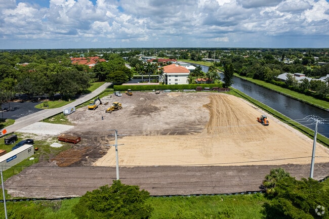


Property Detail
750 Valley Stream Dr
55150880002
LELY GOLF EST TRACT MAP THAT PORTION OF TRACT M DESC AS: COM NE CNR TR M , S 89DEG 32' 18"W 457.44FT, S 28DEG 33'33 W 527FT, THENCE SWLY ALG ARC OF CURVE CONCAVED TO NW 329.54 FT, S 48DEG 1'29"W 400FT TO POB, S 41DEG 58'31"E 300FT, S 48DEG 1'29"W 341
Warehouse
COLLIER
C-4
Florida
AE The base floodplain where base flood elevations are provided. AE Zones are now used on new format FIRMs instead of A1-A30 Zones.
13
2024
2.52 AC
2025
East Naples
010605
Southwest Florida
121,844 SF
Naples-Marco Island, FL
NEARBY LISTINGS FOR SALE OR LEASE
-
-
View all Naples listings for sale on LoopNet.com
DEMOGRAPHICS near 750 Valley Stream Dr
1 mile
3 mile
5 mile
2025 Total Population
9,042
57,129
116,697
2030 Population
10,008
63,088
128,811
Pop Growth 2025-2030
+ 10.68%
+ 10.43%
+ 10.38%
Average Age
52
50
51
2025 Total Households
4,182
25,211
52,550
HH Growth 2025-2030
+ 10.21%
+ 10.18%
+ 10.10%
Median Household Inc
$68,373
$70,814
$75,310
Avg Household Size
2.00
2.10
2.10
2025 Avg HH Vehicles
2.00
2.00
2.00
Median Home Value
$401,032
$423,718
$471,985
Median Year Built
1987
1990
1996
Nearby Places
Map Layers
Map Styles
 Street
 Aerial
Transit
 Traffic
 Biking
Places
Listings with unknown addresses are not visible on the map
- Restaurants
- Banks
- Shops
- Fitness
- Groceries
PUBLIC TRANSPORTATION
AIRPORT
Southwest Florida International
Drive
Walk
Distance
Southwest Florida International
50 min
36.9 mi
Freight Ports
Port of Miami
Drive
Walk
Distance
Port of Miami
149 min
108.6 mi
Nearby Properties
Address
Land Use
TOTAL SIZE
Lot Size
Zoning
Address
Land Use
TOTAL SIZE
Lot Size
Zoning
1,429,641 SF
45.28 AC
P
Address
Land Use
TOTAL SIZE
Lot Size
Zoning
368,003 SF
34.19 AC
PUD
Address
Land Use
TOTAL SIZE
Lot Size
Zoning
359,711 SF
14.89 AC
Address
Land Use
TOTAL SIZE
Lot Size
Zoning
140,512 SF
12.10 AC
PUD
Address
Land Use
TOTAL SIZE
Lot Size
Zoning
170,126 SF
50 AC
PUD
Address
Land Use
TOTAL SIZE
Lot Size
Zoning
285,739 SF
50 AC
A
Address
Land Use
TOTAL SIZE
Lot Size
Zoning
228,696 SF
27.40 AC
Address
Land Use
TOTAL SIZE
Lot Size
Zoning
70,944 SF
9.51 AC
P
Address
Land Use
TOTAL SIZE
Lot Size
Zoning
168,247 SF
25.60 AC
RMF-6
Address
Land Use
TOTAL SIZE
Lot Size
Zoning
240,746 SF
30.45 AC
PUD
Address
Land Use
TOTAL SIZE
Lot Size
Zoning
122,803 SF
27.48 AC
PUD
Address
Land Use
TOTAL SIZE
Lot Size
Zoning
100,588 SF
24 AC
PUD
Address
Land Use
TOTAL SIZE
Lot Size
Zoning
141,042 SF
17.69 AC
RMF-6
Address
Land Use
TOTAL SIZE
Lot Size
Zoning
85,944 SF
11.81 AC
Address
Land Use
TOTAL SIZE
Lot Size
Zoning
191,660 SF
18.87 AC
PUD
Address
Land Use
TOTAL SIZE
Lot Size
Zoning
35,029 SF
8.90 AC
PUD
Address
Land Use
TOTAL SIZE
Lot Size
Zoning
157,089 SF
6.63 AC
PUD
Address
Land Use
TOTAL SIZE
Lot Size
Zoning
23,500 SF
3.23 AC
PUD
Address
Land Use
TOTAL SIZE
Lot Size
Zoning
76,460 SF
17.53 AC
PUD
Address
Land Use
TOTAL SIZE
Lot Size
Zoning
97,609 SF
6.30 AC
Address
Land Use
TOTAL SIZE
Lot Size
Zoning
75,486 SF
2.97 AC
Address
Land Use
TOTAL SIZE
Lot Size
Zoning
164,424 SF
13.41 AC
C-4
Address
Land Use
TOTAL SIZE
Lot Size
Zoning
51,560 SF
9.44 AC
C-3
Address
Land Use
TOTAL SIZE
Lot Size
Zoning
6,308 SF
1.03 AC
NAPLES
Address
Land Use
TOTAL SIZE
Lot Size
Zoning
249,487 SF
23.13 AC
PUD
Address
Land Use
TOTAL SIZE
Lot Size
Zoning
88,783 SF
10.31 AC
PUD
Address
Land Use
TOTAL SIZE
Lot Size
Zoning
72,265 SF
11.73 AC
PUD
Address
Land Use
TOTAL SIZE
Lot Size
Zoning
3,306 SF
0.98 AC
NAPLES
Address
Land Use
TOTAL SIZE
Lot Size
Zoning
112,188 SF
23.65 AC
PUD
The World's #1 Commercial Real Estate Marketplace
Connect with us
© 2026 CoStar Group
The information above has been obtained from sources believed reliable. While we do not doubt its accuracy we have not verified it and make no guarantee, warranty or representation about it. It is your responsibility to independently confirm its accuracy and completeness. Any projections, opinions, assumptions, or estimates used are for example only and do not represent the current or future performance of the property. The value of this transaction to you depends on tax and other factors which should be evaluated by your tax, financial, and legal advisors. You and your advisors should conduct a careful, independent investigation of the property to determine to your satisfaction the suitability of the property for your needs.