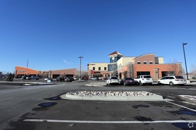
Property Record
750 W Riverdale Rd, Riverdale, UT 84405

NEARBY LISTINGS FOR SALE OR LEASE
Property Detail
750 W Riverdale Rd
06-012-0003
A RIGHT-OF-WAY FOR HIGHWAY KNOWN AS F.A. PROJECT NO. 114-B ACROSS THE GRANTORS LAND IN THE SOUTHEAST QUARTER SOUTHWEST
Commercialacreage
Weber
AE
Utah
49057C0436G
12 AC
0
Davis/Weber Counties
2025
Salt Lake City
211100
Ogden-Clearfield, UT
DEMOGRAPHICS near 750 W Riverdale Rd
1 Mile
3 Mile
5 Mile
2024 Total Population
11,270
82,416
198,632
2029 Population
12,228
88,429
213,005
Pop Growth 2024-2029
+ 8.50%
+ 7.30%
+ 7.24%
Average Age
36
36
35
2024 Total Households
4,081
29,002
68,824
HH Growth 2024-2029
+ 8.80%
+ 7.54%
+ 7.45%
Median Household Inc
$53,815
$65,166
$68,894
Avg Household Size
2.70
2.70
2.80
2024 Avg HH Vehicles
2.00
2.00
2.00
Median Home Value
$327,385
$321,632
$345,864
Median Year Built
1978
1974
1980
Nearby Places
Map Layers
Map Styles
 Street
 Aerial
- Restaurants
- Banks
- Shops
- Fitness
- Groceries
PUBLIC TRANSPORTATION
COMMUTER RAIL
Roy (FrontRunner North - Utah Transit Authority (UTA))
DRIVE
WALK
Distance
Roy (FrontRunner North - Utah Transit Authority (UTA))
9 min
3.4 mi
Ogden (FrontRunner North - Utah Transit Authority (UTA))
DRIVE
WALK
Distance
Ogden (FrontRunner North - Utah Transit Authority (UTA))
9 min
4.0 mi
AIRPORT
Salt Lake City International
DRIVE
WALK
Distance
Salt Lake City International
45 min
36.5 mi
Freight Ports
Port of Stockton
DRIVE
WALK
Distance
Port of Stockton
746 min
726.9 mi
SALE & LEASE HISTORY
LISTING DATE
SALE/LEASE

Sep 25, 2016
For Lease
Oct 06, 2022
For Lease
Mar 15, 2018
For Lease
Nearby Properties
Address
Land Use
TOTAL SIZE
Lot Size
Zoning
Address
Land Use
TOTAL SIZE
Lot Size
Zoning
790,525 SF
57.26 AC
Address
Land Use
TOTAL SIZE
Lot Size
Zoning
200,509 SF
12.75 AC
Address
Land Use
TOTAL SIZE
Lot Size
Zoning
35,219 SF
58.98 AC
Address
Land Use
TOTAL SIZE
Lot Size
Zoning
7,492 SF
8.96 AC
Address
Land Use
TOTAL SIZE
Lot Size
Zoning
83,038 SF
7.54 AC
Address
Land Use
TOTAL SIZE
Lot Size
Zoning
71,940 SF
11 AC
Address
Land Use
TOTAL SIZE
Lot Size
Zoning
48,177 SF
5.54 AC
Address
Land Use
TOTAL SIZE
Lot Size
Zoning
98,660 SF
3.18 AC
Address
Land Use
TOTAL SIZE
Lot Size
Zoning
8,580 SF
6.40 AC
Address
Land Use
TOTAL SIZE
Lot Size
Zoning
115,094 SF
13.88 AC
Address
Land Use
TOTAL SIZE
Lot Size
Zoning
4,442 SF
7.19 AC
Address
Land Use
TOTAL SIZE
Lot Size
Zoning
225,497 SF
20.33 AC
Address
Land Use
TOTAL SIZE
Lot Size
Zoning
63,343 SF
16.43 AC
Address
Land Use
TOTAL SIZE
Lot Size
Zoning
255,596 SF
15.98 AC
Address
Land Use
TOTAL SIZE
Lot Size
Zoning
73,942 SF
8.87 AC
Address
Land Use
TOTAL SIZE
Lot Size
Zoning
23,932 SF
5.53 AC
Address
Land Use
TOTAL SIZE
Lot Size
Zoning
10,440 SF
4.24 AC
Address
Land Use
TOTAL SIZE
Lot Size
Zoning
139,574 SF
9.30 AC
Address
Land Use
TOTAL SIZE
Lot Size
Zoning
96,690 SF
1.39 AC
Address
Land Use
TOTAL SIZE
Lot Size
Zoning
292,364 SF
24.15 AC
Address
Land Use
TOTAL SIZE
Lot Size
Zoning
202,920 SF
10.16 AC
Address
Land Use
TOTAL SIZE
Lot Size
Zoning
17,220 SF
218.11 AC
Address
Land Use
TOTAL SIZE
Lot Size
Zoning
67,248 SF
13.28 AC
The World's #1 Commercial Real Estate Marketplace
Connect with us
© 2025 CoStar Group
The information above has been obtained from sources believed reliable. While we do not doubt its accuracy we have not verified it and make no guarantee, warranty or representation about it. It is your responsibility to independently confirm its accuracy and completeness. Any projections, opinions, assumptions, or estimates used are for example only and do not represent the current or future performance of the property. The value of this transaction to you depends on tax and other factors which should be evaluated by your tax, financial, and legal advisors. You and your advisors should conduct a careful, independent investigation of the property to determine to your satisfaction the suitability of the property for your needs.