Property Record
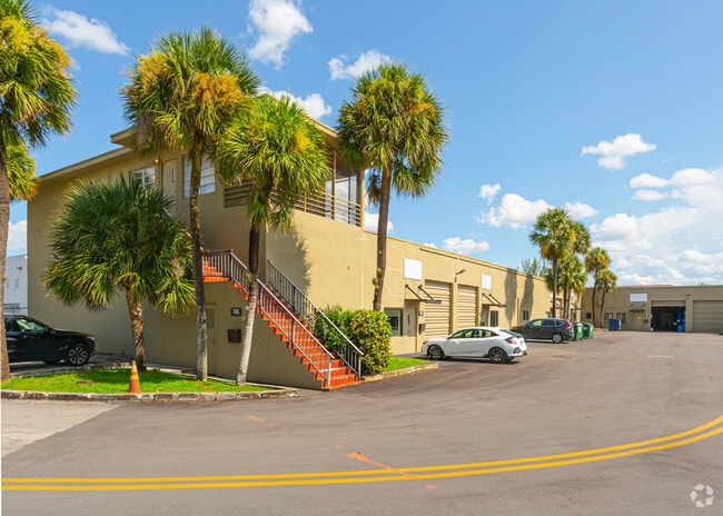
7750 Nw 75Th Ave, Miami, FL 33166


NEARBY LISTINGS FOR SALE OR LEASE
Property Detail
7750 Nw 75Th Ave
22-3011-002-0750
Fla Fruit Land Co Sub
Warehouse
11 53 40 FLA FRUIT LAND CO SUB PB 2-17 N25FT OF W1/2 OF E1/2 OF TR 44 & W1/2 OF TR 44 LESS RR R/W & LESS R/W& LESS COMM AT SW COR N1/2 OF NW1/4 OF SW1/4 TH N 89 DEG E 140.05FT N 01 DEG W 25.60FT S 79DEG E 3.01FT FOR POB TH CONT S 79 DEG E 84.31FT N 0
AH
Miami/Dade
12086C0277L
Florida
2024
4.08 AC
2025
Miami Airport North
980500
South Florida
75,127 SF
Miami-Miami Beach-Kendall, FL
DEMOGRAPHICS near 7750 Nw 75Th Ave
1 Mile
3 Mile
5 Mile
2024 Total Population
7,504
168,734
383,952
2029 Population
7,287
164,949
374,297
Pop Growth 2024-2029
(2.89%)
(2.24%)
(2.51%)
Average Age
45
43
42
2024 Total Households
2,493
58,153
127,834
HH Growth 2024-2029
(3.69%)
(2.68%)
(2.89%)
Median Household Inc
$30,286
$45,950
$54,056
Avg Household Size
2.60
2.80
2.90
2024 Avg HH Vehicles
2.00
2.00
2.00
Median Home Value
$93,749
$338,093
$344,644
Median Year Built
1974
1978
1981
Nearby Places
Map Layers
Map Styles
 Street
 Aerial
- Restaurants
- Banks
- Shops
- Fitness
- Groceries
PUBLIC TRANSPORTATION
COMMUTER RAIL
Okeechobee (Metrorail Green Line - Miami-Dade Transit (Metrorail/Metromover))
DRIVE
WALK
Distance
Okeechobee (Metrorail Green Line - Miami-Dade Transit (Metrorail/Metromover))
5 min
1.8 mi
Palmetto (Metrorail Green Line - Miami-Dade Transit (Metrorail/Metromover))
DRIVE
WALK
Distance
Palmetto (Metrorail Green Line - Miami-Dade Transit (Metrorail/Metromover))
6 min
2.1 mi
AIRPORT
Miami International
DRIVE
WALK
Distance
Miami International
14 min
5.6 mi
Fort Lauderdale/Hollywood International
DRIVE
WALK
Distance
Fort Lauderdale/Hollywood International
38 min
25.4 mi
Freight Ports
Port of Miami
DRIVE
WALK
Distance
Port of Miami
27 min
12.8 mi
SALE & LEASE HISTORY
LISTING DATE
SALE/LEASE

May 29, 2018
For Lease
Jul 27, 2022
For Lease
Jan 10, 2018
For Lease
Feb 18, 2025
For Lease
Apr 09, 2024
For Lease
Nearby Properties
Address
Land Use
TOTAL SIZE
Lot Size
Zoning
Address
Land Use
TOTAL SIZE
Lot Size
Zoning
312,996 SF
157.16 AC
8900
Address
Land Use
TOTAL SIZE
Lot Size
Zoning
851,502 SF
11.73 AC
6119
Address
Land Use
TOTAL SIZE
Lot Size
Zoning
777,714 SF
7.59 AC
9450
Address
Land Use
TOTAL SIZE
Lot Size
Zoning
7.62 AC
7200
Address
Land Use
TOTAL SIZE
Lot Size
Zoning
666,015 SF
4 AC
6119
Address
Land Use
TOTAL SIZE
Lot Size
Zoning
582,921 SF
4.51 AC
6119
Address
Land Use
TOTAL SIZE
Lot Size
Zoning
929,765 SF
453.69 AC
6119
Address
Land Use
TOTAL SIZE
Lot Size
Zoning
418,532 SF
17.95 AC
7300
Address
Land Use
TOTAL SIZE
Lot Size
Zoning
608,139 SF
5.80 AC
6119
Address
Land Use
TOTAL SIZE
Lot Size
Zoning
612,289 SF
3.38 AC
6119
Address
Land Use
TOTAL SIZE
Lot Size
Zoning
498,676 SF
25.96 AC
9450
Address
Land Use
TOTAL SIZE
Lot Size
Zoning
1,700 SF
7.24 AC
7100
Address
Land Use
TOTAL SIZE
Lot Size
Zoning
301,593 SF
16 AC
7100
Address
Land Use
TOTAL SIZE
Lot Size
Zoning
538,715 SF
24.72 AC
7100
Address
Land Use
TOTAL SIZE
Lot Size
Zoning
352,663 SF
0.65 AC
6119
Address
Land Use
TOTAL SIZE
Lot Size
Zoning
322,084 SF
6.60 AC
7100
Address
Land Use
TOTAL SIZE
Lot Size
Zoning
344,465 SF
5.03 AC
6400
Address
Land Use
TOTAL SIZE
Lot Size
Zoning
468,218 SF
17.06 AC
7100
Address
Land Use
TOTAL SIZE
Lot Size
Zoning
344,101 SF
0.74 AC
6119
Address
Land Use
TOTAL SIZE
Lot Size
Zoning
533,605 SF
10.86 AC
9450
Address
Land Use
TOTAL SIZE
Lot Size
Zoning
687,304 SF
3.03 AC
6119
Address
Land Use
TOTAL SIZE
Lot Size
Zoning
648,867 SF
33.08 AC
7100
Address
Land Use
TOTAL SIZE
Lot Size
Zoning
527,157 SF
4.15 AC
6119
Address
Land Use
TOTAL SIZE
Lot Size
Zoning
538,739 SF
5.05 AC
7100
Address
Land Use
TOTAL SIZE
Lot Size
Zoning
387,903 SF
4.49 AC
6119
Address
Land Use
TOTAL SIZE
Lot Size
Zoning
330,528 SF
4.46 AC
6119
Address
Land Use
TOTAL SIZE
Lot Size
Zoning
206,535 SF
7100
Address
Land Use
TOTAL SIZE
Lot Size
Zoning
298,603 SF
24.12 AC
7100
Address
Land Use
TOTAL SIZE
Lot Size
Zoning
355,631 SF
2.02 AC
6119
Address
Land Use
TOTAL SIZE
Lot Size
Zoning
388,143 SF
1.60 AC
6119
The World's #1 Commercial Real Estate Marketplace
Connect with us
© 2026 CoStar Group
The information above has been obtained from sources believed reliable. While we do not doubt its accuracy we have not verified it and make no guarantee, warranty or representation about it. It is your responsibility to independently confirm its accuracy and completeness. Any projections, opinions, assumptions, or estimates used are for example only and do not represent the current or future performance of the property. The value of this transaction to you depends on tax and other factors which should be evaluated by your tax, financial, and legal advisors. You and your advisors should conduct a careful, independent investigation of the property to determine to your satisfaction the suitability of the property for your needs.