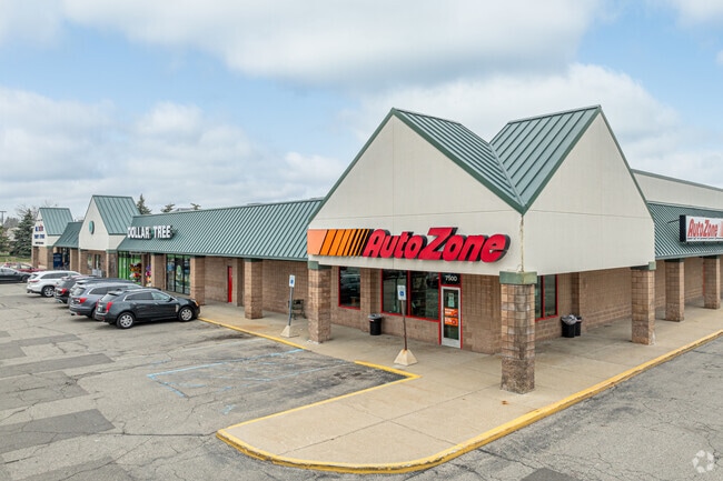
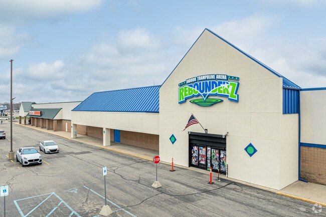
Property Record
7500 Cottonwood Dr, Jenison, MI 49428

NEARBY LISTINGS FOR SALE OR LEASE
Property Detail
7500 Cottonwood Dr
70-14-13-402-008
N Plat
Wholesaleoutletdiscountstore
LOTS 29 THRU 36, 39 THRU 46, 49 THRU 57 & PART OF LOTS 28, 47 & 48 & THAT PART OF VAC GROVE ST ALL IN PLAT OF JENISON
X
Ottawa
26081C0393D
Michigan
2025
8.53 AC
2025
E Ottawa Cnty/Hudsonville
021603
West Michigan
90,900 SF
Grand Rapids-Wyoming, MI
DEMOGRAPHICS near 7500 Cottonwood Dr
1 Mile
3 Mile
5 Mile
2024 Total Population
5,785
47,820
128,059
2029 Population
6,027
49,307
131,816
Pop Growth 2024-2029
+ 4.18%
+ 3.11%
+ 2.93%
Average Age
42
40
38
2024 Total Households
2,570
18,520
47,912
HH Growth 2024-2029
+ 4.47%
+ 3.26%
+ 2.91%
Median Household Inc
$59,658
$74,856
$75,848
Avg Household Size
2.20
2.50
2.60
2024 Avg HH Vehicles
2.00
2.00
2.00
Median Home Value
$208,347
$247,547
$241,273
Median Year Built
1974
1976
1980
Nearby Places
Map Layers
Map Styles
 Street
 Aerial
- Restaurants
- Banks
- Shops
- Fitness
- Groceries
PUBLIC TRANSPORTATION
AIRPORT
Gerald R Ford International
DRIVE
WALK
Distance
Gerald R Ford International
31 min
16.6 mi
SALE & LEASE HISTORY
LISTING DATE
SALE/LEASE

Sep 24, 2016
For Lease
Sep 23, 2016
For Sale
Mar 30, 2017
For Sale
Jun 12, 2023
For Sale
Jan 27, 2020
For Sale
Dec 05, 2017
For Lease
Nearby Properties
Address
Land Use
TOTAL SIZE
Lot Size
Zoning
Address
Land Use
TOTAL SIZE
Lot Size
Zoning
79.40 AC
C-4
Address
Land Use
TOTAL SIZE
Lot Size
Zoning
12.64 AC
PUD
Address
Land Use
TOTAL SIZE
Lot Size
Zoning
268,440 SF
28.11 AC
HDR
Address
Land Use
TOTAL SIZE
Lot Size
Zoning
225,992 SF
14.40 AC
Address
Land Use
TOTAL SIZE
Lot Size
Zoning
230,864 SF
59.58 AC
PUD2
Address
Land Use
TOTAL SIZE
Lot Size
Zoning
269,021 SF
22.89 AC
HDR
Address
Land Use
TOTAL SIZE
Lot Size
Zoning
191,331 SF
9.20 AC
PUD1
Address
Land Use
TOTAL SIZE
Lot Size
Zoning
173,288 SF
4.17 AC
PUD
Address
Land Use
TOTAL SIZE
Lot Size
Zoning
211,138 SF
30.58 AC
C-5
Address
Land Use
TOTAL SIZE
Lot Size
Zoning
293,441 SF
18 AC
I-1
Address
Land Use
TOTAL SIZE
Lot Size
Zoning
222,785 SF
26.69 AC
CS
Address
Land Use
TOTAL SIZE
Lot Size
Zoning
87,414 SF
14.72 AC
PUD
Address
Land Use
TOTAL SIZE
Lot Size
Zoning
246,880 SF
18.33 AC
I-2
Address
Land Use
TOTAL SIZE
Lot Size
Zoning
214,398 SF
18.66 AC
OS-2
Address
Land Use
TOTAL SIZE
Lot Size
Zoning
97,975 SF
12.88 AC
C-1
Address
Land Use
TOTAL SIZE
Lot Size
Zoning
14.69 AC
R3-B
Address
Land Use
TOTAL SIZE
Lot Size
Zoning
89,648 SF
3.17 AC
OS-2
Address
Land Use
TOTAL SIZE
Lot Size
Zoning
9.65 AC
R3-B
Address
Land Use
TOTAL SIZE
Lot Size
Zoning
143,800 SF
20.71 AC
I-1
Address
Land Use
TOTAL SIZE
Lot Size
Zoning
121,602 SF
45.20 AC
I-2
Address
Land Use
TOTAL SIZE
Lot Size
Zoning
9 AC
R3-A
Address
Land Use
TOTAL SIZE
Lot Size
Zoning
60,523 SF
6.48 AC
C-1
Address
Land Use
TOTAL SIZE
Lot Size
Zoning
82,554 SF
5.56 AC
HDR
Address
Land Use
TOTAL SIZE
Lot Size
Zoning
136,766 SF
18.52 AC
B3
Address
Land Use
TOTAL SIZE
Lot Size
Zoning
164,700 SF
19.18 AC
C-5
Address
Land Use
TOTAL SIZE
Lot Size
Zoning
135,400 SF
6.34 AC
Address
Land Use
TOTAL SIZE
Lot Size
Zoning
60,980 SF
2.51 AC
PUD
Address
Land Use
TOTAL SIZE
Lot Size
Zoning
135,752 SF
13.86 AC
C-5
Address
Land Use
TOTAL SIZE
Lot Size
Zoning
62,080 SF
2.54 AC
PUD
Address
Land Use
TOTAL SIZE
Lot Size
Zoning
10.71 AC
The World's #1 Commercial Real Estate Marketplace
Connect with us
© 2026 CoStar Group
The information above has been obtained from sources believed reliable. While we do not doubt its accuracy we have not verified it and make no guarantee, warranty or representation about it. It is your responsibility to independently confirm its accuracy and completeness. Any projections, opinions, assumptions, or estimates used are for example only and do not represent the current or future performance of the property. The value of this transaction to you depends on tax and other factors which should be evaluated by your tax, financial, and legal advisors. You and your advisors should conduct a careful, independent investigation of the property to determine to your satisfaction the suitability of the property for your needs.