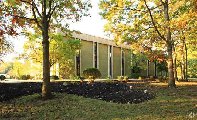
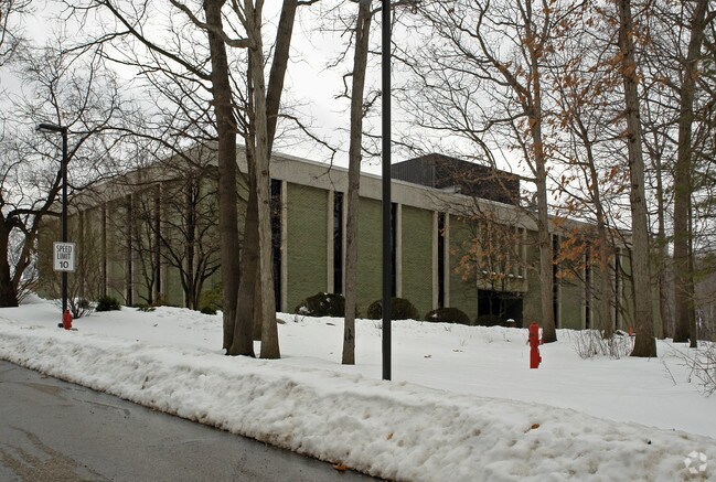
Property Record
7500 E Pleasant Valley Rd, Independence, OH 44131
NEARBY LISTINGS FOR SALE OR LEASE
Property Detail
7500 E Pleasant Valley Rd
Cleveland-Elyria, OH
VOL 384 PG 33 56410001 LISTED WITH 56410037 2017 SR
564-10-001
Cuyahoga
Miscellaneous
Ohio
0
Brecksville/Vly View
2024
Cleveland
156102
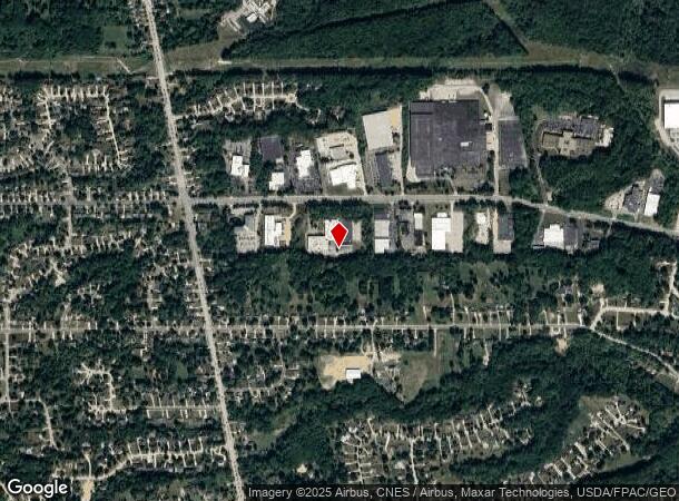
DEMOGRAPHICS near 7500 E Pleasant Valley Rd
1 Mile
3 Mile
5 Mile
2024 Total Population
3,364
27,948
122,542
2029 Population
3,251
27,090
119,104
Pop Growth 2024-2029
(3.36%)
(3.07%)
(2.81%)
Average Age
45
46
44
2024 Total Households
1,347
11,232
51,606
HH Growth 2024-2029
(3.64%)
(3.29%)
(2.93%)
Median Household Inc
$111,280
$95,610
$69,755
Avg Household Size
2.50
2.40
2.30
2024 Avg HH Vehicles
2.00
2.00
2.00
Median Home Value
$283,754
$264,673
$187,412
Median Year Built
1959
1966
1963
Nearby Places
Map Layers
Map Styles
 Street
 Aerial
- Restaurants
- Banks
- Shops
- Fitness
- Groceries
PUBLIC TRANSPORTATION
COMMUTER RAIL
DRIVE
WALK
Distance
5 min
2.2 mi
DRIVE
WALK
Distance
10 min
3.8 mi
AIRPORT
Cleveland-Hopkins International
DRIVE
WALK
Distance
Cleveland-Hopkins International
28 min
16.1 mi
Akron-Canton Regional
DRIVE
WALK
Distance
Akron-Canton Regional
53 min
40.5 mi
Nearby Properties
Address
Land Use
TOTAL SIZE
Lot Size
Zoning
Address
Land Use
TOTAL SIZE
Lot Size
Zoning
376,124 SF
71.73 AC
Address
Land Use
TOTAL SIZE
Lot Size
Zoning
202,152 SF
21.04 AC
U-1
Address
Land Use
TOTAL SIZE
Lot Size
Zoning
436,164 SF
20.01 AC
U-5
Address
Land Use
TOTAL SIZE
Lot Size
Zoning
384,714 SF
4.75 AC
U-5-HR
Address
Land Use
TOTAL SIZE
Lot Size
Zoning
307,703 SF
47.05 AC
U-5
Address
Land Use
TOTAL SIZE
Lot Size
Zoning
238,500 SF
20.31 AC
SC
Address
Land Use
TOTAL SIZE
Lot Size
Zoning
228,253 SF
32.51 AC
C-F
Address
Land Use
TOTAL SIZE
Lot Size
Zoning
162,134 SF
12.24 AC
CG
Address
Land Use
TOTAL SIZE
Lot Size
Zoning
285,065 SF
5.43 AC
D-1
Address
Land Use
TOTAL SIZE
Lot Size
Zoning
475,286 SF
5.81 AC
U-5-HR
Address
Land Use
TOTAL SIZE
Lot Size
Zoning
60,989 SF
9.31 AC
U-4
Address
Land Use
TOTAL SIZE
Lot Size
Zoning
225,593 SF
4.79 AC
U-6A
Address
Land Use
TOTAL SIZE
Lot Size
Zoning
49,998 SF
19.72 AC
U-6
Address
Land Use
TOTAL SIZE
Lot Size
Zoning
260,000 SF
38.18 AC
U-5A
Address
Land Use
TOTAL SIZE
Lot Size
Zoning
86,900 SF
18.01 AC
U-5
Address
Land Use
TOTAL SIZE
Lot Size
Zoning
162,134 SF
13.35 AC
CG
Address
Land Use
TOTAL SIZE
Lot Size
Zoning
124,224 SF
25.99 AC
U-1
Address
Land Use
TOTAL SIZE
Lot Size
Zoning
116,373 SF
13.28 AC
U-3
Address
Land Use
TOTAL SIZE
Lot Size
Zoning
94,997 SF
10.93 AC
L-B
Address
Land Use
TOTAL SIZE
Lot Size
Zoning
54,055 SF
3.11 AC
U-4
Address
Land Use
TOTAL SIZE
Lot Size
Zoning
141,785 SF
9.13 AC
U-5
Address
Land Use
TOTAL SIZE
Lot Size
Zoning
37.77 AC
U-5A
Address
Land Use
TOTAL SIZE
Lot Size
Zoning
258,669 SF
12.80 AC
U-5
Address
Land Use
TOTAL SIZE
Lot Size
Zoning
76,771 SF
2.47 AC
Address
Land Use
TOTAL SIZE
Lot Size
Zoning
238,500 SF
20.89 AC
SC
Address
Land Use
TOTAL SIZE
Lot Size
Zoning
149,468 SF
16.42 AC
U.5
Address
Land Use
TOTAL SIZE
Lot Size
Zoning
56,002 SF
6.76 AC
U-5
Address
Land Use
TOTAL SIZE
Lot Size
Zoning
99,916 SF
4.72 AC
U-3
Address
Land Use
TOTAL SIZE
Lot Size
Zoning
188,503 SF
23.72 AC
D-1
Address
Land Use
TOTAL SIZE
Lot Size
Zoning
121,720 SF
4.71 AC
U-5
The World's #1 Commercial Real Estate Marketplace
Connect with us
© 2025 CoStar Group
The information above has been obtained from sources believed reliable. While we do not doubt its accuracy we have not verified it and make no guarantee, warranty or representation about it. It is your responsibility to independently confirm its accuracy and completeness. Any projections, opinions, assumptions, or estimates used are for example only and do not represent the current or future performance of the property. The value of this transaction to you depends on tax and other factors which should be evaluated by your tax, financial, and legal advisors. You and your advisors should conduct a careful, independent investigation of the property to determine to your satisfaction the suitability of the property for your needs.