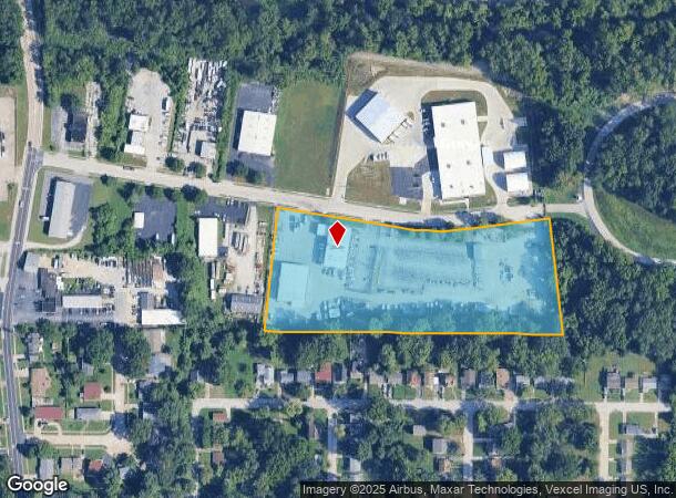
Property Record
7500 Mintert Industrial Dr, Saint Louis, MO 63135

NEARBY LISTINGS FOR SALE OR LEASE
Property Detail
7500 Mintert Industrial Dr
St. Louis, MO-IL
Mintert Industrial Park
12H-24-0494
MINTERT INDUSTRIAL PARK LOTS 14 THRU 18
Warehouse
St. Louis
X
Missouri
29189C0206K
14-18
0
5.50 AC
2025
North County
212400
St. Louis
6,570 SF
DEMOGRAPHICS near 7500 Mintert Industrial Dr
1 Mile
3 Mile
5 Mile
2024 Total Population
10,499
103,845
261,050
2029 Population
10,490
104,166
259,917
Pop Growth 2024-2029
(0.09%)
+ 0.31%
(0.43%)
Average Age
37
39
39
2024 Total Households
4,209
43,017
107,625
HH Growth 2024-2029
(0.14%)
+ 0.22%
(0.50%)
Median Household Inc
$37,962
$38,035
$41,304
Avg Household Size
2.50
2.30
2.30
2024 Avg HH Vehicles
1.00
1.00
1.00
Median Home Value
$67,420
$76,012
$89,512
Median Year Built
1955
1956
1956
Nearby Places
Map Layers
Map Styles
 Street
 Aerial
- Restaurants
- Banks
- Shops
- Fitness
- Groceries
PUBLIC TRANSPORTATION
COMMUTER RAIL
North Hanley (Lambert Airport Shiloh-Scott - St. Louis MetroLink (MetroLink))
DRIVE
WALK
Distance
North Hanley (Lambert Airport Shiloh-Scott - St. Louis MetroLink (MetroLink))
5 min
2.7 mi
Um St. Louis North (Lambert Airport Shiloh-Scott - St. Louis MetroLink (MetroLink))
DRIVE
WALK
Distance
Um St. Louis North (Lambert Airport Shiloh-Scott - St. Louis MetroLink (MetroLink))
6 min
2.8 mi
AIRPORT
St Louis Lambert International
DRIVE
WALK
Distance
St Louis Lambert International
9 min
4.3 mi
Scott AFB/Midamerica St Louis
DRIVE
WALK
Distance
Scott AFB/Midamerica St Louis
54 min
36.0 mi
Freight Ports
Port Milwaukee
DRIVE
WALK
Distance
Port Milwaukee
426 min
373.9 mi
Nearby Properties
Address
Land Use
TOTAL SIZE
Lot Size
Zoning
Address
Land Use
TOTAL SIZE
Lot Size
Zoning
72,612 SF
118.34 AC
3INSTU
Address
Land Use
TOTAL SIZE
Lot Size
Zoning
25,545 SF
82.84 AC
R1B
Address
Land Use
TOTAL SIZE
Lot Size
Zoning
348,233 SF
23.68 AC
Address
Land Use
TOTAL SIZE
Lot Size
Zoning
42.40 AC
M2
Address
Land Use
TOTAL SIZE
Lot Size
Zoning
309,486 SF
10.73 AC
7M-1
Address
Land Use
TOTAL SIZE
Lot Size
Zoning
231,336 SF
18.88 AC
7M-2
Address
Land Use
TOTAL SIZE
Lot Size
Zoning
136,258 SF
263.16 AC
7M-1
Address
Land Use
TOTAL SIZE
Lot Size
Zoning
151,640 SF
5.38 AC
D
Address
Land Use
TOTAL SIZE
Lot Size
Zoning
0.73 AC
B
Address
Land Use
TOTAL SIZE
Lot Size
Zoning
460,170 SF
152.70 AC
22M-1
Address
Land Use
TOTAL SIZE
Lot Size
Zoning
5,640 SF
10.42 AC
A
Address
Land Use
TOTAL SIZE
Lot Size
Zoning
303,535 SF
16.44 AC
B
Address
Land Use
TOTAL SIZE
Lot Size
Zoning
226,000 SF
34.48 AC
7M-2
Address
Land Use
TOTAL SIZE
Lot Size
Zoning
18,734 SF
38.83 AC
24R4
Address
Land Use
TOTAL SIZE
Lot Size
Zoning
1,428 SF
131.27 AC
C
Address
Land Use
TOTAL SIZE
Lot Size
Zoning
19.94 AC
39SFR
Address
Land Use
TOTAL SIZE
Lot Size
Zoning
15,149 SF
120.85 AC
A
Address
Land Use
TOTAL SIZE
Lot Size
Zoning
218,766 SF
13.34 AC
7M-1
Address
Land Use
TOTAL SIZE
Lot Size
Zoning
17.37 AC
B
Address
Land Use
TOTAL SIZE
Lot Size
Zoning
106,957 SF
6.10 AC
C
Address
Land Use
TOTAL SIZE
Lot Size
Zoning
675 SF
20.38 AC
R5
Address
Land Use
TOTAL SIZE
Lot Size
Zoning
58,818 SF
8.02 AC
22C-1
Address
Land Use
TOTAL SIZE
Lot Size
Zoning
166,427 SF
8.98 AC
5G
Address
Land Use
TOTAL SIZE
Lot Size
Zoning
83,705 SF
4.82 AC
7M-2
Address
Land Use
TOTAL SIZE
Lot Size
Zoning
7,449 SF
0.14 AC
H
Address
Land Use
TOTAL SIZE
Lot Size
Zoning
6,366 SF
25.07 AC
22R-1C
Address
Land Use
TOTAL SIZE
Lot Size
Zoning
15.59 AC
R4
Address
Land Use
TOTAL SIZE
Lot Size
Zoning
448,714 SF
34.05 AC
22M-1
Address
Land Use
TOTAL SIZE
Lot Size
Zoning
30.99 AC
39MULTI
Address
Land Use
TOTAL SIZE
Lot Size
Zoning
140,423 SF
284.40 AC
7M-1
The World's #1 Commercial Real Estate Marketplace
Connect with us
© 2025 CoStar Group
The information above has been obtained from sources believed reliable. While we do not doubt its accuracy we have not verified it and make no guarantee, warranty or representation about it. It is your responsibility to independently confirm its accuracy and completeness. Any projections, opinions, assumptions, or estimates used are for example only and do not represent the current or future performance of the property. The value of this transaction to you depends on tax and other factors which should be evaluated by your tax, financial, and legal advisors. You and your advisors should conduct a careful, independent investigation of the property to determine to your satisfaction the suitability of the property for your needs.