Property Record
7500 S Interstate 35, Austin, TX 78745
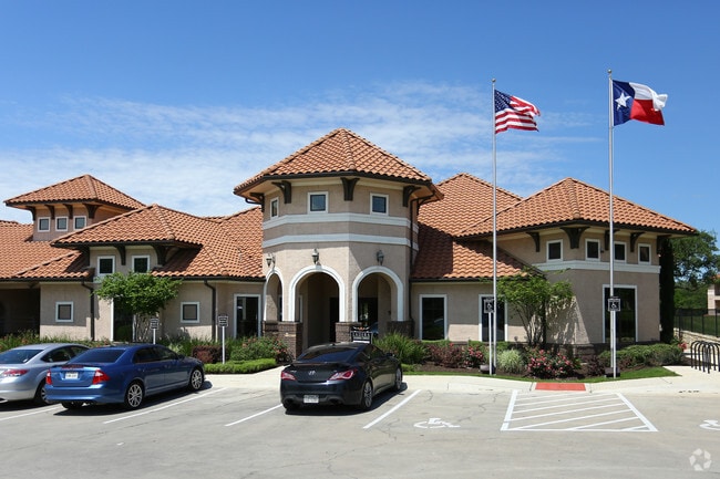

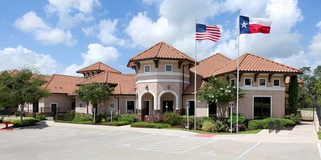

Property Detail
7500 S Interstate 35
Austin-Round Rock-San Marcos, TX
LOT 4A & 5A LENOX INDUSTRIAL PARK SUBD AMENDED PLAT OF LOTS 2-8 & LOT 6B LENOX INDUSTRIAL PK SUBD AMD PLT LT 2,4-8 AMD PLT LT 6A-8A
576087
TRAVIS
Multifamilydwelling
Texas
AE The base floodplain where base flood elevations are provided. AE Zones are now used on new format FIRMs instead of A1-A30 Zones.
4a-5a
2025
15.83 AC
2025
South Austin
002422
Austin
272,824 SF
NEARBY LISTINGS FOR SALE OR LEASE
DEMOGRAPHICS near 7500 S Interstate 35
1 mile
3 mile
5 mile
2024 Total Population
17,926
131,567
279,885
2029 Population
19,003
137,592
293,732
Pop Growth 2024-2029
+ 6.01%
+ 4.58%
+ 4.95%
Average Age
36
37
37
2024 Total Households
8,177
52,888
121,105
HH Growth 2024-2029
+ 6.92%
+ 5.33%
+ 5.60%
Median Household Inc
$72,998
$82,188
$87,188
Avg Household Size
2.20
2.40
2.20
2024 Avg HH Vehicles
2.00
2.00
2.00
Median Home Value
$433,539
$447,427
$497,044
Median Year Built
2005
2001
1999
Nearby Places
Map Layers
Map Styles
 Street
 Aerial
Transit
 Traffic
 Biking
Places
Listings with unknown addresses are not visible on the map
- Restaurants
- Banks
- Shops
- Fitness
- Groceries
PUBLIC TRANSPORTATION
COMMUTER RAIL
Austin (Texas Eagle - Amtrak)
Drive
Walk
Distance
Austin (Texas Eagle - Amtrak)
16 min
8.3 mi
AIRPORT
Austin-Bergstrom International
Drive
Walk
Distance
Austin-Bergstrom International
25 min
11.7 mi
Freight Ports
Calhoun Port
Drive
Walk
Distance
Calhoun Port
180 min
152.2 mi
Nearby Properties
Address
Land Use
TOTAL SIZE
Lot Size
Zoning
Address
Land Use
TOTAL SIZE
Lot Size
Zoning
454,740 SF
27.77 AC
Address
Land Use
TOTAL SIZE
Lot Size
Zoning
539,533 SF
26.50 AC
Address
Land Use
TOTAL SIZE
Lot Size
Zoning
450,836 SF
29.58 AC
Address
Land Use
TOTAL SIZE
Lot Size
Zoning
380,191 SF
37.33 AC
Address
Land Use
TOTAL SIZE
Lot Size
Zoning
256,182 SF
3.63 AC
Address
Land Use
TOTAL SIZE
Lot Size
Zoning
331,650 SF
19.33 AC
Address
Land Use
TOTAL SIZE
Lot Size
Zoning
366,275 SF
39.95 AC
Address
Land Use
TOTAL SIZE
Lot Size
Zoning
372,125 SF
26.22 AC
Address
Land Use
TOTAL SIZE
Lot Size
Zoning
314,325 SF
29.53 AC
Address
Land Use
TOTAL SIZE
Lot Size
Zoning
374,720 SF
26.96 AC
Address
Land Use
TOTAL SIZE
Lot Size
Zoning
330,491 SF
19.37 AC
Address
Land Use
TOTAL SIZE
Lot Size
Zoning
307,584 SF
16.31 AC
Address
Land Use
TOTAL SIZE
Lot Size
Zoning
287,267 SF
13.28 AC
Address
Land Use
TOTAL SIZE
Lot Size
Zoning
414,030 SF
55.96 AC
Address
Land Use
TOTAL SIZE
Lot Size
Zoning
359,144 SF
Address
Land Use
TOTAL SIZE
Lot Size
Zoning
257,400 SF
10.70 AC
Address
Land Use
TOTAL SIZE
Lot Size
Zoning
210,375 SF
3.36 AC
Address
Land Use
TOTAL SIZE
Lot Size
Zoning
315,198 SF
8.88 AC
Address
Land Use
TOTAL SIZE
Lot Size
Zoning
434,872 SF
12.57 AC
Address
Land Use
TOTAL SIZE
Lot Size
Zoning
287,100 SF
13.20 AC
Address
Land Use
TOTAL SIZE
Lot Size
Zoning
226,050 SF
2.28 AC
Address
Land Use
TOTAL SIZE
Lot Size
Zoning
384,254 SF
24.13 AC
Address
Land Use
TOTAL SIZE
Lot Size
Zoning
286,614 SF
15.81 AC
Address
Land Use
TOTAL SIZE
Lot Size
Zoning
328,606 SF
42.16 AC
Address
Land Use
TOTAL SIZE
Lot Size
Zoning
333,746 SF
53.90 AC
Address
Land Use
TOTAL SIZE
Lot Size
Zoning
422,500 SF
30.52 AC
Address
Land Use
TOTAL SIZE
Lot Size
Zoning
371,705 SF
25.94 AC
Address
Land Use
TOTAL SIZE
Lot Size
Zoning
249,600 SF
14.48 AC
Address
Land Use
TOTAL SIZE
Lot Size
Zoning
316,572 SF
22.67 AC
Address
Land Use
TOTAL SIZE
Lot Size
Zoning
318,962 SF
31.88 AC
The World's #1 Commercial Real Estate Marketplace
Connect with us
© 2026 CoStar Group
The information above has been obtained from sources believed reliable. While we do not doubt its accuracy we have not verified it and make no guarantee, warranty or representation about it. It is your responsibility to independently confirm its accuracy and completeness. Any projections, opinions, assumptions, or estimates used are for example only and do not represent the current or future performance of the property. The value of this transaction to you depends on tax and other factors which should be evaluated by your tax, financial, and legal advisors. You and your advisors should conduct a careful, independent investigation of the property to determine to your satisfaction the suitability of the property for your needs.