Property Record
7500 W State Highway 29, Georgetown, TX 78628
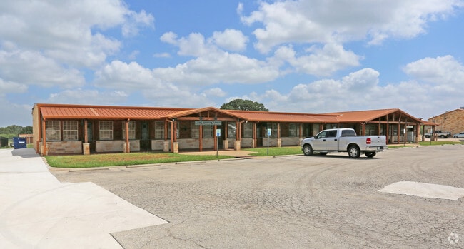

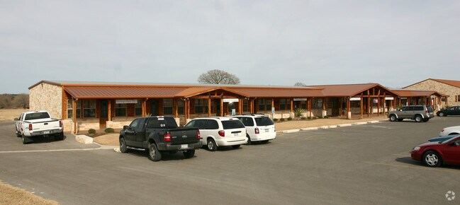
Property Detail
7500 W State Highway 29
Austin-Round Rock-San Marcos, TX
S10840 - COPPER RIDGE (LT 1 REPLAT), BLOCK A, LOT 2, ACRES 2.61
R538851
WILLIAMSON
Commercialnec
Texas
B and X Area of moderate flood hazard, usually the area between the limits of the 100-year and 500-year floods.
1,2
2024
2.61 AC
2025
Georgetown
020120
Austin
5,151 SF
NEARBY LISTINGS FOR SALE OR LEASE
DEMOGRAPHICS near 7500 W State Highway 29
1 mile
3 mile
5 mile
2025 Total Population
4,891
33,971
77,864
2030 Population
5,972
41,246
93,106
Pop Growth 2025-2030
+ 22.10%
+ 21.42%
+ 19.58%
Average Age
37
37
37
2025 Total Households
1,714
11,764
27,175
HH Growth 2025-2030
+ 22.52%
+ 21.83%
+ 19.98%
Median Household Inc
$158,379
$146,781
$139,208
Avg Household Size
2.90
2.90
2.90
2025 Avg HH Vehicles
2.00
2.00
2.00
Median Home Value
$531,375
$499,690
$496,202
Median Year Built
2011
2011
2011
Nearby Places
Map Layers
Map Styles
 Street
 Aerial
Transit
 Traffic
 Biking
Places
Listings with unknown addresses are not visible on the map
- Restaurants
- Banks
- Shops
- Fitness
- Groceries
PUBLIC TRANSPORTATION
AIRPORT
Robert Gray AAF
Drive
Walk
Distance
Robert Gray AAF
59 min
38.3 mi
Austin-Bergstrom International
Drive
Walk
Distance
Austin-Bergstrom International
57 min
41.7 mi
Killeen Municipal
Drive
Walk
Distance
Killeen Municipal
58 min
44.4 mi
Nearby Properties
Address
Land Use
TOTAL SIZE
Lot Size
Zoning
Address
Land Use
TOTAL SIZE
Lot Size
Zoning
312,374 SF
15.77 AC
Address
Land Use
TOTAL SIZE
Lot Size
Zoning
124,625 SF
14.41 AC
Address
Land Use
TOTAL SIZE
Lot Size
Zoning
286,888 SF
20.68 AC
Address
Land Use
TOTAL SIZE
Lot Size
Zoning
247,584 SF
18.45 AC
Address
Land Use
TOTAL SIZE
Lot Size
Zoning
Address
Land Use
TOTAL SIZE
Lot Size
Zoning
109,663 SF
19.54 AC
Address
Land Use
TOTAL SIZE
Lot Size
Zoning
11.98 AC
Address
Land Use
TOTAL SIZE
Lot Size
Zoning
256,008 SF
15.88 AC
Address
Land Use
TOTAL SIZE
Lot Size
Zoning
35,223 SF
9.75 AC
Address
Land Use
TOTAL SIZE
Lot Size
Zoning
37,809 SF
6.26 AC
Address
Land Use
TOTAL SIZE
Lot Size
Zoning
127,329 SF
32.79 AC
Address
Land Use
TOTAL SIZE
Lot Size
Zoning
159,400 SF
8.26 AC
Address
Land Use
TOTAL SIZE
Lot Size
Zoning
1,412 SF
20.17 AC
Address
Land Use
TOTAL SIZE
Lot Size
Zoning
72,209 SF
14.16 AC
Address
Land Use
TOTAL SIZE
Lot Size
Zoning
90,802 SF
10.36 AC
Address
Land Use
TOTAL SIZE
Lot Size
Zoning
25,928 SF
15.13 AC
Address
Land Use
TOTAL SIZE
Lot Size
Zoning
21,065 SF
0.47 AC
Address
Land Use
TOTAL SIZE
Lot Size
Zoning
16.64 AC
Address
Land Use
TOTAL SIZE
Lot Size
Zoning
12.64 AC
Address
Land Use
TOTAL SIZE
Lot Size
Zoning
72,199 SF
7.85 AC
Address
Land Use
TOTAL SIZE
Lot Size
Zoning
21.13 AC
Address
Land Use
TOTAL SIZE
Lot Size
Zoning
Address
Land Use
TOTAL SIZE
Lot Size
Zoning
13,170 SF
0.30 AC
Address
Land Use
TOTAL SIZE
Lot Size
Zoning
1,588 SF
28.64 AC
Address
Land Use
TOTAL SIZE
Lot Size
Zoning
177,611 SF
6.42 AC
Address
Land Use
TOTAL SIZE
Lot Size
Zoning
32,092 SF
0.14 AC
Address
Land Use
TOTAL SIZE
Lot Size
Zoning
61,130 SF
7.71 AC
Address
Land Use
TOTAL SIZE
Lot Size
Zoning
672 SF
50.79 AC
Address
Land Use
TOTAL SIZE
Lot Size
Zoning
624 SF
67.42 AC
Address
Land Use
TOTAL SIZE
Lot Size
Zoning
15,132 SF
4.07 AC
The World's #1 Commercial Real Estate Marketplace
Connect with us
© 2026 CoStar Group
The information above has been obtained from sources believed reliable. While we do not doubt its accuracy we have not verified it and make no guarantee, warranty or representation about it. It is your responsibility to independently confirm its accuracy and completeness. Any projections, opinions, assumptions, or estimates used are for example only and do not represent the current or future performance of the property. The value of this transaction to you depends on tax and other factors which should be evaluated by your tax, financial, and legal advisors. You and your advisors should conduct a careful, independent investigation of the property to determine to your satisfaction the suitability of the property for your needs.