Property Record
7505 Wise Rd, Auburn, CA 95603
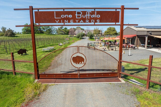


This Property Is For Sale
Property Detail
7505 Wise Rd
031-370-026
12.3 AC SEC 2 12 7
Privatepreserveopenspacevacantlandforestlandconservation
Placer
AE
California
B and X Area of moderate flood hazard, usually the area between the limits of the 100-year and 500-year floods.
12.30 AC
2025
Auburn/Lincoln
2025
Sacramento
021501
Sacramento-Roseville-Folsom, CA
4,960 SF
NEARBY LISTINGS FOR SALE OR LEASE
-
-
View all Auburn listings for sale on LoopNet.com
DEMOGRAPHICS near 7505 Wise Rd
1 mile
3 mile
5 mile
2025 Total Population
460
5,516
29,698
2030 Population
480
5,753
31,094
Pop Growth 2025-2030
+ 4.35%
+ 4.30%
+ 4.70%
Average Age
47
47
46
2025 Total Households
171
2,103
11,684
HH Growth 2025-2030
+ 4.09%
+ 4.33%
+ 4.67%
Median Household Inc
$116,447
$116,641
$89,197
Avg Household Size
2.60
2.60
2.40
2025 Avg HH Vehicles
3.00
3.00
2.00
Median Home Value
$770,454
$776,987
$695,392
Median Year Built
1981
1982
1981
Nearby Places
Map Layers
Map Styles
 Street
 Aerial
Layers
 Traffic
 Biking
Places
Listings with unknown addresses are not visible on the map
- Restaurants
- Banks
- Shops
- Fitness
- Groceries
PUBLIC TRANSPORTATION
COMMUTER RAIL
Auburn-Conheim (Capitol Corridor - Capitol Corridor Joint Powers Authority)
Drive
Walk
Distance
Auburn-Conheim (Capitol Corridor - Capitol Corridor Joint Powers Authority)
15 min
6.9 mi
Auburn Amtrak (Capitol Corridor - Amtrak)
Drive
Walk
Distance
Auburn Amtrak (Capitol Corridor - Amtrak)
15 min
7.0 mi
AIRPORT
Sacramento International
Drive
Walk
Distance
Sacramento International
57 min
41.5 mi
Freight Ports
Port of Stockton
Drive
Walk
Distance
Port of Stockton
100 min
81.7 mi
Nearby Properties
Address
Land Use
TOTAL SIZE
Lot Size
Zoning
Address
Land Use
TOTAL SIZE
Lot Size
Zoning
6,312 SF
20 AC
FBX
Address
Land Use
TOTAL SIZE
Lot Size
Zoning
3,282 SF
30.10 AC
FBX
Address
Land Use
TOTAL SIZE
Lot Size
Zoning
5,670 SF
24.10 AC
FBX
Address
Land Use
TOTAL SIZE
Lot Size
Zoning
5,754 SF
78.80 AC
Address
Land Use
TOTAL SIZE
Lot Size
Zoning
3,382 SF
31.30 AC
FBX
Address
Land Use
TOTAL SIZE
Lot Size
Zoning
4,958 SF
45.90 AC
FBX
Address
Land Use
TOTAL SIZE
Lot Size
Zoning
1,198 SF
10.70 AC
RAB100
Address
Land Use
TOTAL SIZE
Lot Size
Zoning
3,579 SF
10 AC
FBX
Address
Land Use
TOTAL SIZE
Lot Size
Zoning
2,712 SF
20.60 AC
F
Address
Land Use
TOTAL SIZE
Lot Size
Zoning
2,044 SF
28.90 AC
FBX
Address
Land Use
TOTAL SIZE
Lot Size
Zoning
1,512 SF
42 AC
FBX
Address
Land Use
TOTAL SIZE
Lot Size
Zoning
1,250 SF
17.90 AC
FBX
Address
Land Use
TOTAL SIZE
Lot Size
Zoning
1,140 SF
31.30 AC
Address
Land Use
TOTAL SIZE
Lot Size
Zoning
2,850 SF
5.80 AC
FBX
Address
Land Use
TOTAL SIZE
Lot Size
Zoning
2,994 SF
23.30 AC
AE
Address
Land Use
TOTAL SIZE
Lot Size
Zoning
3,218 SF
11 AC
FBX
Address
Land Use
TOTAL SIZE
Lot Size
Zoning
2,939 SF
30.40 AC
FBX
Address
Land Use
TOTAL SIZE
Lot Size
Zoning
1,797 SF
4.40 AC
RAB100
Address
Land Use
TOTAL SIZE
Lot Size
Zoning
10.80 AC
FBX
Address
Land Use
TOTAL SIZE
Lot Size
Zoning
1,984 SF
6.70 AC
FBX
Address
Land Use
TOTAL SIZE
Lot Size
Zoning
1,344 SF
119.80 AC
FBX
Address
Land Use
TOTAL SIZE
Lot Size
Zoning
2,428 SF
41.84 AC
FBX
Address
Land Use
TOTAL SIZE
Lot Size
Zoning
3,626 SF
9.70 AC
FBX
Address
Land Use
TOTAL SIZE
Lot Size
Zoning
Address
Land Use
TOTAL SIZE
Lot Size
Zoning
10 AC
FBX
Address
Land Use
TOTAL SIZE
Lot Size
Zoning
2,000 SF
20.80 AC
F
Address
Land Use
TOTAL SIZE
Lot Size
Zoning
2,854 SF
30 AC
FBX
Address
Land Use
TOTAL SIZE
Lot Size
Zoning
7,488 SF
1.90 AC
C2B43DC
The World's #1 Commercial Real Estate Marketplace
Connect with us
© 2026 CoStar Group
The information above has been obtained from sources believed reliable. While we do not doubt its accuracy we have not verified it and make no guarantee, warranty or representation about it. It is your responsibility to independently confirm its accuracy and completeness. Any projections, opinions, assumptions, or estimates used are for example only and do not represent the current or future performance of the property. The value of this transaction to you depends on tax and other factors which should be evaluated by your tax, financial, and legal advisors. You and your advisors should conduct a careful, independent investigation of the property to determine to your satisfaction the suitability of the property for your needs.