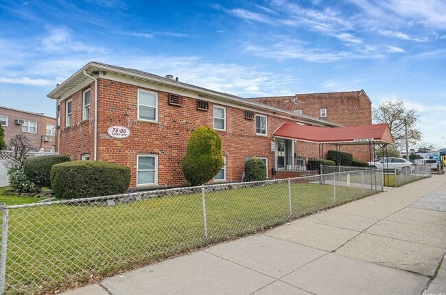
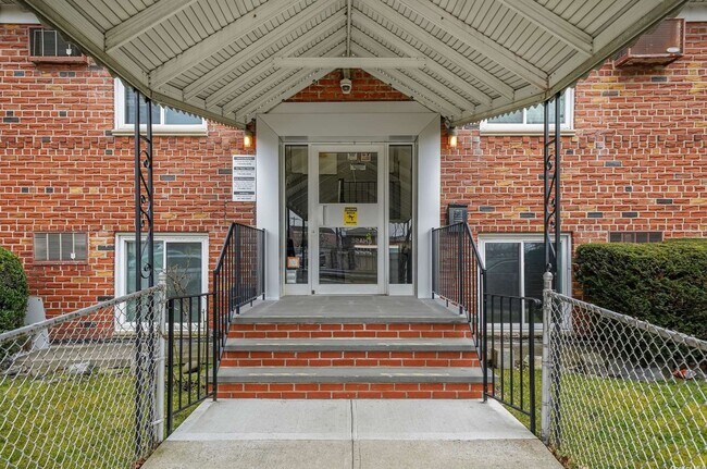
Property Record
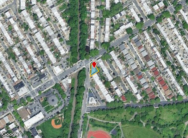
7506 Eliot Ave, Middle Village, NY 11379
NEARBY LISTINGS FOR SALE OR LEASE
Property Detail
7506 Eliot Ave
02931-0007
Queens
Funeralhome
New York
X
7
3604970207F
0.14 AC
2024
Central Queens
2025
Long Island (New York)
066501
New York-Jersey City-White Plains, NY-NJ
4,500 SF
DEMOGRAPHICS near 7506 Eliot Ave
1 Mile
3 Mile
5 Mile
2024 Total Population
70,003
925,205
2,583,007
2029 Population
63,926
862,039
2,421,041
Pop Growth 2024-2029
(8.68%)
(6.83%)
(6.27%)
Average Age
42
40
39
2024 Total Households
24,436
326,281
969,509
HH Growth 2024-2029
(9.22%)
(6.93%)
(6.47%)
Median Household Inc
$80,164
$71,339
$71,067
Avg Household Size
2.70
2.70
2.50
2024 Avg HH Vehicles
1.00
1.00
1.00
Median Home Value
$776,130
$675,868
$725,979
Median Year Built
1951
1949
1950
Nearby Places
- Restaurants
- Banks
- Shops
- Fitness
- Groceries
PUBLIC TRANSPORTATION
TRANSIT/SUBWAY
Middle Village-Metropolitan Avenue (M - New York MTA Subway (The Subway))
DRIVE
WALK
Distance
Middle Village-Metropolitan Avenue (M - New York MTA Subway (The Subway))
3 min
18 min
0.9 mi
COMMUTER RAIL
Woodside Station (Babylon Branch - Long Island Rail Road, Far Rockaway Branch - Long Island Rail Road, Hempstead Branch - Long Island Rail Road, Long Beach Branch - Long Island Rail Road, Montauk Branch - Long Island Rail Road, Port Jefferson Branch - Long Island Rail Road, Port Washington Branch - Long Island Rail Road, Ronkonkoma Branch - Long Island Rail Road)
DRIVE
WALK
Distance
Woodside Station (Babylon Branch - Long Island Rail Road, Far Rockaway Branch - Long Island Rail Road, Hempstead Branch - Long Island Rail Road, Long Beach Branch - Long Island Rail Road, Montauk Branch - Long Island Rail Road, Port Jefferson Branch - Long Island Rail Road, Port Washington Branch - Long Island Rail Road, Ronkonkoma Branch - Long Island Rail Road)
8 min
2.7 mi
Forest Hills Station (Babylon Branch - Long Island Rail Road, Hempstead Branch - Long Island Rail Road, Long Beach Branch - Long Island Rail Road, Port Jefferson Branch - Long Island Rail Road)
DRIVE
WALK
Distance
Forest Hills Station (Babylon Branch - Long Island Rail Road, Hempstead Branch - Long Island Rail Road, Long Beach Branch - Long Island Rail Road, Port Jefferson Branch - Long Island Rail Road)
8 min
2.8 mi
AIRPORT
LaGuardia
DRIVE
WALK
Distance
LaGuardia
13 min
4.4 mi
John F Kennedy International
DRIVE
WALK
Distance
John F Kennedy International
18 min
9.8 mi
Newark Liberty International
DRIVE
WALK
Distance
Newark Liberty International
33 min
20.6 mi
Freight Ports
NY - Red Hook Container Terminal
DRIVE
WALK
Distance
NY - Red Hook Container Terminal
18 min
9.4 mi
SALE & LEASE HISTORY
LISTING DATE
SALE/LEASE

Mar 29, 2024
For Lease
Nearby Properties
Address
Land Use
TOTAL SIZE
Lot Size
Zoning
Address
Land Use
TOTAL SIZE
Lot Size
Zoning
1,258,350 SF
410.24 AC
PARK
Address
Land Use
TOTAL SIZE
Lot Size
Zoning
1,502,532 SF
6.35 AC
R7B
Address
Land Use
TOTAL SIZE
Lot Size
Zoning
772,163 SF
5.24 AC
C4-5X
Address
Land Use
TOTAL SIZE
Lot Size
Zoning
54,170 SF
229.57 AC
PARK
Address
Land Use
TOTAL SIZE
Lot Size
Zoning
1,292,074 SF
C4-2F
Address
Land Use
TOTAL SIZE
Lot Size
Zoning
234,891 SF
3.17 AC
C4-5X
Address
Land Use
TOTAL SIZE
Lot Size
Zoning
1,516,458 SF
5.97 AC
R7-1
Address
Land Use
TOTAL SIZE
Lot Size
Zoning
15,000 SF
255.27 AC
PARK
Address
Land Use
TOTAL SIZE
Lot Size
Zoning
126.85 AC
PARK
Address
Land Use
TOTAL SIZE
Lot Size
Zoning
264,691 SF
5.17 AC
M1-2
Address
Land Use
TOTAL SIZE
Lot Size
Zoning
1,000 SF
210.07 AC
R3-2
Address
Land Use
TOTAL SIZE
Lot Size
Zoning
1,572,198 SF
22.06 AC
M1-2
Address
Land Use
TOTAL SIZE
Lot Size
Zoning
344,116 SF
0.92 AC
R7-1
Address
Land Use
TOTAL SIZE
Lot Size
Zoning
826,915 SF
8.83 AC
M3-1
Address
Land Use
TOTAL SIZE
Lot Size
Zoning
446,763 SF
12.52 AC
R6
Address
Land Use
TOTAL SIZE
Lot Size
Zoning
2,193 SF
94.72 AC
PARK
Address
Land Use
TOTAL SIZE
Lot Size
Zoning
360,000 SF
5.88 AC
C4-2
Address
Land Use
TOTAL SIZE
Lot Size
Zoning
307,038 SF
7.84 AC
M1-1
Address
Land Use
TOTAL SIZE
Lot Size
Zoning
474,715 SF
1.72 AC
M14R8A
Address
Land Use
TOTAL SIZE
Lot Size
Zoning
458,778 SF
2.09 AC
R6
Address
Land Use
TOTAL SIZE
Lot Size
Zoning
490,600 SF
12.01 AC
M1-1
Address
Land Use
TOTAL SIZE
Lot Size
Zoning
480,000 SF
16.98 AC
M1-1
Address
Land Use
TOTAL SIZE
Lot Size
Zoning
248,200 SF
1.25 AC
R6
Address
Land Use
TOTAL SIZE
Lot Size
Zoning
353,333 SF
1.99 AC
R6A
Address
Land Use
TOTAL SIZE
Lot Size
Zoning
88,700 SF
4.59 AC
M3-1
Address
Land Use
TOTAL SIZE
Lot Size
Zoning
388,023 SF
1.58 AC
R7A
Address
Land Use
TOTAL SIZE
Lot Size
Zoning
266,195 SF
4.59 AC
C4-2
Address
Land Use
TOTAL SIZE
Lot Size
Zoning
272,081 SF
4.59 AC
C4-2
Address
Land Use
TOTAL SIZE
Lot Size
Zoning
240,000 SF
2.09 AC
R6
Address
Land Use
TOTAL SIZE
Lot Size
Zoning
528,000 SF
6 AC
R5B
The World's #1 Commercial Real Estate Marketplace
Connect with us
© 2025 CoStar Group
The information above has been obtained from sources believed reliable. While we do not doubt its accuracy we have not verified it and make no guarantee, warranty or representation about it. It is your responsibility to independently confirm its accuracy and completeness. Any projections, opinions, assumptions, or estimates used are for example only and do not represent the current or future performance of the property. The value of this transaction to you depends on tax and other factors which should be evaluated by your tax, financial, and legal advisors. You and your advisors should conduct a careful, independent investigation of the property to determine to your satisfaction the suitability of the property for your needs.